YUKON-ALASKA 2018
June 24 cont...
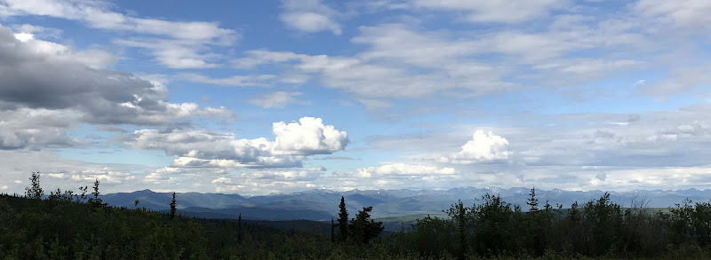
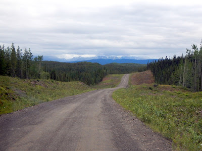
TOP OF THE WORLD HIGHWAY - Yukon
There was no lineup at the Canada/US border and we had to compliment the border guard on the quality of his office. Those little blue buildings are the Customs and Border control buildings... there is nothing else anywhere near here. The Little Gold/Poker Creek border crossing from the Yukon to Alaska is the most northern international border crossing in all of North America. There is giant stacks of firewood and a massive mosquito repellent device, I would imagine it can get pretty quiet here. In mid-September this border crossing closes until May, I would not want to drive this highway in the winter.


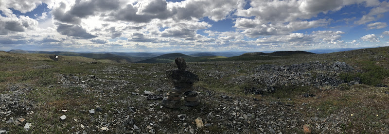
There is a pullout area overlooking the border and surrounding areas, and as far as you can see in all directions is mountains and valleys. Once again I can clearly see why they call it the top of the world highway.


We see a truck on the side of the road with his hood up, so we stop to make sure he's OK. Apparently he is just looking for someone to take a note to Dawson City saying he can't make it into work. There's no cell service between Chicken and Dawson City, and he needs someone to tell his CFYT radio station that he can't do tonight's show because he's playing hooky.
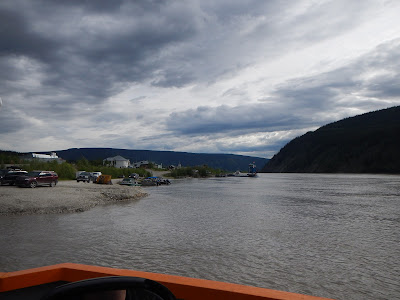
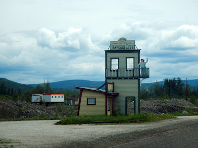
The highway continues it's Gravel-paved-gravel-paved-gravel pattern until we arrive at a small ferry that will take us in to Dawson City. We knew we must be getting close, because they have the cutest city limits signs we've seen on this trip.
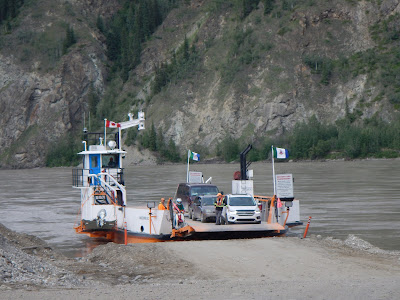

Did I mention it was a small ferry?

We had made it to the historic centre of the Klondike Gold Rush, the town of Dawson City. Dawson City began in 1896 and changed the First Nations camp into a thriving city of 40,000 by 1898. By 1899, the gold rush had ended and the town's population plummeted to less than 8,000. It served as Yukon's capital from 1898 until 1952, when the seat was moved to Whitehorse. Mostly because the Alaska Highway bypassed Dawson City and Whitehorse was more central.
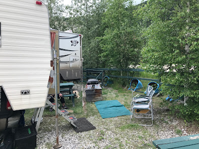
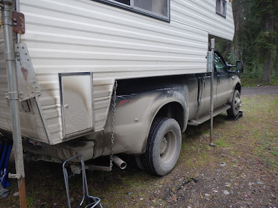
We stayed at the Gold Rush campground, an RV park right in middle of the city. Not very private, but we could hookup to recharge, use showers, and it was only a block away from the main part of town.


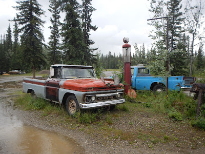
Vehicles were here from all over North America, nestled below a historic Landslide from the 1700's. It's interesting to check out the varieties of vehicles, and the passengers that some of them have brought.
We headed into town and went to the Triple J Hotel for dinner, and passed on the message from the delinquent DJ.


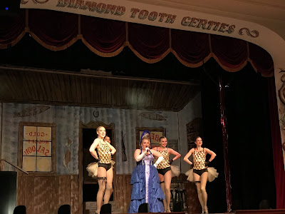
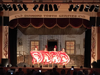
After dinner it was a block over to the world famous Diamond tooth Gertie's Gambling Hall, where we were treated to an old-timey cabaret show featuring Can-Can girls. The show told the story of Gertie and a new-in-town man and their love story.


We headed back to our camper and met our mud-covered next door neighbors who had just come down from Tuktoyaktuk in the Northwest Territories. The 800 km (500 Mile) highway leaves from Dawson and crosses the Peel River and the Mackenzie Rivers using a combination of seasonal ferry service and ice bridges. Year-round road access from Inuvik to Tuktoyaktuk opened in November 2017 with the completion of the Dempster Highway. They told us when they arrived in "Tuk" that the Arctic Ocean was still frozen over, three days of rain later and it was all broken up. Interesting, but it wasn't going to be added to this trip.
It never got dark in Dawson City, apparently you can go to the top of a mountain known as the Midnight Dome, and watch as the sun comes down, touches the horizon and then starts going up again. Unfortunately earlier that day some jackass had started a forest fire, and we couldn't go do that, at least not for a day.
June 25
After breakfast we wandered the town of Dawson City. Dawson and the nearby ghost town of Forty Mile are featured prominently in the novels and short stories of author Jack London, including 'The Call of the Wild'. London lived in the Dawson area from October 1897 to June 1898. Apparently Pierre Berton and the poet Robert Service also spent time there.


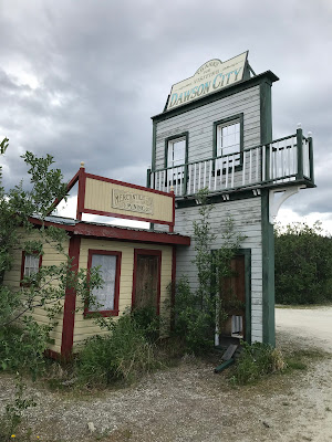
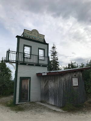
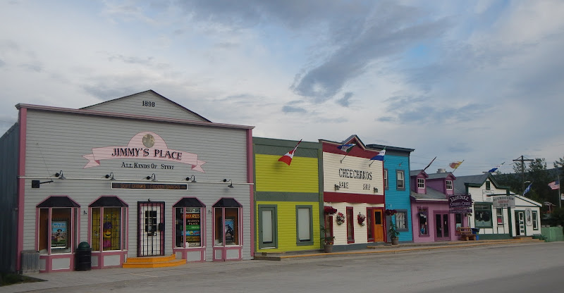
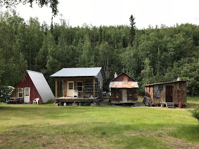
The town has been kept authentic both as a part of preserving the history, but also because of the stability of the ground. The entire town sits on a mix of of frozen earth and permafrost. Paving the roads would melt the permafrost, so dirt roads and wooden sidewalks remain. Several buildings have started to tilt and collapse due to melting permafrost, and although the signs state they want the public to see the natural decay, it's most likely because the government won't let private citizens restore them or invest to do it themselves.


St. Mary's Catholic Church was originally built in 1897, the pews weren't much more than boards on stumps with cloth nailed up instead of windows, after it burned down, this church was built, and it was restored in the 90's... 1990's.


The Downtown Hotel is famous for its Sourtoe Cocktail, which features a real mummified human toe. The hotel and the toe received increased attention in June 2017 after the toe was stolen; it was soon returned to the hotel by mail along with a written apology. As much as it would be a unique story to tell, letting a mummified toe touch my lips after soaking in a glass full of booze I need to swallow, we passed.


We had lunch at the Red Mammoth Bistro (a hipster style French bistro) mostly because a lot of the more interesting places were closed. It really had that old France feel, you know... high prices, mediocre food and slow service.


There was a wide range of hotels, B&B's and Inn's.


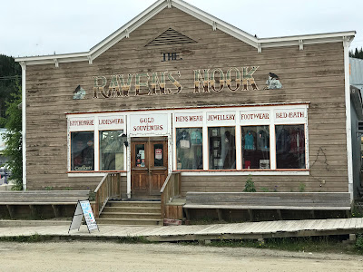
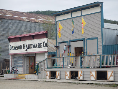
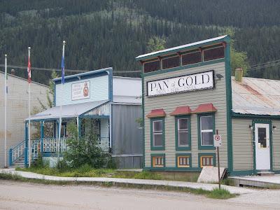
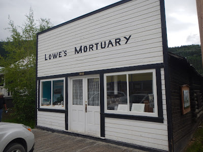
Some of the simplest storefronts were the most authentic.


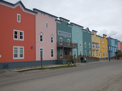
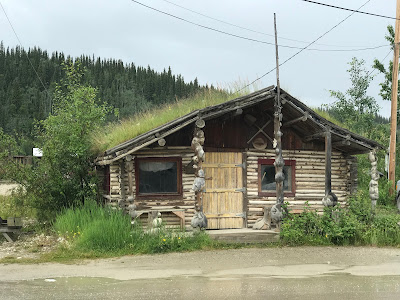
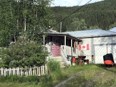
The old houses outside of the city centre are all quite unique, some maintained, some not.


and yes, thats a wall of Budweiser cases. You just never know what you will find in an old town like this.


Having wandered pretty much the entire town, we headed back to the camper to spend the afternoon in the sun and hang out with Silva. One of the most entertaining things was watching the convoy of motorhomes come in, 20+ RV's all traveling together. We thought some of them were big, until this guy pulled in... when you can park a smart car on the back of your tow vehicle, you're compensating for something.


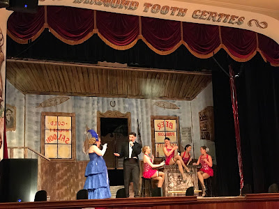
Earlier on we met one of the Can-Can girls working at one of the shops, and she told us to go to a different time slot for the night shows as they were different. Since we now had a season pass for the Gambling Hall, we went back to Diamond Tooth Gertie's for a different show. The previous nights show was better, there just wasn't a good plot to this one. ![]()

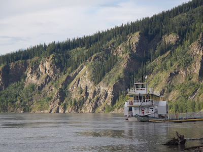
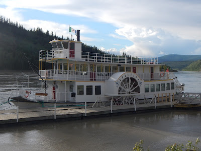
After the show we went and got Silva, and stopped for Ice Cream from the Klondyke Cream & Candy store, and sat on the riverbank overlooking the SS Keno, and watching the water flow by.


The SS Keno is a preserved historic sternwheel paddle steamer that was constructed in 1922. It was a key transportation ship in it's heyday as a subsidiary of the White Pass and Yukon Route railway company.
After getting back to the campsite, I checked messages and got a 90% data used warning from Rogers... Oops. Going to have to watch that over the last week of our monthly data plan. Good thing they have an app so you can see exactly how much data you have used.
We met a few more of our neighbors, it's hard not to when they are less than 10 feet away. They were both going to Tuktoyaktuk. It's still very weird when the entire campground has gone to sleep and you are sitting there in sunshine, in the middle of the night.
June 26
![]() $143.80 Dawson City
$143.80 Dawson City
In the morning we filled up with gas, and were finally able to venture to the top of the Midnight Dome. This is where you can watch the sunset almost, and sunrise... we just enjoyed the views over the city of Dawson. No sign of the fire that closed the mountain.


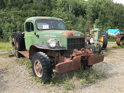
We took a detour to check out some of the Klondike Gold Rush history, and the first stop was Claim 33, a historic museum of gold panning dating back to the gold Rush... they even have an area where you can rent gold pans and try it for yourself.


I'm guessing they may have done a bit of drinking back in the day.

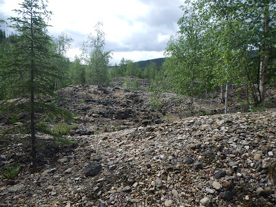
The next stop was Dredge #4. its a wooden-hulled bucketline sluice dredge that mined gold on the Yukon River from 1913 until 1959. It is the largest wooden-hulled dredge in North America with 72 large buckets, the dredge excavated gravel at the rate of 22 buckets per minute.
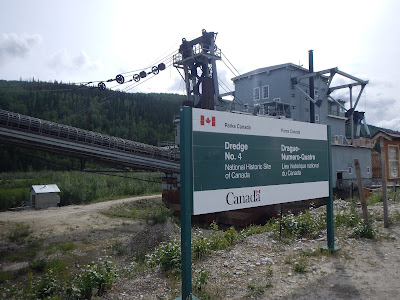

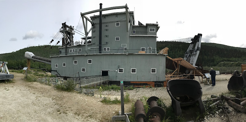
During its operational lifetime, it captured nine tons of gold, leaving behind stacked rows of gravel piles.

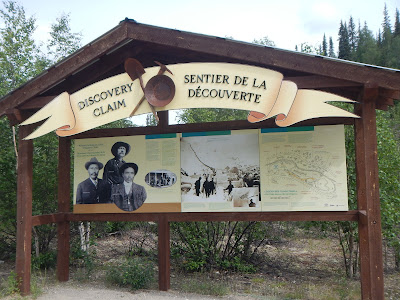
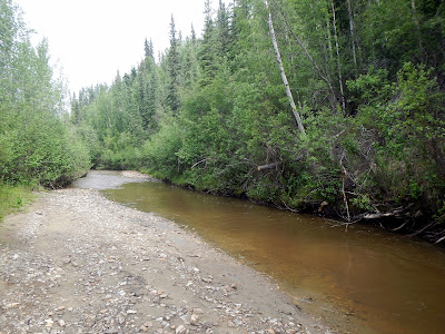
Our last stop on this detour was the Discovery Claim, it is the site where, in the afternoon of August 16, 1896, the first piece of gold was found in the Yukon by prospectors. The site is considered to be the place where the Klondike gold rush started.


Finished with our little Gold Rush detour, we were back on the highway and heading out of Dawson City limits.
The Tintina Trench is a large valley extending through the Yukon. It is the northern extension of the Northern Rocky Mountain Trench in B.C..
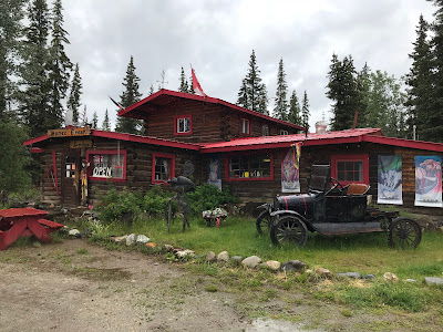
Moose Creek Lodge is a historic lodge, and one of the few businesses along this route. It's a mix of history and oddity, and of course we arrived minutes after a tour bus from Holland America. We took our time looking around and then the bus was gone and we were alone. Not sure that I would want to stay here, but it was a unique place to stop and get some fresh baked goods.


![]() $117.15 Pelly Crossing, the crankiest gas station in the yukon
$117.15 Pelly Crossing, the crankiest gas station in the yukon
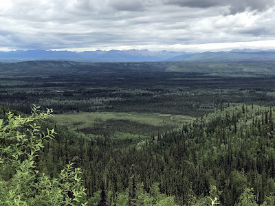
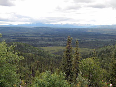
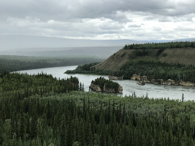
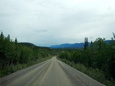
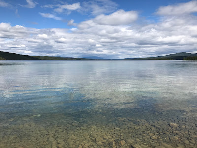
This stretch of highway has amazing views over the Yukon River.


We decided to spend the night at Tatchun creek campground before adventuring on to another remote Highway.
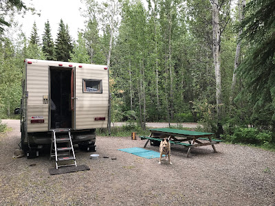

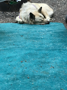
We like to make sure Silva is comfortable, it's a good thing we put this blanket down for her.
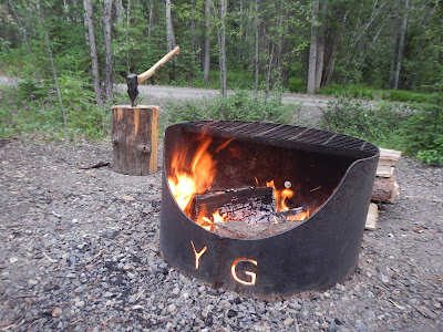
It's nice to have a campfire before bed, complete with free firewood, it's just so strange to have to do it while it's still light out.
June 27
It's actually nice to listen to the rain overnight, especially if it's not raining when you wake up.
The Five Finger Rapids are located on the Yukon River. Four islands divide the river into five narrow channels of which only the eastern is passable. The Five Finger Rapids is mentioned in Jack London's novel The Call of the Wild.

This is the stretch of river where the worst disaster in the Yukon River's history occurred, the sternwheeler SS Columbian exploded and burned at Eagle Rock, killing six men. The steamer was carrying a crew of twenty-five men and a full cargo, including cattle and three tons of blasting powder destined for the Tantalus coal mine, thirty miles (48 km) downriver. The explosion happened after the fireman on the ship thought it would be fun to take pot shots at a flock of ducks on the water. He tripped and accidentally discharged the gun into the load of blasting powder stored on deck. Following the ensuing explosion and fire, the captain grounded the ship on shore; those not killed or injured by the blast jumped ashore to safety. Kids, the moral of the story here is...
CAMPBELL HIGHWAY - Yukon
From the Klondike Highway we would take another route to avoid repeating our previous route. The Campbell Hwy is a 583 km (362 Miles) mixed paved and gravel road connecting Carmacks to our destination of Watson Lake on the Yukon border.
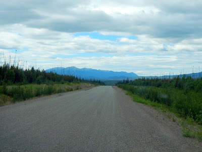
The first stretch of highway didn't seem to bad, paved, a little windy, and only a few minorly damaged sections of road.


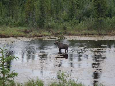
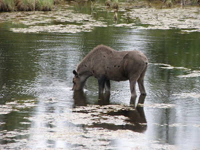
We were just talking about how these off-the-main-track highways just seem to have no wildlife compared to the main highways, and in a small lake on the side of the road is a giant Moose. You always have to be looking, or you could drive right by.


We took the turnoff for the town of Faro, mainly because it had a "gas station"... it was just a giant tank with a hose on it, but it worked.

![]() $113.74 Faro
$113.74 Faro

Faro is famous for it's viewing sites of the rare Fannin sheep. The Tourist Info directed us up the road to the "Fingers site"... There was no sheep, but they had outhouses and great views.
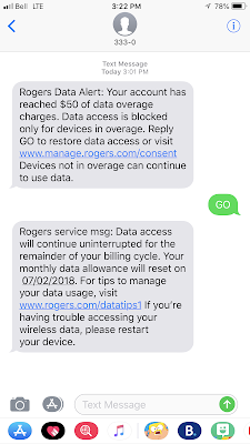
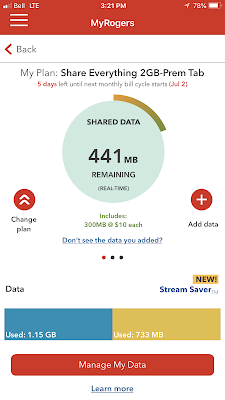
SIDE STORY: This is also where we received this notification from Rogers that we had gone over our data usage, and were being charged an extra $50, plus data was now blocked. I paid $10 to add 300Mb of data so I could see what was going on using the Rogers app... and hmmm, look, now I have 441 Mb of data remaining on our plan. We hadn't gone over, and Rogers was trying to screw us. Looks like I might be spending some quality time on the phone with Rogers once we get home.
Venting over, let's get back to the trip... We took the bridge out of Faro and back on to the Campbell Highway.

As it turns out, that bridge from Faro would be the last pavement we would see for a long long time.

Flowers of the North
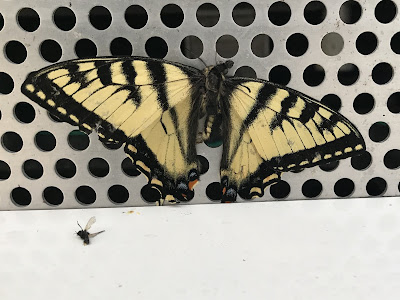
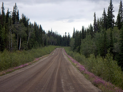
I want to take a second to talk about the wildflowers of Northern BC, Yukon and Alaska. Especially because as you drive the Northern highways, the sides of the roads are covered in flowers of assorted colours and sizes. It just adds something to the views.


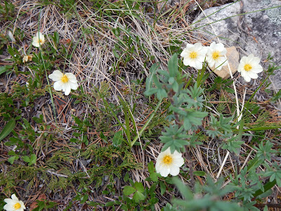
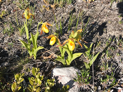
I'll let the botanists of the Internet chime in as to what flowers are what, but it sure does add to the views.
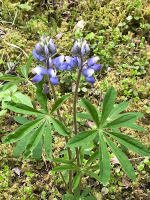

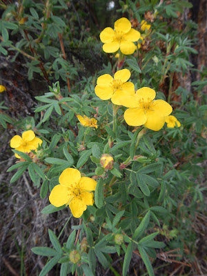

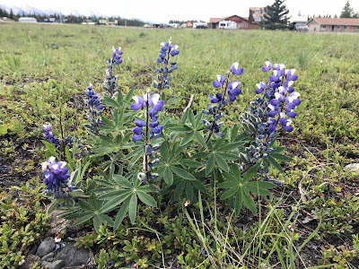
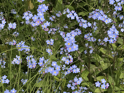
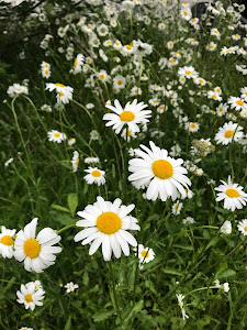
This is just a small sampling of the wild colours of the North!
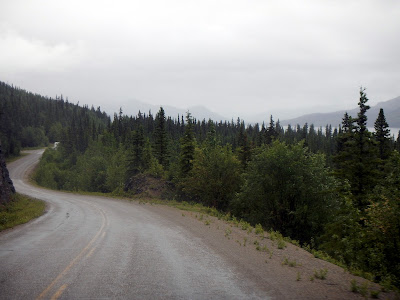
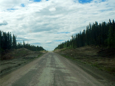
Although it's dirt road the views are spectacular, such as Lapse Canyon, and these pics from the bridge. Don't worry, we weren't blocking any traffic by stopping and taking these pictures... there was no traffic.


When it started lightly raining, the road started getting a little muckier, but it was still fine.

Even when you're crossing Coffee Lake on a dirt path, with no guard rails, it was fine.


Along the way here we spotted a bear & Cubs crossing in front of us, but they were gone before we could get a picture, I'm guessing they aren't used to seeing traffic in this area.
It's not until you stop for a break that you realize just how much mud is being kicked up on your truck.
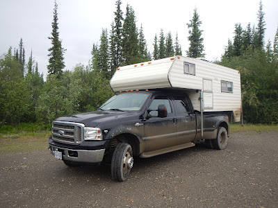
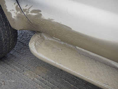


You can't see out the back windows anymore, and you need a throw-away-towel to open the back door, but it's all worth it for the scenery.


When you see a Porcupine waddling along the road, or a great horned owl staring at you from a tree stump, your brain doesn't react quick enough to grab a camera, you just stare back in wonder and appreciate the moment.
We made it as far as the Frances Lake campground, and needed to call it a day. We pretty much had our pick of campsites, so a nice private campsite right on the edge of the lake would do just fine for us. Silva was happy to be out of the truck and breaking off tree branches.


As we were doing a walk around the campground, Silva starts staring off in to the trees and growling. This is not normal behavior for her, so we were pretty startled, and trying to see what she was looking at. That's when we saw it, a giant Porcupine trundling through the low brush, and people ask us why we always keep Silva on a leash when walking through trails... that's why.
June 28
There was some very heavy rain overnight, but it was sunny in the morning, I wonder what affect that may have on the roads? As we are packing up to leave we spot a Ptarmigan in the campsite, some chicken would have been good with breakfast.

We didn't see a lot of large wildlife along this stretch, but there was a bear on the side of road, my photography skills are amazing, huh?
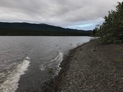
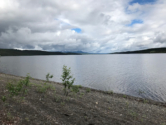
We took a lunch break and rest stop at the beautiful Simpson Lake, the colours were astounding.

From Simpson lake we started to see the effect the overnight rain had on the road.

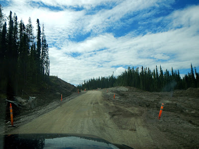
We were only 50km out of Watson, but we weren't sure we would make it. There was a stretch of road that was a little mucky, and I had to put the truck in 4WD when we started slipping a little. Then we hit a construction zone and it was bad, the material they use on the road may as well have been frosting, the truck was bogging down, sliding and it was like driving on grease.


4WD and a slow and steady pace while correcting in to and out of deep troughs, and eventually we made it through to semi-descent roads again. Pretty sure we'll need to wash the truck again when we get off this highway.
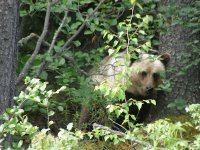
Not only was the road better, but we spotted a Grizzly heading in to the trees. When we stopped to watch it, she turned around and watched us from the tree line. So very cool to see one in the wild, and also very glad to be inside our truck.

![]() $166.50 Watson Lake
$166.50 Watson Lake
plus $20 for a propane refill, and a well spent
$10 for an RV Car Wash, so we could see out the windows again.
After a recommended Chinese Food restaurant lunch, we replenished our food and water, and repeated the short stretch of road towards Nugget City to get to the turnoff for the Cassiar-Stewart highway in British Columbia. After that lunch, it's a good thing B.C. has Rest Areas.