YUKON-ALASKA 2018
ALASKA HIGHWAY - Alaska
June 18 cont...
We finally made it to the US border crossing and into Alaska. Surprisingly there was no lineup, we pull up to a red light, and wait a minute or two for it to turn green, and drive up. We're pretty sure we woke the US customs guy up, but no problems, and we were on our way.


The roads still aren't great, with a lot of frost-heave making them a little exciting at times, for the first stretch of US Highway 2 you can see how it has affected their telephone poles. The first town and services as you cross the border are completely closed down, looks like forest fires and lack of business have hit this area too.


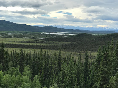
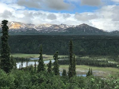
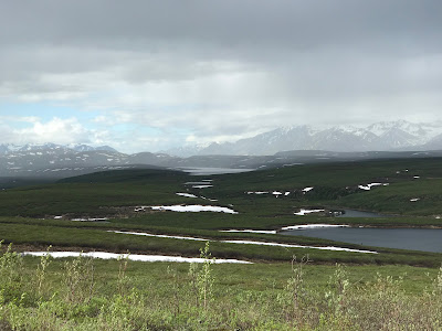
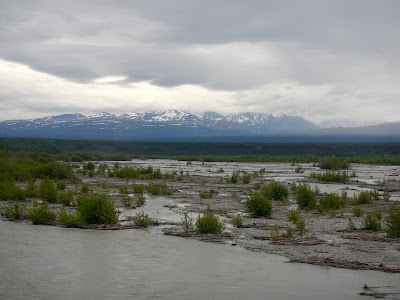
We made a brief stop at the Tetlin National Wildlife Refuge to gaze across the forest and get an Alaska Campground map.

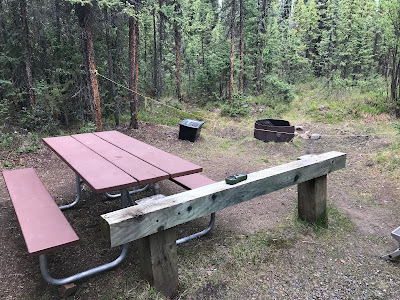
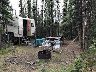
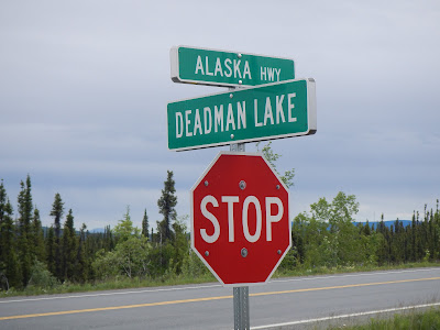
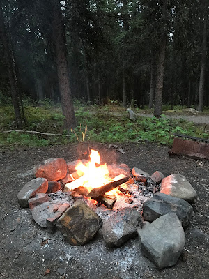
Because the first campsite in the Tetlin refuge had such a welcoming name, we stayed the night at Deadman Lake campground. The campsites here are very well treed, and spaced far apart from each other, and best of all, there is no fee and free firewood (it's by donation). The only downside is we went to get water and the park host called out to us "have you been to Alaska before? Wells have to be tested once a year, so most campgrounds don't have water"... OK? That's kind of odd, but for free, you can't complain.
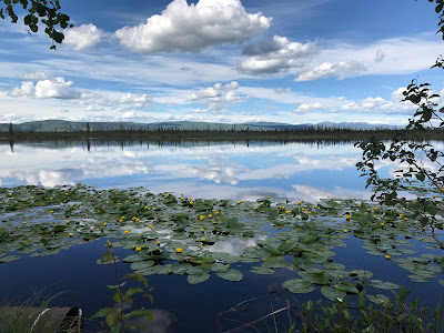
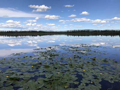
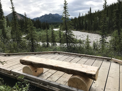
There's a nice little boardwalk trail that takes you down to the marshy lake edge.


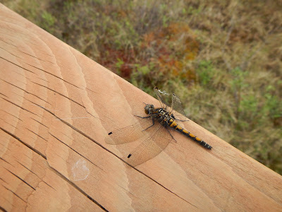
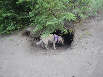
The area is teaming with wildlife, from Dragonflies to snowshoe Hares, guess which Silva liked best?


We knew Silva was feeling better when she started waiting outside the camper for food again.

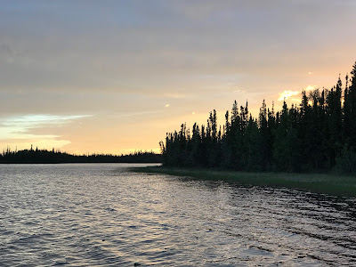
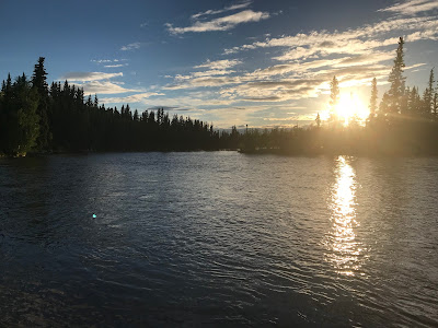
When it's Midnight and still sunny out, may as well go for a walk down to the dock for sunset.


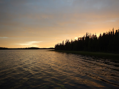
It's really hard to describe the colours of a midnight sunset.
June 19
I forgot to mention, also included in your Alaskan campsite stay is free canoe usage, so we took Silva out for her first canoe ride in the morning. It took a little coaxing to get her in, but once she settled and laid down, she seemed to enjoy it... check that off her bucket list.


Back out on to the highway again, and past vast stretches of burned forest.


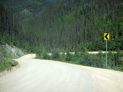
This is probably a good spot to talk about the quality of the Highway in Alaska. With their extreme range of weather, the roads take a beating from mother nature. There is potholes and cracks in some areas, but the frost-heave woop-dee-doos make it a little exciting when you have a big camper on the back of your truck. Crews must drive this highway constantly, and they stick little orange flags on the side of the road where there is damage. When it gets bad enough they must come fix it, although there is not a lot of signs of that in mid-June. Sometimes you can brake quick enough to avoid a big bounce or pothole crunch, sometimes you can steer to avoid them, and sometimes you just know all your coats in the back of the camper will be in a big pile at the bottom of the closet... again.

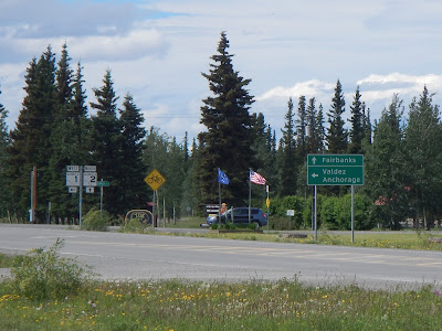
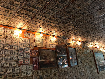
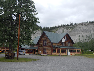
Our first "big town" stop in Alaska is the town of Tok, pronounced Toke, as in short for little Tokyo. We had lunch at the famous Fast Eddies, it was big, had a huge menu with large portions and was very busy... probably because it still has a salad bar.


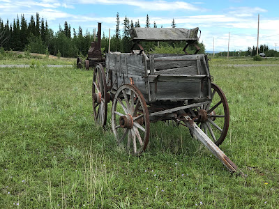

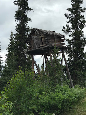
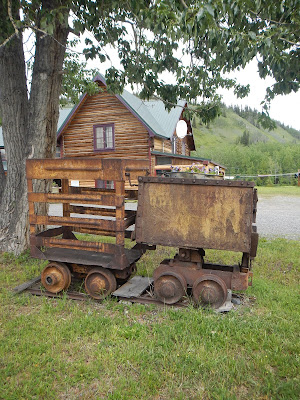
A lot of old relics in this town.

![]() $44.15 US Tok, Alaska
$44.15 US Tok, Alaska
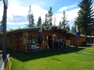
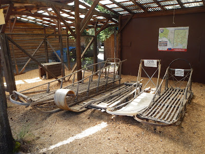
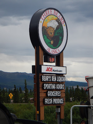
A quick stop at the Three Bears for groceries, and free use of their water and sani-dump at the gas station and we would be on our way towards Fairbanks. Before we continue on though, we have to stop at the world famous Burnt Paw Gift Shop and Cabins. They have displays of dog sledding, a wide assortment of Alaska made souvenirs, and most importantly they have Husky puppies...
but apparently not today. SAD!


We didn't visit Mukluk Land, but we did stop to take a picture of the worlds largest Mukluk.


We made a stop at the very pretty Dot Lake, and checked out the historic Dot Lake community chapel built in 1949.

You have to love the small town charm of a place like this. Just inside the door is a stack of camping gear with a handwritten note, saying that the owner just couldn't carry it anymore, and will come back for it on his return trip.


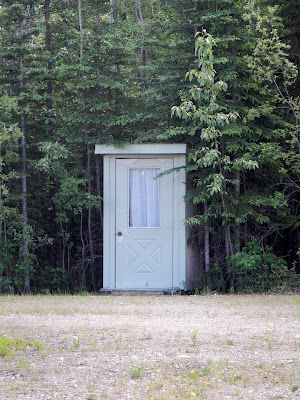
I'm not sure if this is a confessional or an outhouse.
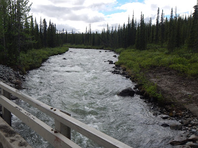
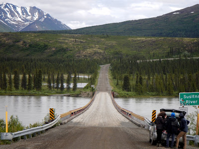
Gerstle River bridge, a truss bridge built in 1944 as part of the Alaska Highway construction. Now called Gerstle River Black Veterans memorial bridge in honour of the 3,695 African American soldiers that worked on the Alcan highway.
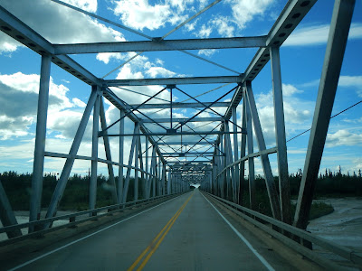

There's a great pullout on the end of the bridge, and you can drive right down to the river. If we had of arrived earlier, we could have camped right on the sandy bank of the river. This was another of Silva's favourite stops, with amazing views of the mountains.


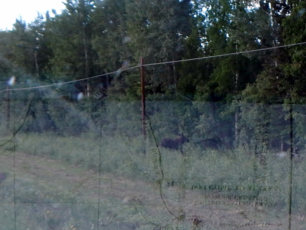
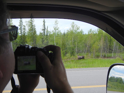
Just as we get back on to the highway I had to slam on the brakes as a moose ran across the road right in front of the truck. It's not great pictures, but I felt we needed to have photographic evidence in case it turns out to have caused heart damage... scared the crap out of us.
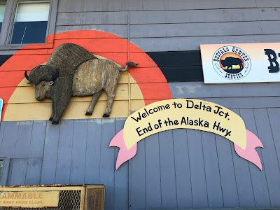
Our next major stop was Delta Junction, the official end of the Alaska Highway. 1422 Miles from Dawson Creek (2288.5 km).


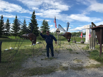
Now you know what they mean when they say the mosquitoes are huge in Alaska.


From Delta Junction you continue north to Fairbanks on the Richardson Highway, but we would stay at a campsite near to town on the Delta-Clearwater river. The Clearwater State Park, was a 'meh' campground. They were all out of firewood, and the campsites were so lopsided we had to prop the camper up on logs we brought with us. The river behind our campsite was nice but as the sun is coming down it is like a rainstorm of bugs, and you have to remember the sun is coming down for hours and hours.


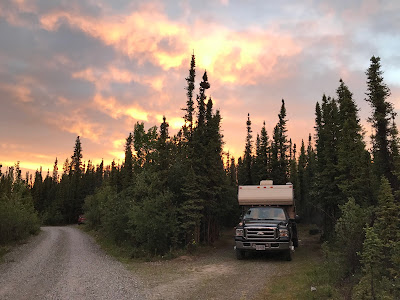
Once again because of the late sunset we can take a midnight walk along the river.

Lucky for us, there is a nice lodge at our end of the campsite, the Clearwater lodge, which has burned down and been rebuilt at least 3 times. It's party central at the ole lodge, with drunks on the deck looking out on the river, and what I assume is drunks racing in and out of the parking lot in their Hot Rods.


It wouldn't be a great nights sleep , with all the noise, and it still being light at 1am, but we made it to the end of the Alaska Highway, and you have to feel pretty good about that. As we were enjoying our fireless night, we spent some time looking at maps and planning the next leg of our trip. Originally we had only planned to go to the end of the Alaska Highway at Delta Junction, but we noticed a few highlights worth changing plans for... You can't come this far and not go to the North Pole, who knew it was so close to Fairbanks, Alaska. When you look at a map and see Fairbanks, who knew that Denali National Park was so close, it's been on our bucket list for a while.
North Pole, Fairbanks, Denali... "RECALCULATING" (in my best GPS voiceover)
June 20
As we were packing up the camper in the morning, I noticed that the exhaust tailpipe was loose, obviously shaken by the Alaska Highway. We went to a recommended repair place in Delta Junction, and they told me to come back in an hour and a half.
As we were waiting we went to the library to use their WIFI, and a sign said Internet was down, so we drove to the back of the library to let Silva run in the park. Turns out the WIFI works just fine behind the building, so we used the free Internet to book a campsite for 1 night at Denali National Park... We would have done more but only 1 night was available for our newly planned detour.
We went back to Full Moon Auto, the receptionist tells us the mechanic is just finishing up another vehicle. After 30 more minutes waiting, we see the mechanic drive the vehicle out and walk past us to go back in his garage. Then the receptionist comes over and tells us he can't fix it, he doesn't have time. No consideration for wasting our entire morning waiting for them, he couldn't tell us himself and he didn't even look at our truck. We totally got dicked around, and they wasted our time at Full Moon Auto.
![]() $58.19 US Delta Junction, Alaska
$58.19 US Delta Junction, Alaska
With our tailpipe a little loose, we hit the road and headed towards Fairbanks

Amazing how diverse scenery can be, from snow covered mountains, to a suspended oil pipeline across a river.


At first we thought we spotted a Grizzly on the side of the road, turns out it was a Moose.


One of those funny must stop places along the Richardson Highway is the Knotty shop.


With it's odd collection of Burl shaped animals, to it's collection of Taxidermy animals, it was a fun souvenir stop.


It's a little unnerving when you're driving down the highway and a tank drives past you. It was a little settling to know we were right near the Alaska Air National Guard (Eielson Air Force base), and not in the midst of some Trump driven invasion of Canada. It's a huge airport with all kinds of fighter jets (A-10 Warthogs and F-18s), but there is all kinds of signs saying, absolutely no stopping and no pics allowed.


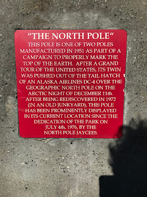
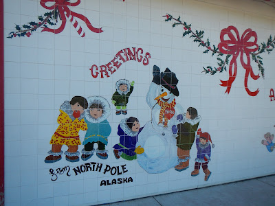
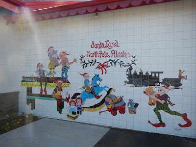
I know it's a little hard to see through our bug-splattered windshield, but yes Virginia, that is the North Pole!
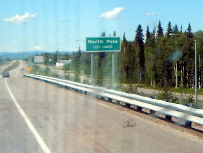

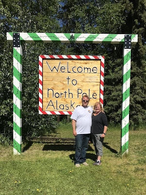


After a brief visit with the nicest hosts at the North Pole Information Center, we took our town map and headed towards Santa's house.

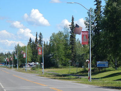
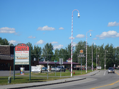
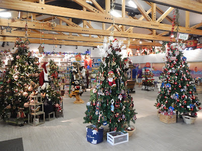
It's kind of ridiculous how cute this Christmas-all-year-round town is, and we were surprised at how big it was.


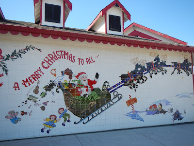
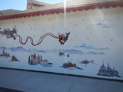
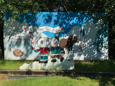
All the tile artwork surrounding Santa's house has been painted by local elves (errr, school children).
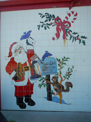


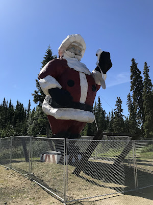
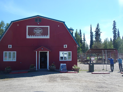
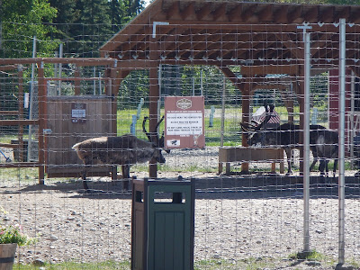
Santa Claus was there, taking pictures with local soldiers who came to visit, and right next door was the Reindeer academy.
It was hard to leave the North Pole, but we did, and our first stop was at the Midas Muffler shop in Fairbanks. Initially we were told they had an appointment in a couple days, but one of the guys in the shop told us to pull up to his bay. He took ten minutes, pulled out his welder and fixed the Muffler-Tailpipe that had broken a couple welds. When I went to pay, he said "Don't worry about it, enjoy the rest of your trip". Now that is customer service!!! I gave him some money anyways to go get himself a couple beers after work, he earned it!

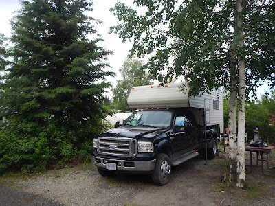
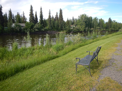
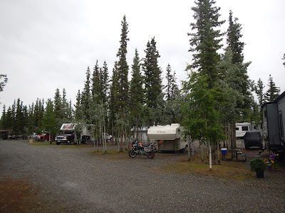
For the night we decided to stay in the city at Rivers Edge RV park, and for a nice change, it was actually a pretty nice RV park, a good amount of trees, and a nice walk right along the Chena River.
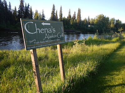
They had a really nice restaurant on one side of the campground, called Chena's Alaskan Grill. A great spot with a balcony right on the river for dinner. It was hot as hell in the sun at 9:00pm, but the food was great, and watching the paddlers and boaters cruising past on the river made for a very nice evening.

At midnight it is still sunny out, and as Norine posted on FB, "Not much time to sleep before Sunrise".
The next night would be The Midnight Sun Game, it's an amateur baseball game played every summer solstice in Fairbanks. Because the sun is out for almost 24 hours a day, the game starts at about 10:30 at night and completes around 1:30 the next morning. We would miss it, because we'll be in Denali Nat'l park.
June 21
Our next stretch would be a little more remote with no big towns for quite some time, so we hit a Fred Meyers (which is huge BTW), to load up on groceries, gas and some firewood, just in case the campsites have run out again.
![]() $52.15 US Fairbanks, Alaska
$52.15 US Fairbanks, Alaska
Ready to head off Into the Wild, we did a quick Fairbanks city center tour.


I had just one more stop before we could leave Fairbanks though, the Fountainhead Antique Auto Museum. Perhaps one of the nicest car museums I have ever seen in my life. Full of very unique and rare cars in exceptional condition, all accompanied with clothing of the era.

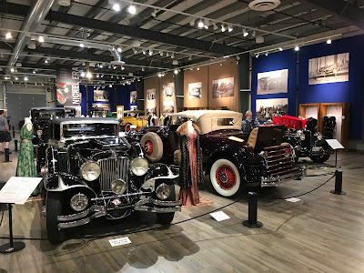


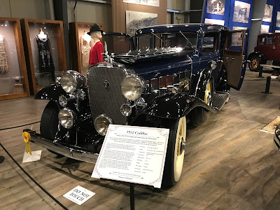
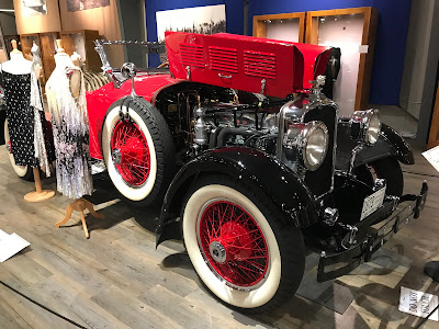
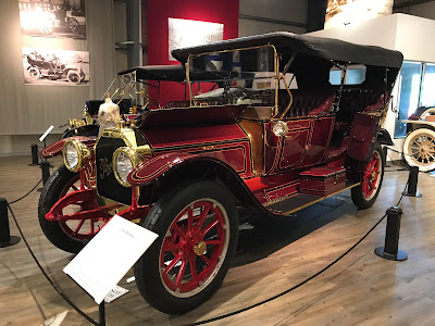
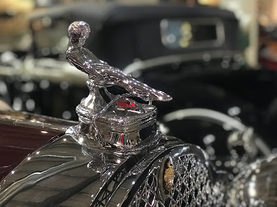


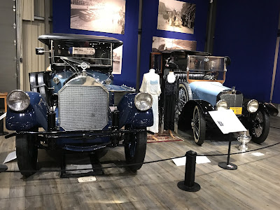

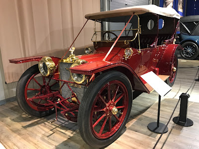
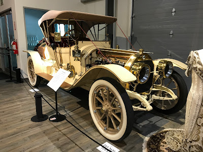


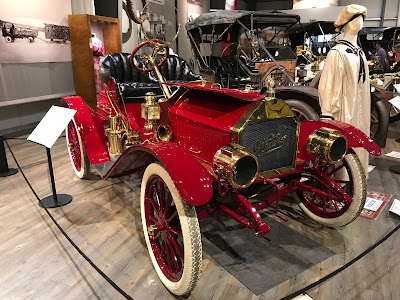

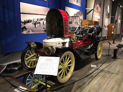
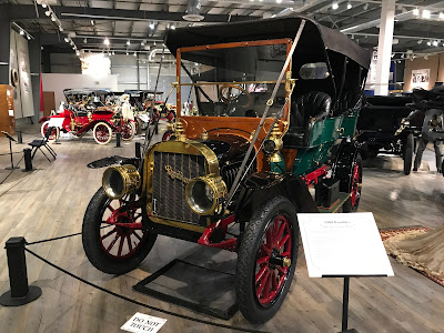


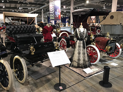


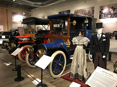
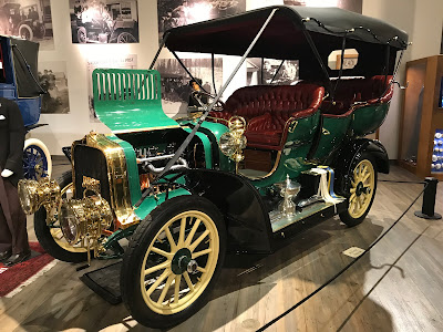
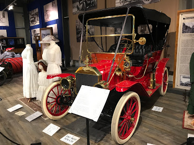
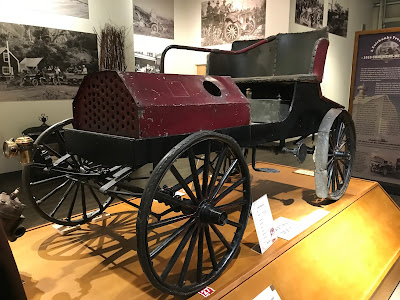
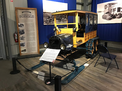
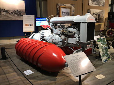

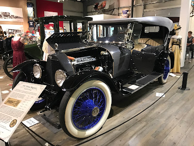
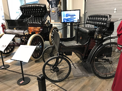


We parked in the shade, and left all the windows wide open for Silva, but if she wasn't with us, we could have spent the entire afternoon here. Even their non-car displays and garage were like historic works of art.
HEADING SOUTH
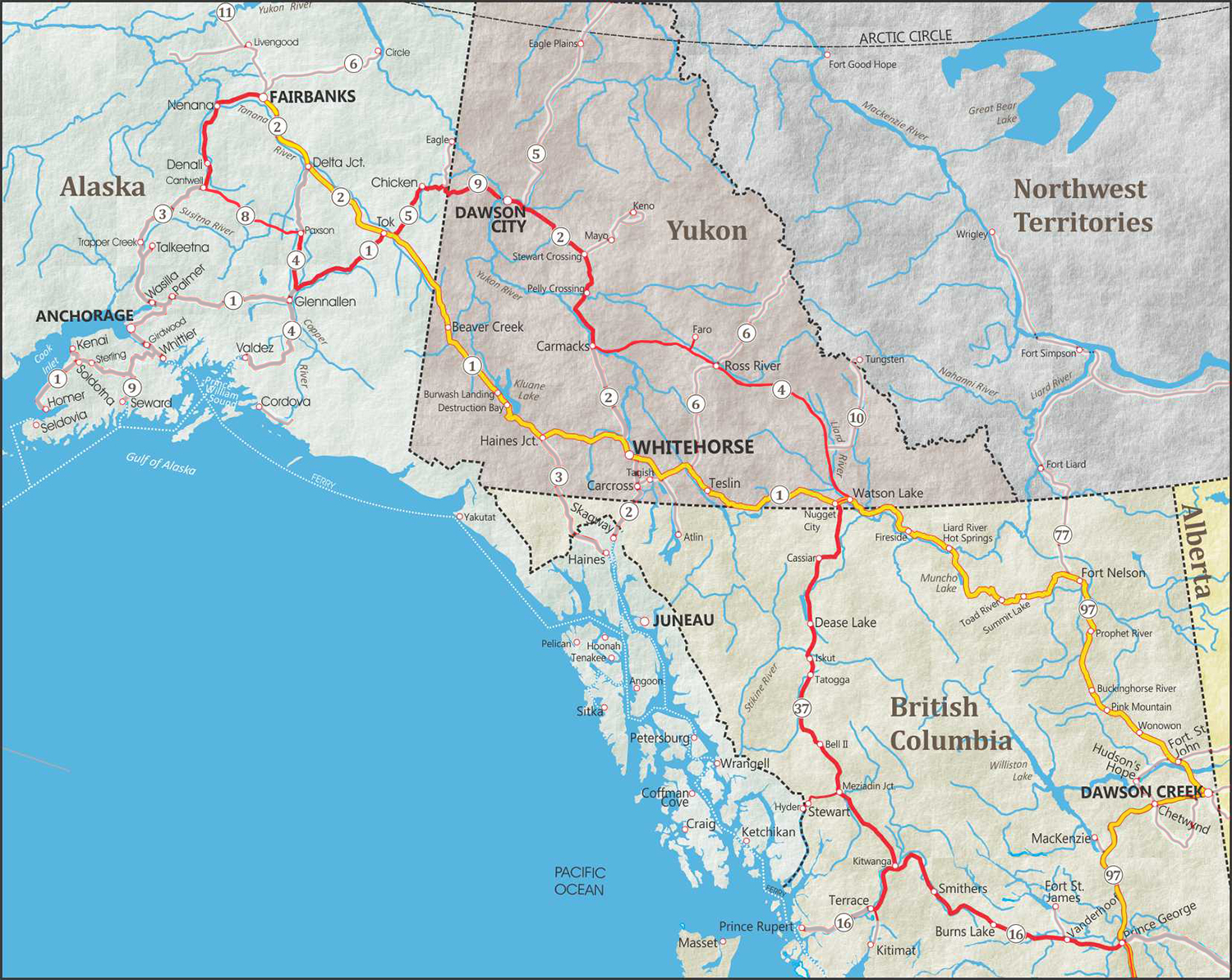
(click to enlarge)
RED Line indicates South route
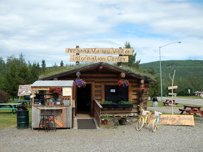
Finally leaving Fairbanks and heading to Denali, we made a stop at the cute little Nenana Info Center, complete with a Blueberry lemonade stand run by the young kids of the couple that ran the Info center and Art Gallery. They make some fine Blueberry Lemonade.


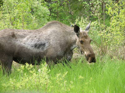
Our next wildlife sighting we spent a little more time safely watching a Moose from the side of the road. She knew we were there, but was more interested in eating.


![]() $46.85 US Healey, Alaska
$46.85 US Healey, Alaska
We made a stop in Healey for a last gas up and snacks before heading into Denali, which wouldn't be a big event, but Healey is famous for being the area where Christopher McCandless died in the book and movie "Into the Wild". You can still walk 20 miles through mosquito-infested tundra, risk your life crossing the Teklanika River to get a photo next to the 'Magic Bus' or a replica of the bus is located at a local bar... we chose neither. Apparently a lot of people make the pilgrimage to see "the bus", several have needed to be rescued or died.


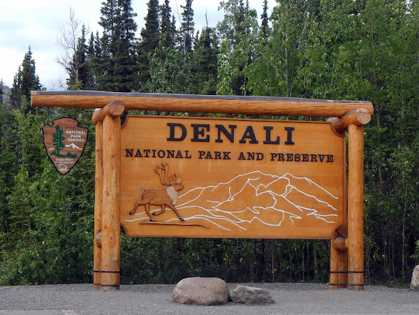
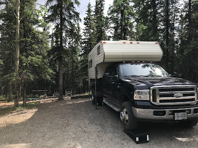
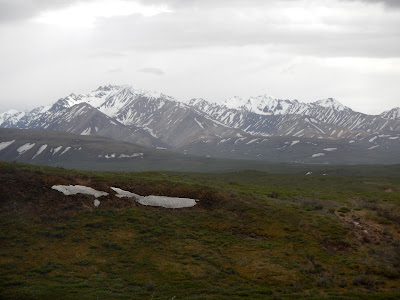
We finally arrived at Denali national Park, a place that has been on our bucket list for many years. Along the way we see dozens of Cruise Ship buses, which is where we first developed the idea of going to Denali one day... just not on a cruise. As I mentioned earlier we could only get a campsite for 1 night, as the weekend was full up. They have two campsites that you can drive in to, and 3 that are only accessible by park bus, we were lucky to get in to Riley Creek campground on the day of Summer Solstice, the longest day of the year.

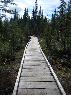
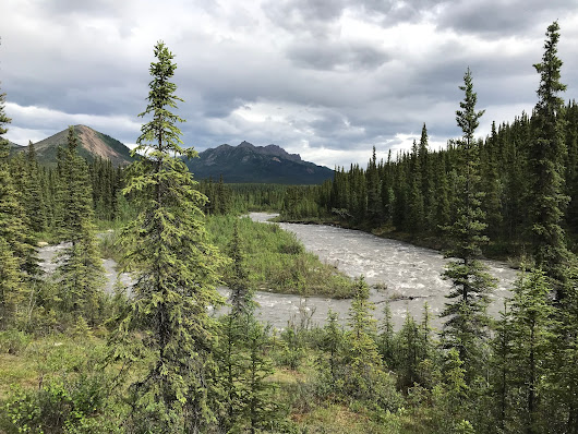
From the back of our campsite is a nice little trail that leads to a boardwalk and an amazing view across the river and the valley.
We didn't have a lot of time to get settled in, as when we checked-in the ranger tells us about a 6.5 hour Toklat bus ride we can take for the Solstice night. Denali is six million acres of wild land, with only one road in, and the same road back. The Denali Park Road is 92 miles, running from east to west, and you can only drive private vehicles for the first 15 of them. The park service provides two bus options, the narrated tour, and the non-narrated tour, we were able to get on the non-narrated tour that left at 5:00pm and returned at 11:30pm. With Silva nestled comfortably in the camper with lots of food and water, we caught the bus just outside our campground.


Although it was called a non-narrated tour, our bus driver was awesome, providing lots of info, answering questions and stopping whenever wildlife was spotted. For most of the trip it was just 5 of us on the bus, and then we were joined by a family group that was staying at one of the tent only campgrounds. We did have one very talkative woman who constantly bragged about her spotting ability, she wasn't that good.


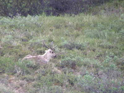
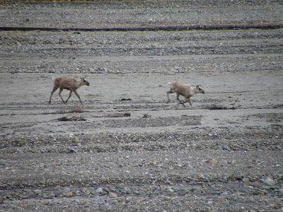
With their colouring, you can see why it might be hard to spot a Caribou nestled in some dry grass.

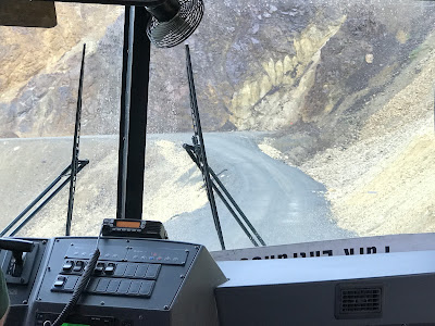
Some stretches of the road are a little unnerving, and I can see now why they wouldn't just let everyone go driving down this "road".


It's already after 9pm, the time has just flown as we drove out here, we had numerous photo stops, and even a couple bathroom stops. Toklat River rest stop is 53 miles from our start point, and also our turn around point. Some day we'll come back and go all the way to Kantishna at Mile 89, but that's an 11-12 hour bus ride for another trip.
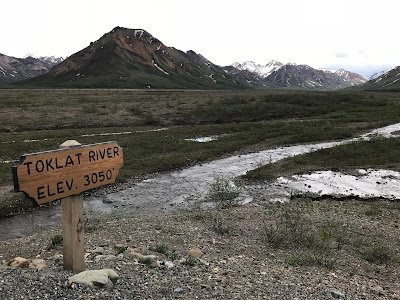
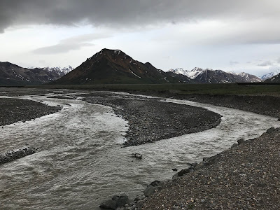


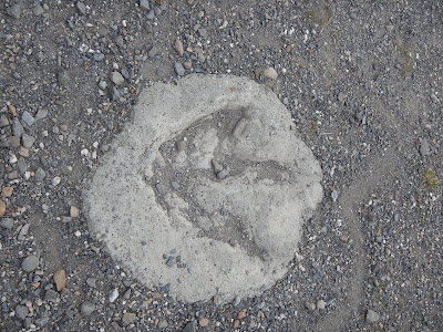
There's a lot to take in at this rest area, there is Dall Sheep on both hillsides, Antlers scattered around, preserved dinosaur tracks, and just mountain/river scenery galore.

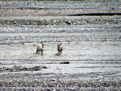
While everyone else is wandering around, Norine and I spot a pair of Caribou in the river basin, and they are just wandering straight down towards us. We give a few others hand signals to let them know, but their yelling and screaming about it may have resulted in them changing directions and wandering down the riverway.


A very nice little stop at Toklat, and we are back into the bus for the trip back down the Denali Park Road.

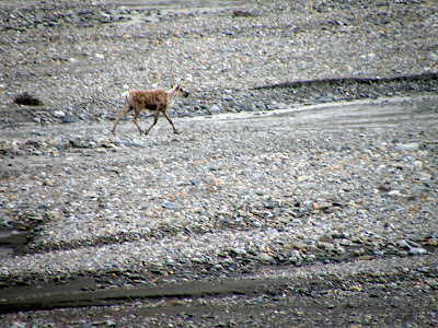
Another Caribou spotting, and no it wasn't by our traveling companion wonder-spotter either.


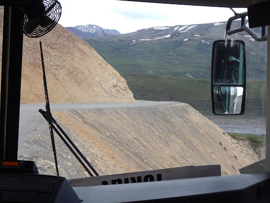
Back past the harrowing cliff edges.


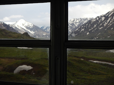
Apparently we joined a special club that night, it's called the 30% Club, because apparently only 30% of people that come to Denali National park ever actually see Denali Mountain (formerly known as Mt. McKinley until 2015). It is the highest mountain peak in North America, with a summit elevation of 20,310 feet (6,190 m) above sea level. Denali is the third most prominent and third most isolated peak on Earth, after Mount Everest and Aconcagua. The clouds parted and the sun shone down on the mountain as made our way back to our campground.


As we drove back to the bus stop at our campground, our driver apologized as we didn't see much on this trip. It was a pretty good tour I would say, we would have liked to have seen more wildlife like a wolf or a bear, but we did see Caribou, Moose, Dall sheep, a Great Horned Owl, and lots of snowshoe hares. The mountain and park scenery were magnificent. Then just as we pull in to the campground there is a Moose beside the train tracks and a Lynx runs across the road in front of us. Sorry for the blurry photos, it was the best I could get on the spur of the moment. I couldn't even get a picture of the Lynx, I was in shock, and then he was gone.


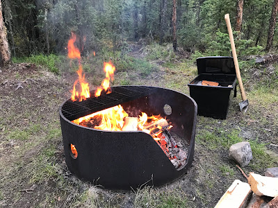
Getting back to our campsite after midnight on Solstice, the longest day of the year, it just never got dark. As we walked through the campground it was surprising that no-one was awake experiencing this, it didn't matter what type of camping setup they had, RV, Camper, Tent, tent on car... they were all asleep. We had to stay up late and appreciate the event, and Silva likes nestling near the fire.

June 22
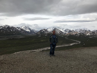
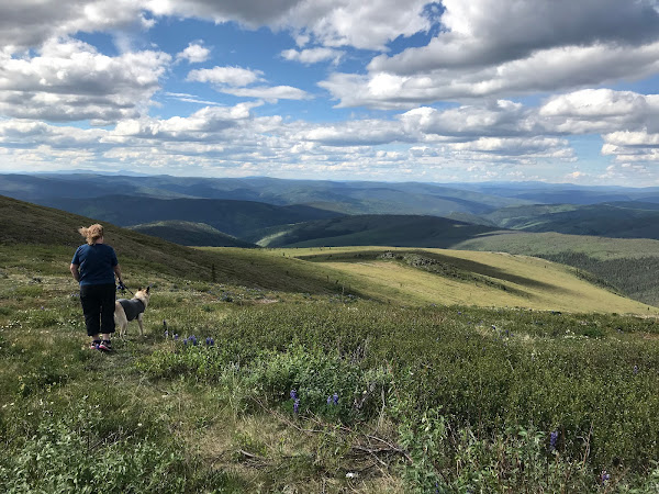
An early morning walk with Silva back to the river look out for one last view of Denali National Park.
As we were packing up, I noticed a little girl standing at the edge of the campsite staring at Silva, so I invited her to come visit with her mom. She was elated, coming over to pet Silva, a few minutes later the dad came with their even younger son. The family had traveled here from Spain, and like us, had been traveling to a lot of the same places over the years. Norine got to practice her Spanish skills, I got to try and figure out what they were saying, and Silva got a ton of attention, just like she has been trained to do.
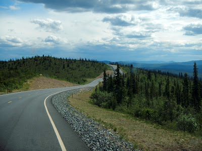
DENALI HIGHWAY - Alaska
Today started a new aspect of our trip, as we left Denali, our goal was to continue our trip without driving the same roads we took to get here. The first part of that was the historic Denali highway, a 135 mile (217 km) dirt road. When the Denali highway opened in 1957, it was the only road link to Mount McKinley National Park (now Denali National Park). This 'Highway' isn't even open in the winter.


A short drive down the Park Highway and a left turn at Cantwell, and we go from pavement to dirt.


It's not the nicest of days, but at least the occasional light rains keep the dust levels down, and there is blue sky every once in a while. At least long enough to stop for a snack and pee break. I think we passed less than 6 other cars the entire stretch of Highway.


Our first planned stop, (there isn't many marked stops on this highway) was the Clearwater Roadhouse. It's good to support these middle of nowhere businesses, so we thought we would top up our fuel. You are supposed to pull up and honk, but when the owner comes out, he discovers that the fuel pumps weren't primed after replacing a hose. He apologized and offered to give us a few gallons from some jerry cans, but we had more than enough to get to the next station at the end of the Denali highway.


It was a funky little place with a lodge, cabins to rent, all kinds of hillbilly displays, and a super cute little bar called the Sluice Box.


We had to support them somehow, so we spent a few dollars at the Sluice Box, and continued on.

There's nothing quite like driving over a single lane wooden floating bridge in a giant camper, I'm glad I'm not pulling a giant trailer along here. Come to think of it, I don't think we passed and Trailers, just trucks and a few other campers.


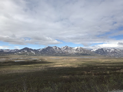
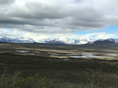
If we wanted to just do some wild camping, there was all kinds of little roads (trails) leading off, and most had a little campfire area. There was lots of mosquitoes, but you would have the campsite all to yourself. Photography was no problem along here, you could stop anywhere and not have to worry about affecting the traffic... there was none.


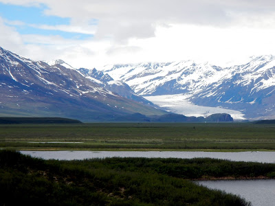
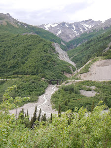
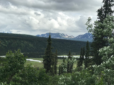
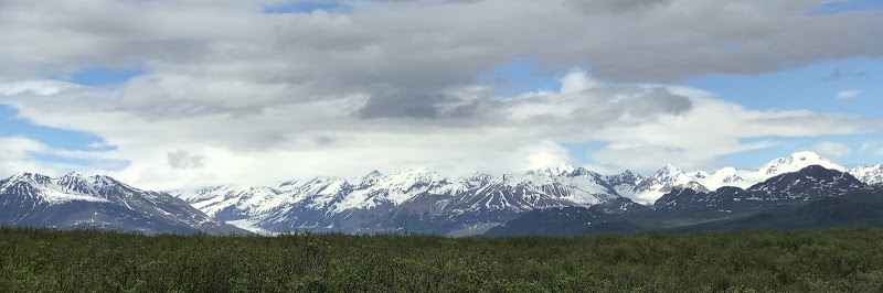
The Scenery was stunning, snow covered mountains, lush valleys, and great views of the West Fork Glacier.


Unfortunately this was the only big animal we saw the whole drive. Lots of hares and birds, scenery, but no large animals... Weird. We did keep catching glimpses of this mountain, we thought it looked like a happy bear, so it is now known as "Happy Bear Mountain".


Our Milepost book did tell us to watch for nesting Swans in the small lakes, so we did, and they were there. Good book.

The last stretch of the road was much more windy and mountainous (is that a word?), we were getting close to our planned stop for the night at Tangled Lakes Campground. Apparently being a weekend, and fairly close to the main highway from the Paxson side, everyone and their dog likes to come to this campground. We hadn't seen other vehicles almost the entire day, probably because they were all here. As we drove through the campground looking for a spot, a Ranger stopped us and told us it was full, but we could stay in the group area, a giant open field with a bunch of other campers... no thanks.
The last stretch of Highway changed from dirt to pavement again, which also helps to explain why so many people were at Tangled Lakes campground. It's very strange to be driving this last stretch nearing the end of June and there is still snow on the side of the road, hope all those campers enjoy swimming in the near frozen waters of Tangled Lakes.
At the end of the Denali Highway is the town of Paxson, it's apparently gone out of business, and there is no services there, so we turned right onto the Richardson Highway and continued South to Paxson Lake campground. If we went North we would have ended up back at the end of the Alaska Highway and Delta Junction, and we had no desire to go there again.


Like I have mentioned before, when we can't stay somewhere and move on, we usually end up somewhere better, Paxson Lake Campground was no exception to this. Lots of trees, fairly private sites on a nice lake. As we are setting up, i notice a Giant Eagles nest and pair of eagles right beside campsite. We had our evenings entertainment right from our camp chairs, it rained a little, so we had to watch from the cover of our canopy for an hour or so, then it cleared up.


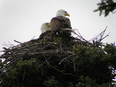
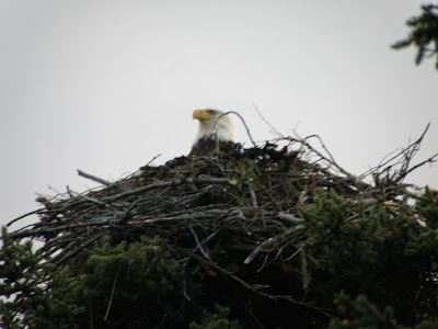

As the night went on, we would watch them swap spots, and one would go off hunting. With the binoculars you could see them being harassed in their nest by mosquitoes. Very very happy to have 2 Thermacell's clearing our area down below.


Even with a near empty campsite, or maybe because of it, we did have a few annoying neighbors. Nobody wants to hear you blaring your Stompin Tom Connors music Mr. Fisherman, and hey you, people sitting inside your Winnebago all night, we don't want to listen to your generator. At least with the late night sunshine everyone was in bed, and we could enjoy the campfire and watch the Eagles after midnight.
June 23
We checked on our Eagle friends in the morning, and they were still swapping egg sitting duties. What a special experience to observe them so close. So we made a bigger breakfast on the BBQ to delay our departure a little.


Today we would continue South to take another alternate highway, The Glenn Highway, aka the Tok Cutoff. A quick stop to fill up with gas, and wait for a "Wide Load" to safely pass us. The Wide Load was a giant Air Boat on it's way to some big lake I'm guessing.
![]() $92.30 US Meiers Lake, Alaska
$92.30 US Meiers Lake, Alaska

A left turn onto the Tok Cutoff and we are heading Northeast back towards the town of Tok, one of the few spots on our route where we would cross paths with the way we came up through Alaska.

The Tok Cutoff is not as pretty as the Denali Highway, but it is paved (aside from a few frost heaves), so that is a nice change. We made a short stop at the historic Gakona Lodge, built in 1929. They were in the midst of setting up for a Christmas in June event, and we were way too early for the Antique car show that would be there that night.

Did I mention the frost-heaves? As we got closer to Tok, they got a little more exciting. A couple times we throughly tested the chains that hold the camper into the back of the truck.


Our little detour on the Tok Cutoff gave us way more wildlife than the Denali highway did, we saw 1 Moose.


![]() $59.80 US Tok, Alaska
$59.80 US Tok, Alaska
Then we were back in Tok for a second time, another stop at the gas station that let's you use their RV wash and fill up with water if you buy gas. After driving that Denali Highway, anytime you got near to the camper you were covered in dirt and dust.

Tonight we would stay at the "we have a few trees" Tok RV park. We could recharge batteries, do a little laundry, and most importantly, they had Hot showers! It ended up raining all night anyways, so we stayed inside and watched Blue Jasmine on the iPad. before bed.
June 24
Today would be our last day in Alaska, from Tok we are heading north on the Taylor Highway, and then taking the Top of the World Highway back into the Yukon and Dawson City.


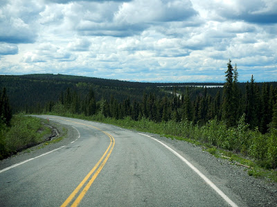
Taylor highway heading up towards the junction has it's fair share of "Bumps", but it also has it's fair share of scenery.

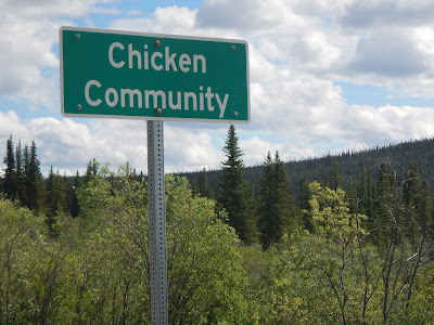
Our last stop in Alaska is the town of Chicken. Apparently they wanted to name it Ptarmigan after the local birds, but no-one knew how to spell it, so they called it Chicken... the closest relative of the Ptarmigan.
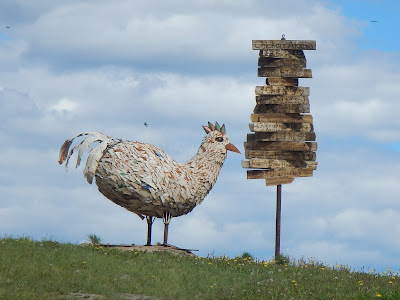


They take full advantage of the Chicken name, from the decorations to the souvenirs.

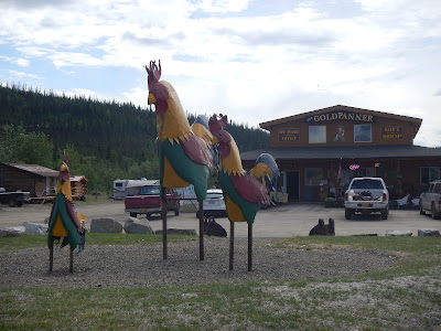
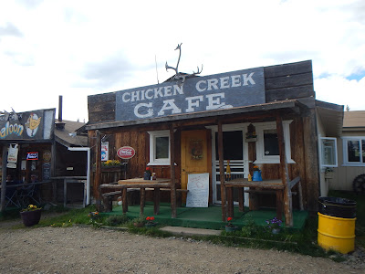

It's really quite the unique place, it feels true Gold Rush, including a hold panning area outside. Seems like the perfect place to stop for some lunch... see if you can guess what we had, yep, BBQ Chicken.

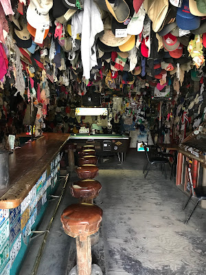


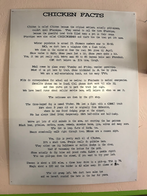
Apparently Chickenstock Music Festival is a big deal, even if their stage isn't that big. I had to take a picture of the info sign in the Cafe, it really just summed up the whole town. The people we met there were loud, funny, and super friendly.
There is all kinds of historic elements in Chicken, from the giant Dredge #4 (Pedro Dredge) to the old miners cabins, I'm just not sure how the modern bridge across Chicken creek really fits into it all.


As you leave Chicken there just seems to be vast areas of burned trees, both before and after the Taylor Highway becomes the Top of the World Highway. If you wanted to do more exploring you could turn left at the junction, and drive up top Chicken's sister town, Eagle... no joke.
TOP OF THE WORLD HIGHWAY - Alaska
There's really no turnoffs on the Top of the World Highway, there's no where else to go up here. It is a little creepy when you see a gravel turnoff and there's an Abandoned RV off the side of the road. I'm not sure I want to know that story.


It's pretty country up here, it's winding narrow gravel road gives you a different perspective from regular highway driving.


It's funny, as you drive along, and finally see pavement, you're thinking, oh this must be it, then it's Gravel again... paved... gravel... paved... gravel. Until you hit a little more paved road on the last few miles up to the Border of the US and Canada.


Literally, the last mile... of Alaska

I think I understand why they call it the Top of the World Highway now.
And then, out here in the middle of nowhere, we pull up to the Canada/US Customs border crossing.