YUKON-ALASKA 2018
We have done a bunch of traveling without our dog Silva, so this time we thought we would do a trip with Silva. It's always our plan to try and go somewhere we haven't been, and this time it would be no different. Our grand idea was to travel North, and go further than just the start of the Alaska Highway at Dawson Creek, which is as far North as we have driven. So knowing we didn't really have a calendar tying us down, and a camper that could get us most places, we loaded up the truck, put Silva's thunder-coat on, and started driving North(ish) to Alaska.
HEADING NORTH
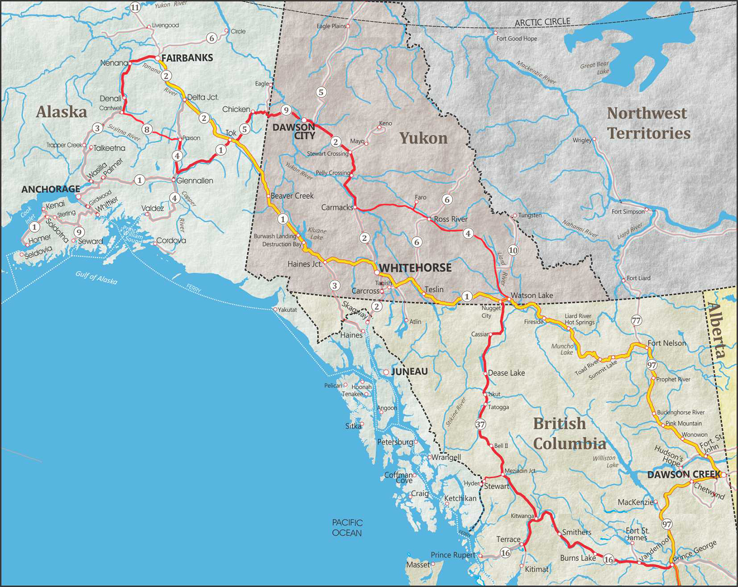
(click to enlarge)
YELLOW Line indicates South route
June 7
Nothing ever quite goes perfectly when planning a vacation, on the day we leave we discover that the electrical plug in for our fridge doesn't work, so it would only be propane for the duration of our trip. As we are nearing Chilliwack, I remember that I have forgotten the table legs I made for the lower bed in our camper, they are sitting on my workbench, so I don't forget them. When we stopped in Hope to visit my dad, we had to make some new ones out of 2x4's. Now we are ready to continue the journey.
To make things a little more real for everyone during this time of continually rising gas prices, I thought it might be fun (or awful) to include our gas stops along the way. When I do the final tally at the end, an all-inclusive resort may not look so bad.
![]() $107.75 Hope, BC
$107.75 Hope, BC
Our first stop (excluding Rest areas) is Arrowhead Campground at Green Lake, a nice little spot outside of 70 Mile House.
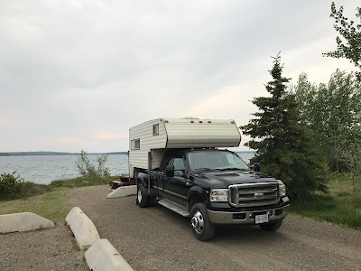

It's a very nice camp spot right on the water, but windy AF. You would think with all that wind there wouldn't be as many mosquitoes, wrong. As we are sitting with Silva enjoying the view, we hear what sounds like a child screaming, look out and a Fox is standing at the edge of our campsite and screeching at us. Before I can get my camera, he has wandered away into the trees.
When the ranger came to collect the camp fee, we asked and he tells us there is a family of three foxes living in the forest area behind us, and they often chirp at them when they clean up the sites. Later in the evening we hear some noise and shine a flashlight and 3 pairs of eyes are watching us... The foxes.

On our last trip to the outhouse, everyone else is asleep in their RV's and we hear a noise right behind the toilets. I am expecting to see a fox skulking around when I shine the flashlight and an entire herd of deer are nestled in and wandering around the treed area. G'night deer.
June 8
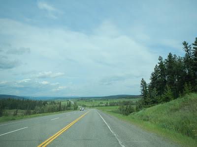
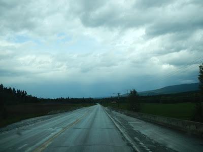
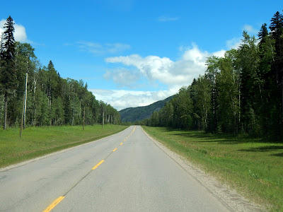
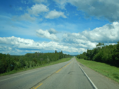
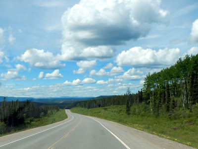
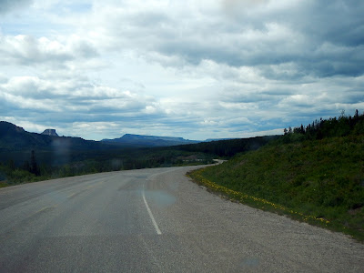
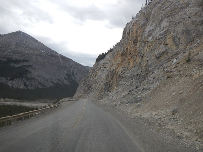
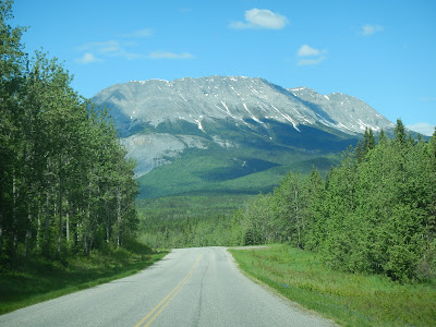
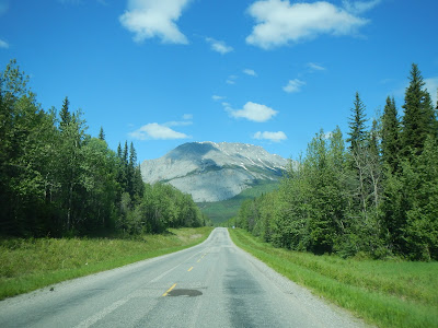
The next morning we packed up, said goodbye to the photo elusive foxes, and headed back towards Highway 97. Today would mostly be a driving day, as our true start destination was still a day away. Since it's a Road trip, I may as well start with pictures of roads.
![]() $152.56 Williams Lake
$152.56 Williams Lake

![]() $83.95 Prince George
$83.95 Prince George
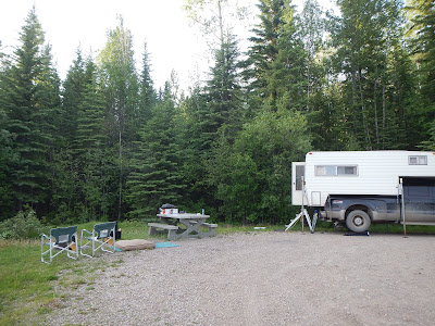
Just north of Prince George is Crooked River campground, a scenic stretch on Bear Lake.

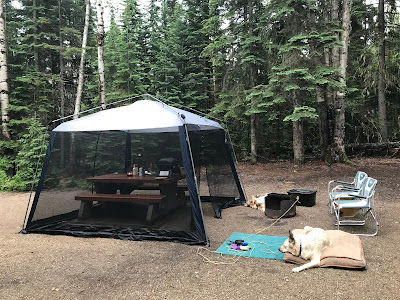
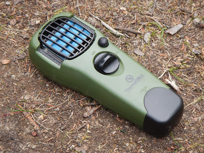
This is probably a good time for a public service announcement... Introducing Thermacell, a Butane powered mosquito repellent. First thing we do when we arrive in our campsite is turn on the Thermacell, and then setup the camper. Within 15 minutes a 15 foot circle of bug-free is created, Silva loves it, and it makes it much more comfortable for us once we sit down.
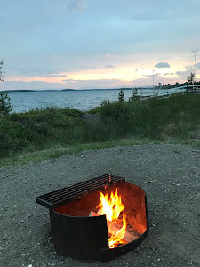
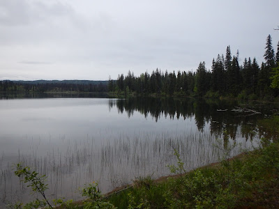
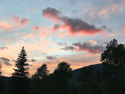
Bear Lake is quite nice, a calm mirror lake when we went walking around it.

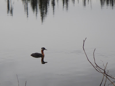
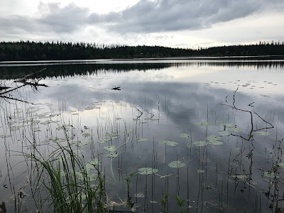
But nothing quite prepared us for the beautiful sunset, it was lucky timing for us to be walking along the lake-shore at that exact moment in time. Our campsite was nestled back in the trees, and we would have only noticed the sky change colour.
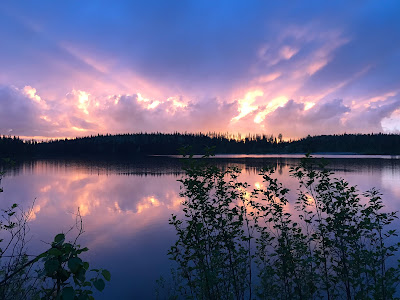


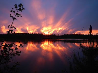
We went to sleep with the sounds of rain falling on the camper overnight, if that's when it wants to rain, I'm fine with that.
June 9
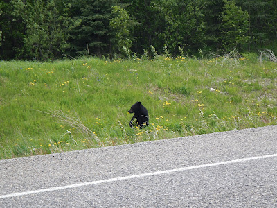
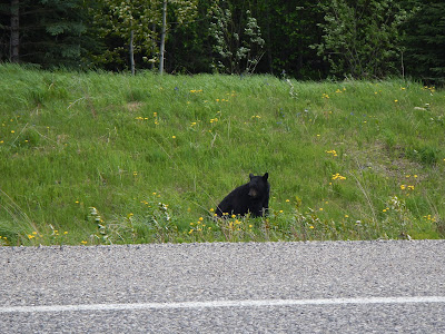
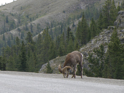
We packed up the camper in the morning and continued our trek. At Pine Pass, we spotted our first big hairy animal where we could safely stop to take a picture. As you can see in the first picture, you could easily drive right past and not even know she was there.

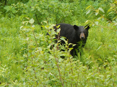


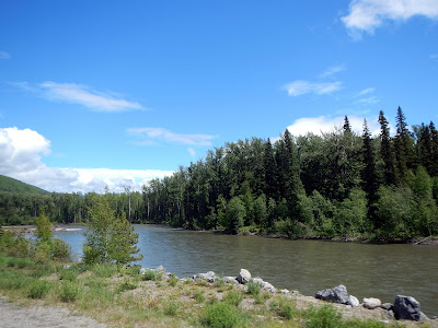
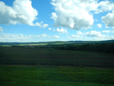
As we moved closer to our destination, the day just kept getting nicer.
![]() $100 Chetwynd
$100 Chetwynd
We stopped in the little town of Chetwynd, BC and noticed one of our tires was a little low when filling up with gas. The first 2 gas stations we checked had cheap air supplies and more air came out of the tire than went in. So we popped in to Kaltire, and they couldn't put air in because the tire valve wouldn't bend to fit their air tool. We asked them to change the air valves, and after an hour of waiting around, pulling both tires and putting them back on, they tell me the replacement valves don't fit our wheels. So an hour wasted sitting around and they ended up doing nothing... At least we got the tires filled with air.
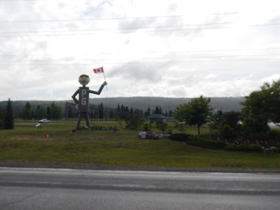
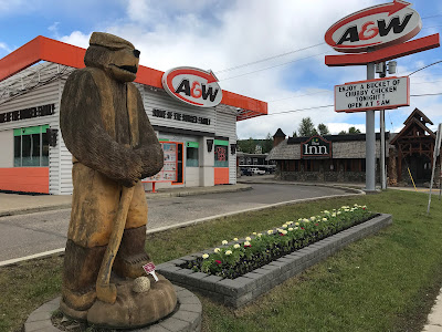
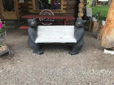
Chetwynd is the Wood carving capital of British Columbia, and we just happened to arrive while their carving championship was going on in town. So we took some extra time to wander around the town checking out the amazing variety of wood carvings.
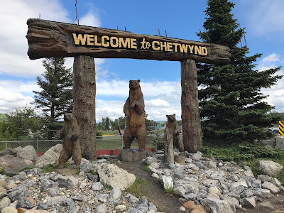
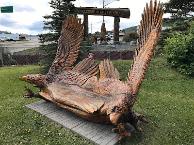
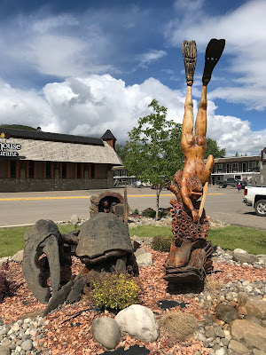
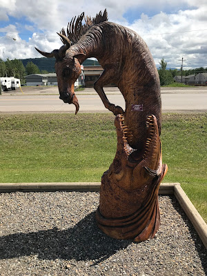
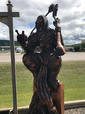


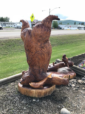

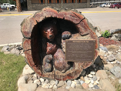
There was a little bit of everything there, natural, super natural, and super weird.
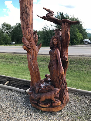


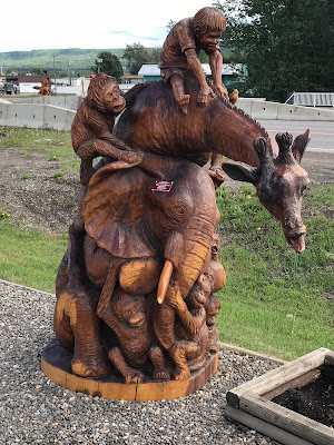
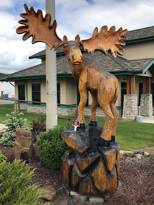
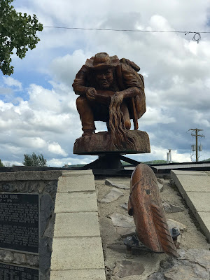


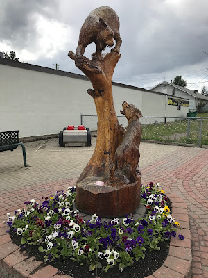

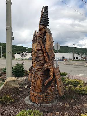
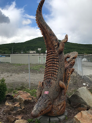
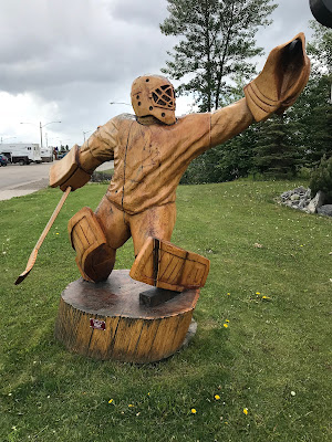

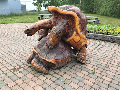


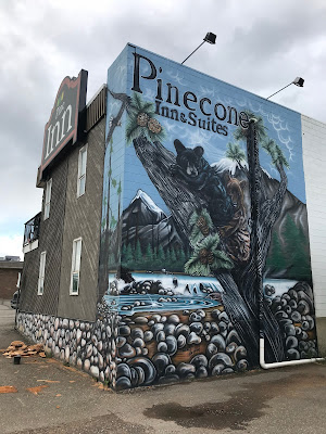
It's really quite a cute town, and well worth the stop to explore.

We picked up a few supplies we noticed we were missing, found a new clock for the camper, then continued towards our key destination.
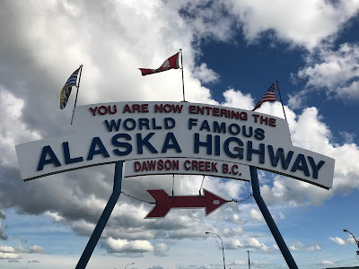
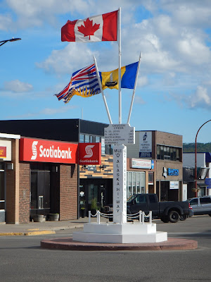
This is where the planned journey really begins... Dawson Creek, Mile 0 of the Alaska Highway. In 1992 we had loaded up my little Toyota Corolla with a tent and thought we would do the Alaska Highway, when we got to Dawson Creek it was raining so hard we just turned East and went to the Rockies instead. So this was the furthest Northern point we had ever driven to.
The Alaska Highway was built by the American Military after the bombing at Pearl Harbor, With the threat now posed by the Japanese, the Americans became increasingly insistent on the development of a safe overland route from the southern US states to Alaska. An agreement was made between Canada and the US: the Americans would pay for the construction, with the sections on Canadian soil to be turned over to Canada six months after the end of the war. Canada, in turn, would provide the right-of-way, waive import duties and other taxes, offer special arrangements for incoming American workers and permit the free use of timber and gravel where required.
The US Army began construction of the Alaska Highway in March 1942. In a matter of weeks, seven regiments of American engineers (approximately 11,000 men), and 6,000 civilians from Canada and the US, as well as thousands of pieces of equipment, arrived in Canada's northwest to undertake one of the most tremendous engineering achievements in the world. By October 1942, a 2451-km rough 'pioneer' road, beginning at the railhead in Dawson Creek, BC and ending in Fairbanks, Alaska, was passable and in use for supply purposes. The Al-Can Highway was officially opened 20 November 1942.
The highway is divided into three distinct sections. In British Columbia it is known as Highway 97; in the Yukon as Highway 1; and in Alaska as Highway 2. We considered doing this route last year to celebrate the 75th Anniversary of the Highway, but the forest fires in BC had all routes blocked to get there... we would see the negative effect of a lost tourist season on a lot of roadside businesses, now closed.


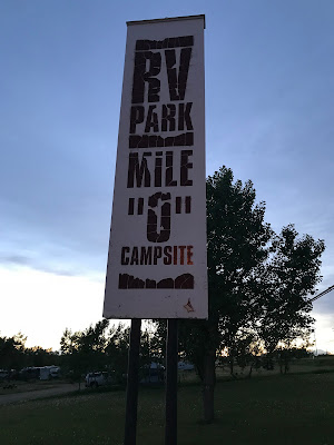
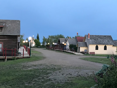
Our first real refresher stop was in Dawson Creek, the Mile 0 campground, an RV park, with hookups for electricity and water, and most importantly showers. You pay the price with few trees and side by side "camp spots", but you need to recharge every 3 days or so, right?

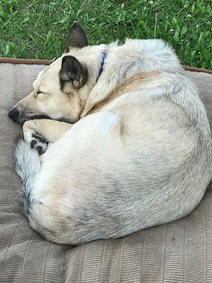
It doesn't take Silva long to settle in, wherever we are. Right next door to the RV Park is a pioneer village, but, like a number of traveler destinations, this one seemed to be closed due to lack of tourists.
June 10
ALASKA HIGHWAY - British Columbia

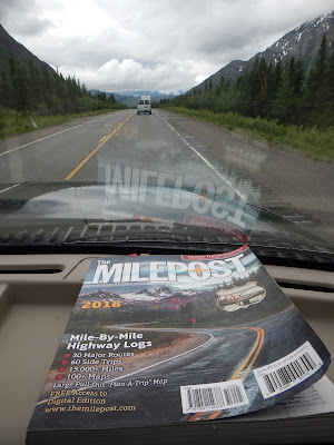
Today we start driving the Alaska Highway, so far it just looks like any BC Highway. Time for another Public Service Announcement... If you are going to be driving the highways of Northern BC, Yukon and/or Alaska, pick up a copy of the Milepost book. Invaluable details of milepost by milepost points of interest, rest areas, and nicely detailed maps. Best purchase we made for the trip!


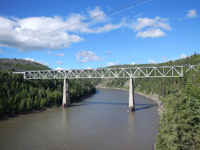
The first detour takes us to the Kiskatinaw historic wooden bridge on the old Alaska highway. It is a curving timber bridge built in 1942 to replace the original trestle bridge.


![]() $79.40 Fort St John
$79.40 Fort St John
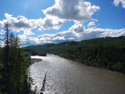
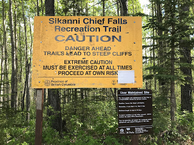
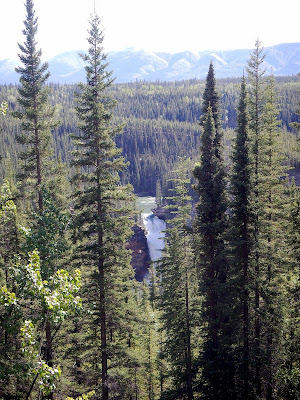
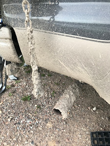
Our second detour of the day was a lot more "interesting", we drove 16 km down a very rough dirt road to Sikanni Chief falls. The road was sometimes narrow, and sometimes pot-holed, but a few times we were very glad to have a 4x4 suspension as we went through a couple muddy and creek worn sections. Let's just say its a good thing our camper is well secured to the back of the truck.

After the long and sometimes worrisome road, we find ourselves in a little parking lot at the 1.5 km long trail head.
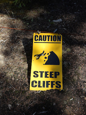

When you first spot the Sikanni Chief falls, they look amazing, as you finally get a full view, you realize it was all worth it.
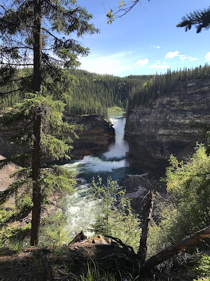
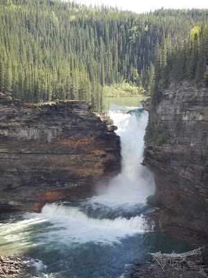
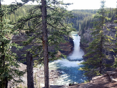

It's a little hard to turn your back and wander back to the truck, but we have some rough driving to get out, and we need to find a campsite.

![]() $118.27 Pink Mountain
$118.27 Pink Mountain
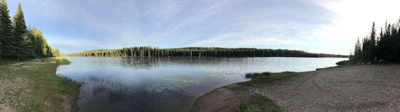
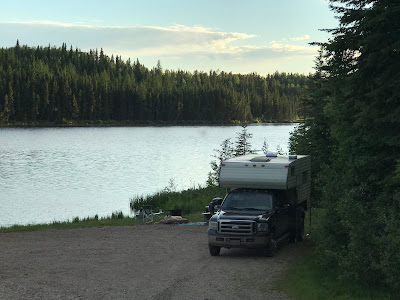
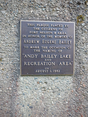
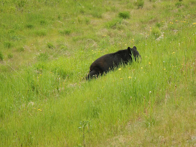
Our first attempt at a campsite was the Buckinghorse River campground, but it really sucked, with wide open campsites that looked designed for large RV's, so we drove further up the highway and ended up at Andy Bailey regional campground. We have almost always found that when a campsite doesn't work out because it is full or we just don't like the looks of it, that we end up somewhere better, and Andy Bailey Lake was one of these cases. It's a good condition 12 km gravel road in to the campground, so our fingers are crossed as we head along the road. Partway we spot a baby black bear on the side of the road, but it took off, and we knew Mama was nearby.
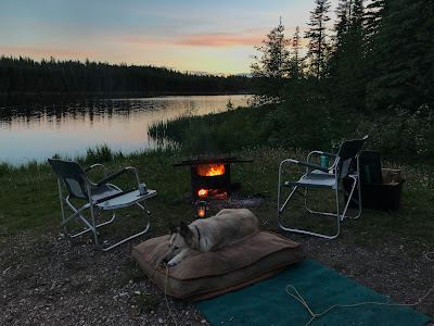
When we finally get to the campground, we are basically alone, there is only 1 tenter at far end of campground, and when we woke up he was gone. We had a spot right on the side of the lake, and no noisy people with music or generators... just us. Perfect!

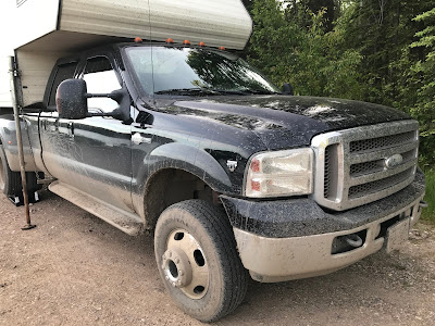
Getting out of the truck, we noticed just how muddy that road to the falls was, I guess a car wash would be in our future.


One of the dangers of camping this far north, is that you're sitting by the campfire, enjoying the chirping of birds, and frogs, when you look at your watch and suddenly realize that although it's still light out, it's midnight.

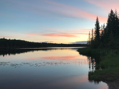
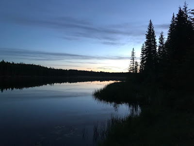
At around 1 am, as we head to bed, it looks like the sun is finally going down.
June 11
We woke up to a completely empty and quiet campground... what a treat. After a nice breakfast of BBQ eggs and Bacon we packed up and headed back down the gravel road to the Highway.
![]() $82.00 Fort Nelson
$82.00 Fort Nelson
Fort Nelson wasn't as big as I was expecting, but they did have a quaint western style RV Park with an RV wash.
We definitely had to wash the truck after the dirt roads of the previous day.
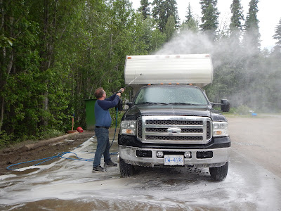


SMALL WORLD SIDE STORY: While waiting to wash the truck we met Candice and Jordan. They had quit their jobs in Vancouver, and were traveling as far north as they could go, and then driving all the way down the Pan-American Highway to South America in their customized 4WD van with their dog Nugget. Over the next week we would keep crossing paths, and out of the blue a picture comes across my Instagram feed of their van right where we started in Dawson Creek. I started following them as we crossed paths, they literally pulled out right in front of us in Whitehorse. I saw their pics as they traveled to Tuktoyaktuk and am watching as they start their trek South now. Back home I see a post from another friend who flew up to Alaska to see the grizzlies, and who are they having lunch with? Candice. Apparently we were only separated by 1 friend in Vancouver. SMALL SMALL WORLD
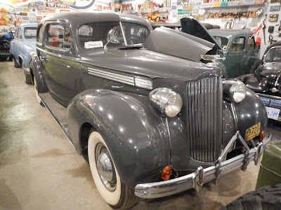
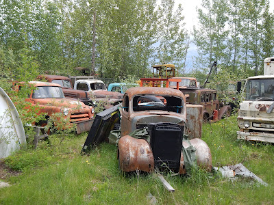
With the truck clean enough so I wouldn't be covered in dirt every time I brushed by it, we popped over to the famous Fort Nelson Museum.
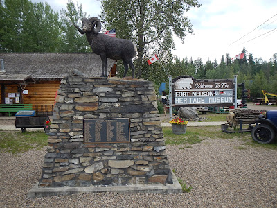
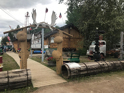
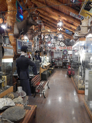

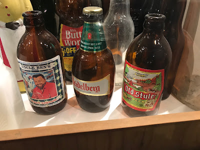
The Fort Nelson Heritage museum is themed around transportation, but it has a bit of everything dating back over 100 years of Fort Nelson history. I mean when a museum has bottles of Old Style and Uncle Ben's beer, you know you have stepped back in time.

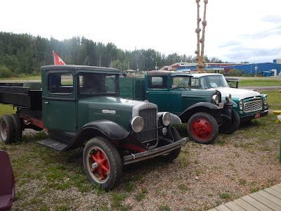
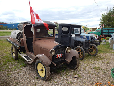
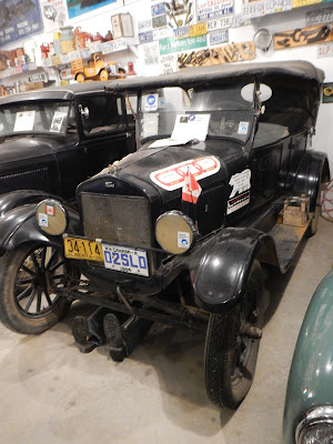
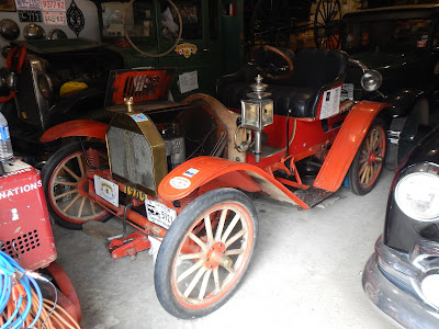
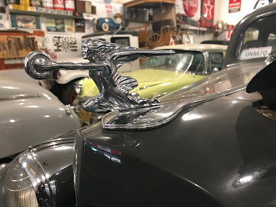
Scattered throughout the grounds are old cars of all types, all vehicles that made it to Fort Nelson and never went back, including vehicles used in the construction of the Alaska Highway. Some have been slightly restored, some have definitely not... but a lot of them are still drivable, and the curator of the museum 86 yr old Marl Brown, often takes the cars on tours to faraway places, or puts them in parades.
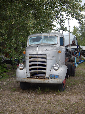

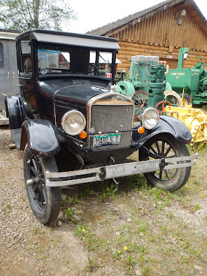
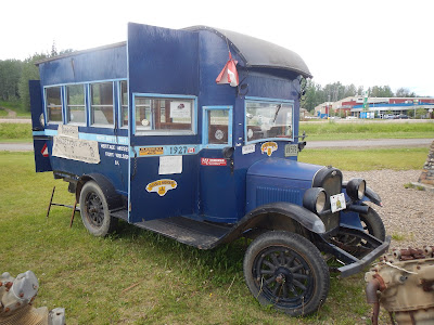


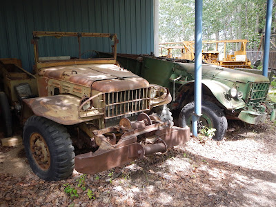
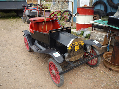


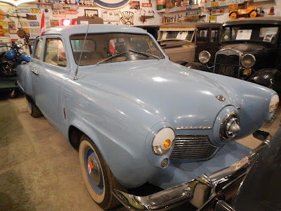
There is an old church and an old building with all the Northwest Telephone systems, but the highlight is Marl's garage, a collection of unique old cars. We got the personal tour from Marl himself, who even encouraged Norine to sit in some of them... he didn't ask me.


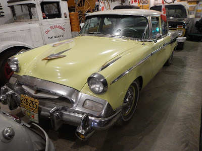
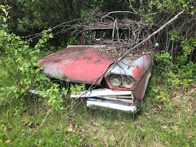
There's even a few hidden gems in behind the buildings and at the back of the parking lot.

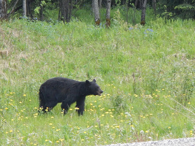
Having had my fill of old cars for the day, we got back on the Highway and headed past Stone Mountain provincial park.

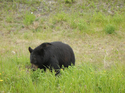
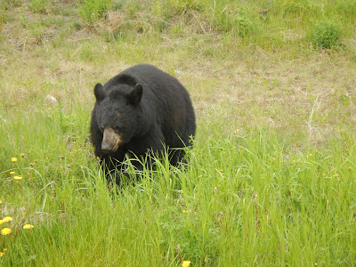
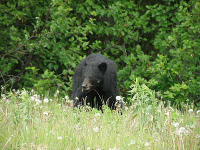
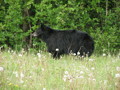
It's a good thing we left when we did, as we ended up seeing three different bears wandering the side of the road... some bears are a little more shy than others and run away, some just look at you and keep on munching the dandelions.

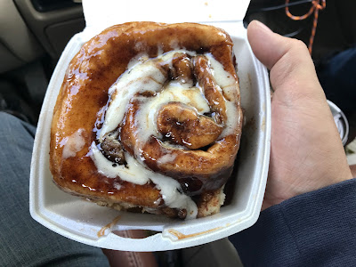
In a number of our travel books we had seen that the Tetsa River Lodge was recommended as a place to stop for the "Worlds Best Cinnamon buns", so we had to stop... and I have to say it would be hard to argue with that statement,
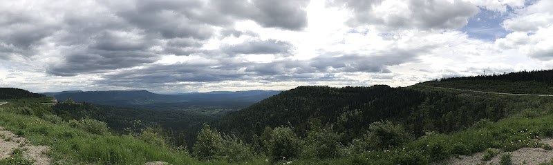
Our plans for where to stay kept changing... Initially we thought Summit Lake campground sounded really nice, but it was a little early in the day to stop driving. The lake was pretty though.

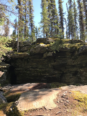
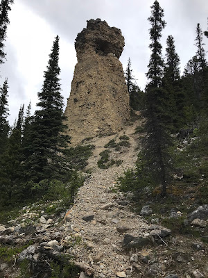
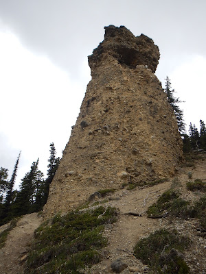
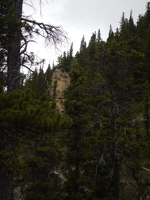
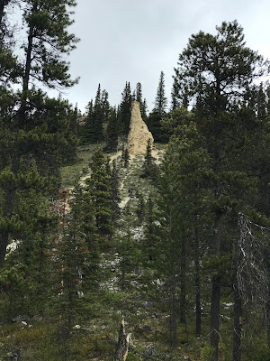
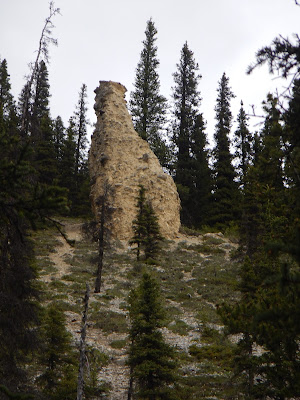
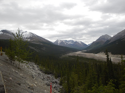
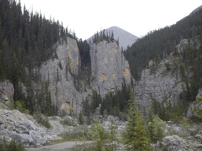
We made a stop at Erosion Pillar trail, a series of Hoodoo like sand towers. A nice easy trail until you get to the largest pillar, and then it was a steep landslide waiting to happen. We looked around at the amazing views across the valley, and carefully stepped back down the trail without slipping. Of course Silva's 4 wheel drive never had any problems, I think she's part goat.

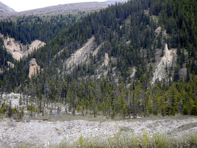


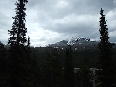
The area definitely has some very scenic mountain ranges.
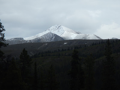
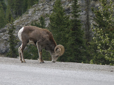
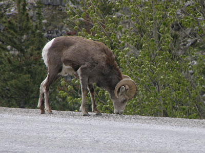
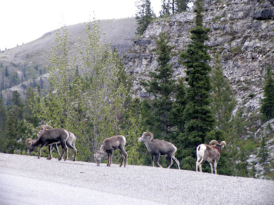
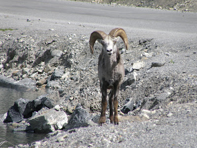
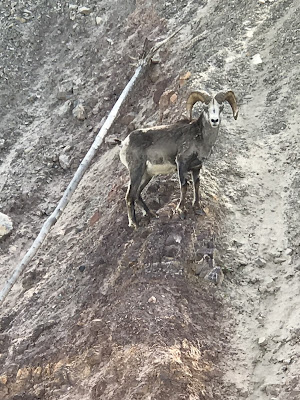
And where there is mountain ranges, you find mountain sheep, specifically Stone Sheep in this region. They are cousins of the Big Horn sheep in the Rockies, and just like them, they enjoy the sandy roadside of the Highway. At first there was just a couple sheep, ooh, nice photo opp... then as we are quietly watching them, more and more came up the cliffside onto the road.
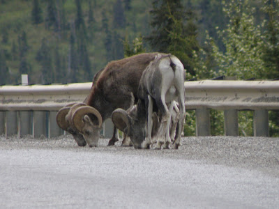


Having bothered these Stone Sheep enough, we continued down the windy road, ironically to an area called Baba Canyon, known for sheep sightings. We didn't see any sheep there.

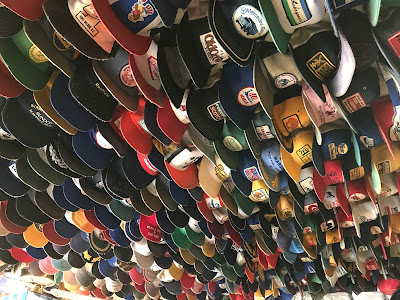
Our next grand plan was to stay at the Toad River Lodge, a mix of small cabins and RV campsites. The only thing good about this place was the collection of ball caps attached to the ceiling. They were full up anyways, so we would continue on.
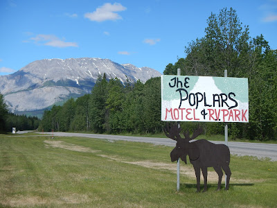
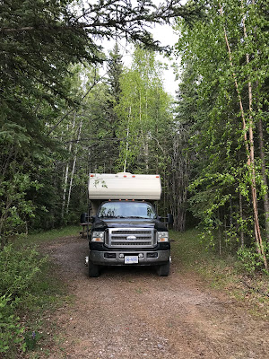
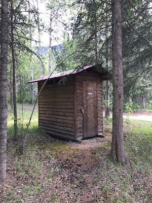
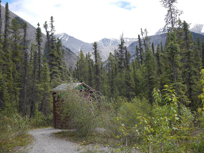
As usually happens, when we don't or can't stay somewhere, we find somewhere better. We ended up at the Poplars campground, a small family run campsite, with big RV sites and pull throughs on one side, and nice quiet treed sites on the other side. We were tucked in a little grove of poplars, with a nearby trail, a nearby outhouse, and all the firewood we wanted.
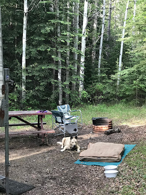

With the super late sunset, we stayed up late with our campfire and I was able to sneak some stuff into an empty RV site and get batteries recharged, so we were good for another few nights of more rustic camping.
June 12
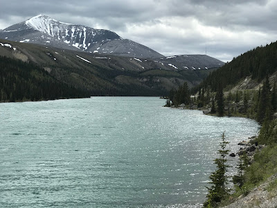
It's not far to drive and we are in Muncho Lake Provincial Park, the views as you drive are stunning.


![]() $150.00 (1.98c/L) Muncho Lake
$150.00 (1.98c/L) Muncho Lake


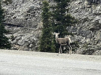
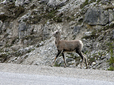
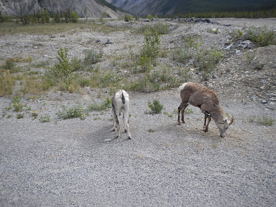
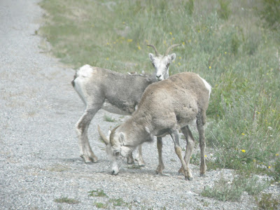
As you drive through this section, you have to watch closely as there might be Stone Sheep on the road. Apparently if you see one, there is more coming, and that was the case when we spotted a lone Sheep on the side of the road.


We decide to leave this group alone, and just around the corner is another pair munching on the roadside salt.
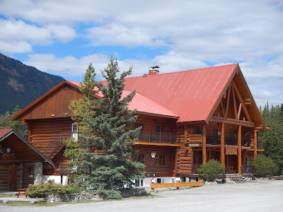
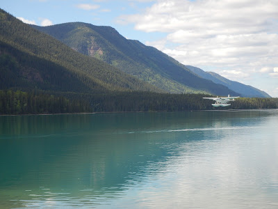
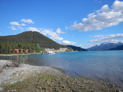
One of the highly recommended places to stay was the Northern Rockies Lodge, it's a beautiful log chalet with a series of smaller cabins, a spa and a restaurant sitting right on Muncho Lake. Float planes sit out front to take their guests on scenic flights. Sadly, it's not a dog friendly resort, so we'll stick to our lovely camper accommodations.

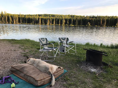
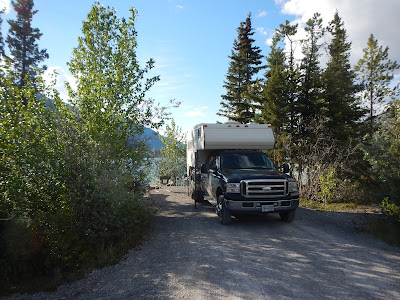
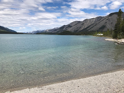
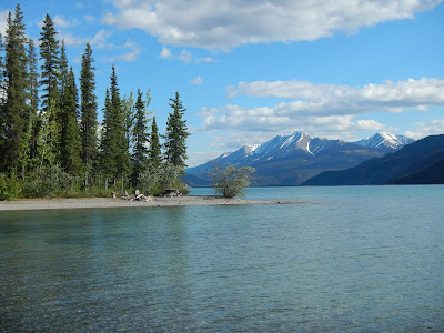
Muncho Lake is a beautiful green/blue coloured lake and our planned destination for the day, it has 2 campgrounds. Our planned campsite was Strawberry Flats Lakeside campground, until we saw what looked like a rest area pullout at one end of the lake, turns out that was the campground... yoiks. Instead we ended up at MacDonald campground which had 1 spot left... Right on the water with our own beach. What did I say about always ending up somewhere nicer?
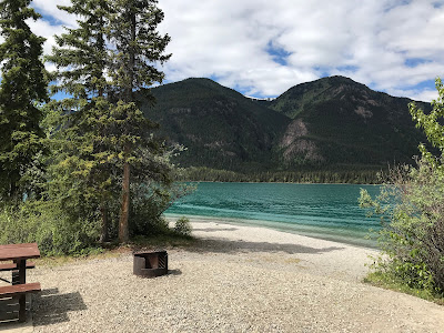


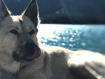
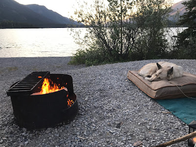
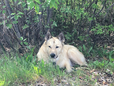
Silva was very happy with this campsite. Wandering down to the water and back... her own giant waterbowl.

Seriously? This is the view from our camp chairs.


We are sitting enjoying the view, when I notice a Conservation officer sneaking in to our campsite, I guess he is hoping to catch someone fishing without a license, or keeping too many fish. We had a bit of a chat about the area, and he tells us 2 weeks earlier that there was still ice on this lake.
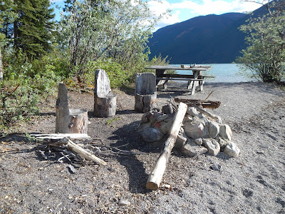
You can walk down the beach to the Northern Rockies Lodge, there's a little firepit carved seat picnic area, and the views, OMG the views. When we get back to our site, an older couple paddle by in a canoe from the lodge. I don't think she knows how voices carry on the water... "Oh my God, I think those people are DRY CAMPING, yeah, they're DRY CAMPING, I could never do that!". Dry Camping? Apparently that's camping without an electrical/water/sewer hookup... that's just what we call CAMPING!


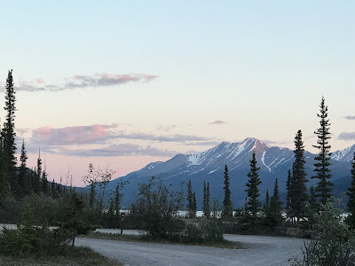
Another late night bright night, but at least the mountains provide an earlier sunset.


Nothing creepy about this boat when you're heading to the outhouse at 1 am, at least it's still light out..
June 13
We had a little bit of a protest when we packed up in the morning, Silva didn't want to leave her favourite campsite.
Strangely this morning stop for Stone Sheep, and there only seemed to be one of them.


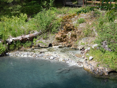
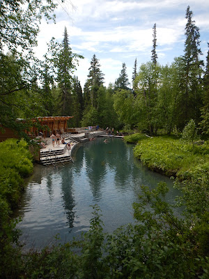
Our first planned stop was the Liard River hotsprings, the second largest Hot Springs in Canada with water temps ranging between 42-52° Celsius (that's over 100° for my American friends). A boardwalk leads through a nice forest into the riverway, and unlike many hotsprings which are just a concrete pool, it's an actual river with a seating area and access stairs on one bank.


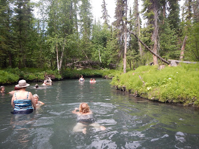
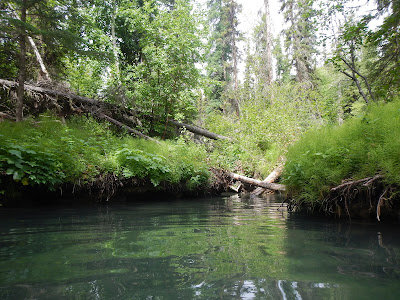
Probably the nicest Hot Springs we have ever been to with it's forest setting. At one end of the area is the hot springs percolating into the river, as you move further down river the waters get cooler and there is a windy Indiana Jones style waterway you can follow to get away from the people. As you get away from the main area, the mosquito population increases though.

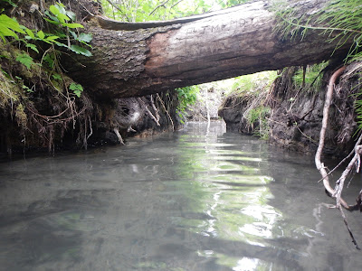
If we were ever passing through this area we wouldn't hesitate to stop again, although I hear it can be very busy during July and August.

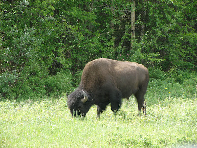
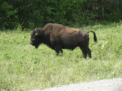
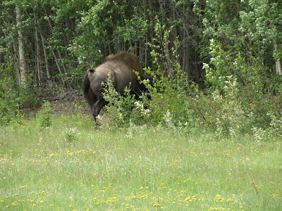
After a very refreshing break at Liard River we aren't back on the road for very long before we spot our first wild Bison. You don't realize how big they are until you see them wandering past your vehicle.


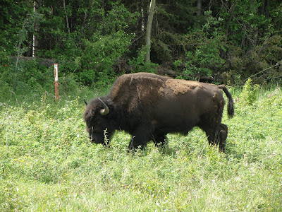

No sooner do we get underway and we see another bear on the side of the road. I didn't need a zoom lens for this one, as he just ignored us and ate dandelions right beside the road.

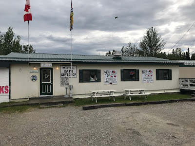
We made a stop in Coal River for lunch, Coal River is one of the last settlements in this Northern stretch of British Columbia. They are famous for their Bison burgers, so I had one... I mean we just saw them, and I was hungry. It was very good.
Today was a good day for seeing wildlife, as we got closer to the Yukon border we saw more Bears and Bison on the side of road


We even saw a Porcupine on the side of the road, he was a little shy, and didn't like getting his picture taken though.


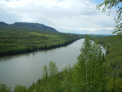
As we drove the last stretch of BC Highway 97, we weave our way along the Yukon border, crossing in and out 6 times before the formal signage. We had to make one last Bison stop before we officially entered Yukon territory.

