Sunshine Coast 1994
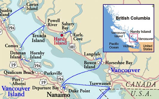
Having just finished up my first couple of EA NHL games (NHL on the PC, and NHL 94 SNES) and Skitchin', it was time to take a break and get away for a while. We weren't the avid travellers that we would become back in 94, but we had a tent and some camping gear. A short ferry ride away is the scenic inner coastline of British Columbia, an area know as the Sunshine Coast.
We loaded up all of our camping gear, put our dog Pepper in the back, and headed to Horseshoe Bay where we would catch the little BC Ferry for the 40 minute ride to the Sunshine Coast.
(click to enlarge)
The Sunshine Coast lives up to its name. With 1,400 to 2,400 hours of sunshine a year- sunny days outnumber gloomy days by a wide margin. The area benefits from a rain shadow cast by Vancouver Islands mountains, which catch most of the moisture coming in off the Pacific Ocean.
The Ferry from Horseshoe Bay drops us off in Langdale, a few minutes from the world famous town of Gibson's. Gibson's is the home of CBC's 'The Beachcombers' TV show that ran from 1972-1990.
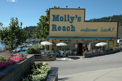
At the center of Gibson's is Molly's Reach, a fixture location from the Beachcombers, and when the series ended, the made for TV set was left behind to become an actual cafe. We grabbed some lunch in Gibsons, and wound our way north up Highway 101, towards our booked cabin.
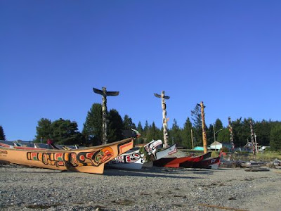
Our first stop would be Sechelt, The word "Sechelt" means land between two waters. It is located at the narrowest point of the coast nestled between the Sechelt inlet and the Strait of Georgia (Pacific Ocean inside passage). It's a small coastal town famous for it's waterfront Salish Totems.
From Sechelt we would make our way back along Highway 101, past the scenic Halfmoon Bay, and into Pender Harbour, 52 kilometres of jagged harbour shoreline. A strategic bathroom stop.

After all three of us empty our bladders, we are ready for the last stretch of driving for the day, we drive past the cute little Ruby Lake Lodge and make our way to the town of Egmont.
Calling Egmont a town is a bit of a stretch, but at least it appears on maps. It's a
small waterfront village on Secret Bay in Sechelt Inlet, and is the nearest accommodations
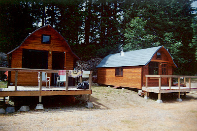
to the BC Ferries terminal at Earls Cove. This is where we had arranged for a small cabin
for our getaway, the cabin belonged to a friends dad, and was home of the infamous
'Foamhenge' of a previous group trip.
(But that's another story for another day)
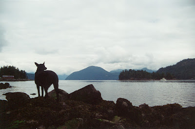
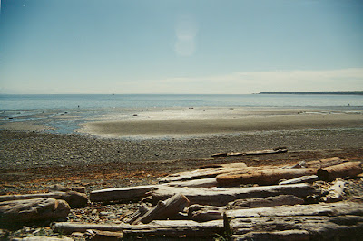
Mere steps from the cabin is a rocky shore, a quiet little bay to explore and hike around, Pepper loved it, a grassy area for frisbee and pees. On our first night on the Sunshine Coast... it rained.
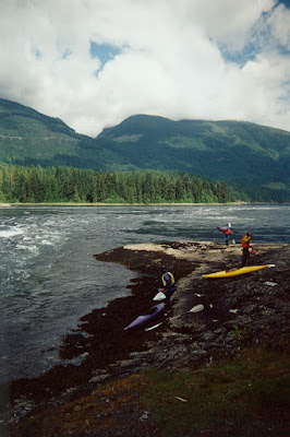
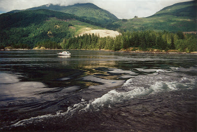
The next morning we would explore a little more, very close to Egmont is the marine area know as Skookumchuck Narrows... “Skookumchuck” is a Chinook name meaning turbulent water or rapid torrent. The awesome power of incredibly turbulent tidal rapids is amazing to see. When the tide changes, 200 billion gallons of water flow through the narrows connecting Sechelt and Jervis Inlet. The difference in water levels between one side of the rapids and the other sometimes exceeds 2 metres in height (6.5 feet for my US friends). The water current can exceed 30km/hr (that's almost 20mph for you Yanks). The rapids are world famous for their spectacular whirlpools and whitewater, and a major destination for whitewater kayaking. At its extremes even Kayakers aren't allowed.
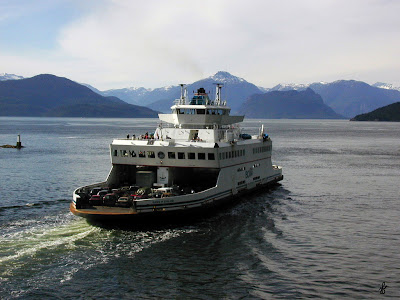
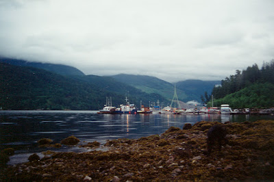
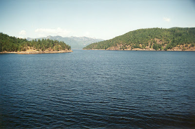
After a few days of relaxation in our little cabin, a little hiking, a little swimming, and a little BBQ, the urge to explore built up, and it was time to move on. We headed to Earl's Cove where we would catch another tiny BC Ferry for a 60-minute ride to Saltery Bay. Across Jervis Inlet the Sunshine Coast continues north from Saltery Bay. Saltery Bay was named after a Japanese salmon saltery that was built on stilts out in the bay in the early part of last century, I guess they spilled.
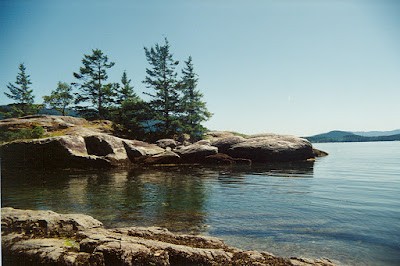
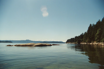
In Saltery Bay Provincial Park we found the perfect campsite, lots of trees in a semi-private campsite, a short trail to the amazing Mermaid Cove. One of the most beautiful clear water bays around, even if it was a bit chilly, it was spectacular. Pepper approved too.
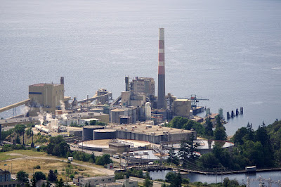
After a couple days of cool clear floating and campfires, we headed to Powell River. From beautiful and tranquil to... the smell. Powell River is a bigger city, centered around a pulp mill. It was not what we had been accustomed to, and it really really stank, so we decided to take the BC Ferry across Georgia Strait to Vancouver Island, where the air is much clearer.
The BC Ferry drops us right in the town of Comox, home of a Canadian Armed Forces base.
The nicer town of Courtenay is nearby, but we didn't come here to camp in a city, so we
headed north towards Campbell River. First, with the sun shining down, we had to stop in
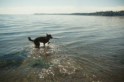
Oyster Bay, it's a nice sandy shallow beach area. Pepper loved this spot, she ran around
the sandy shore, chased a stick back and forth into the water, then as soon as the water
level reached her tail, took a ![]() right in the water... how do you clean that up? It's time to go!
right in the water... how do you clean that up? It's time to go!
Miracle Beach is located midway between Courtenay and Campbell River on the east coast of Vancouver Island, Miracle Beach is one of the most popular parks on Vancouver Island. That popularity is a good reason to stay overnight and move on, so we did.
Campbell River is the salmon fishing capital of the world, during the summer months it is cram packed full of fishermen. It used to be that you could walk from C.R. to Quadra Island without getting wet, by stepping boat to boat. With the number of people in Campbell River, it was a good place to make a left turn and head inland towards the small town of Gold River.
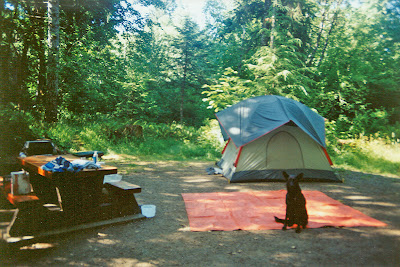
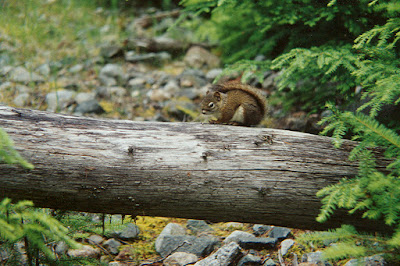
1994 was not a good year for Gold River, earlier in the year a cougar attacked a seven-year-old as he walked to school. The kid was seriously wounded and lost an eye in the attack. Six months later, the RCMP officer who shot and killed the cougar that attacked the child was himself attacked by a cougar while horseback riding. The Officer was clawed on the leg, but not seriously injured. When we were setting up our tent the thoughts of Cougars stalking us runs through our heads, good thing we had Pepper there to protect us, or at least bark to warn us.
Just as we are getting our tent set up, it starts to rain (we weren't on the Sunshine Coast anymore), but not just any old rain... Vancouver Island rain... within seconds we are drenched, and make a mad dash into town to buy a bigger tarp. Once we got that tied up, it was bearable, we just had to tip the puddles every few hours so it didn't collapse. In the morning we wake up to a beautiful sunny day, and then a big tanker truy drives by spraying the gravel road with some stinky chemical oil. It smelled really bad, but kept the dust down. It's probably toxic, time to go!
Strathcona Park in Central Vancouver Island. Strathcona Provincial Park is a rugged mountain wilderness of over 250,000 hectares that dominates central Vancouver Island. Created in 1911, Strathcona is the oldest provincial park in BC and the largest on Vancouver Island. The triangular shaped park practically spans the entire width of Vancouver Island.
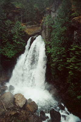
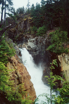
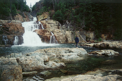
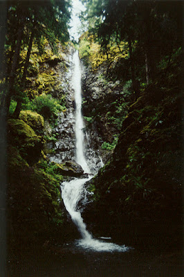
Our first day of hiking was all about waterfalls, first up was a climb to Myra Falls, and then another hike to Lady Falls. Both sets of falls were spectacular, and well worth the hikes to get there.
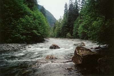
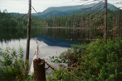
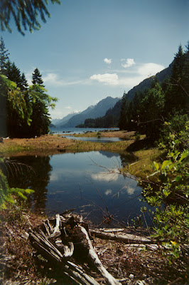
Having had enough of waterfalls we changed our strategy to focus on lakes and rivers. Not far from Lady Falls is the Elk River, a majestic winding river, sometimes rough, but always giving the sense that you are in the middle of the wilderness, even if the trail is nearby. Too finish our day we trek down to the far end of Buttle lake and do a circle hike around the sleepy Darkis Lake. Buttle Lake seems like a good place to camp for a few days.
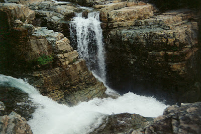
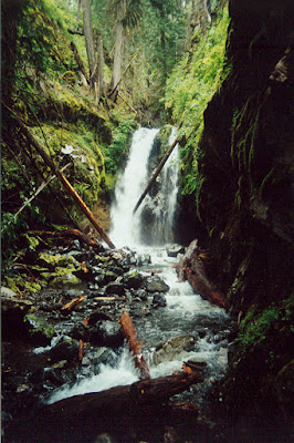
The next morning we realize we just haven't had enough of waterfalls and set out to do some more scenic hiking. First stop, Lupin Falls. Lupin Falls are very different from the traditional falls we have seen, and provide a very scenic backdrop with their tiered layers and colourful rock formations. We spend a good portion of our day here, enjoying the views from every angle, and Pepper takes advantage of every rock ledge and small pool to have some doggy fun.
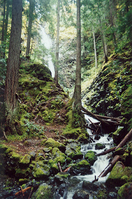
Karst Creek is the polar opposite of Lupin Falls, they are hidden in dense dense forest, and appear as small streams winding their way trying to escape the mountainous area they have been trapped in, some areas go underground, and re-appear further down the mountain, very cool, very wild.
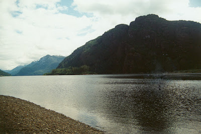
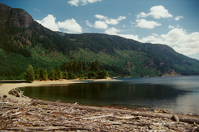
Once the weather improved it was time to take advantage of the beaches at Buttle Lake. Buttle Lake is 40 km southwest of the city of Campbell River, and is the major body of water in Strathcona park. It is named for Commander John Buttle who explored the area in the 1860s.
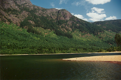
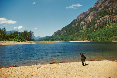
Buttle Lake is actually a flooded forest, with deadheads and submerged stumps, but you would never know it to see the nice golden sand beaches that surround it. When we hike around the lake looking for a better beach, or nicer swimming spot, it just keeps improving. To Peppers surprise it gets deep quick, and suddenly I become a doggie flotation device. She didn't want to stay on the shore with us swimming, so she made a beeline for me, and then climbed on me once she realized she couldn't touch. I still have some of those scars. Even with the claw scratches a couple of days on this lake, match any summer destination lake.
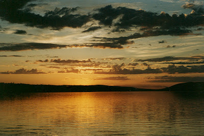
After another beautiful sunset on Buttle lake, it was time to get a good nights sleep and start making our way back down the Island.
Spending a little extra time at Strathcona Park was well worth it, but now we had to start heading home. We worked our way back down the coast of Vancouver Island, past Fanny Bay, Qualicum Beach, Parksville, Nanaimo, skipped Victoria and headed home.
It's often said that you never realize what you have so close to home. The Sunshine Coast and Vancouver Island are so close to us, our little circle route was proof that you don't have to go far to have a magnificent vacation... assuming that you live in this beautiful part of the world.