Rocky Mountain Retreat 2008

Crowsnest Pass
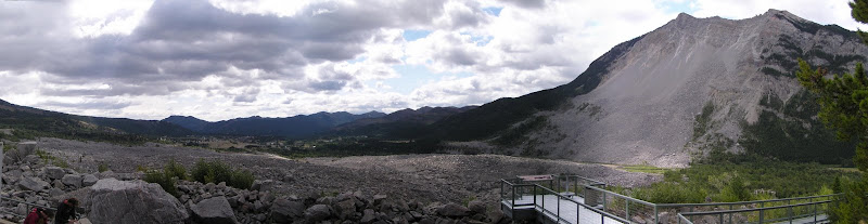
We managed to outrun the rain for a while as we crossed back into Alberta through the Crowsnest Pass. As you cross the last of the B.C. Kootenay area, it's very scenic with mountains and little lakes. The scenery continues on the Alberta side as it transitions from Rockies to prairies, that natural beauty suddenly changes when you arrive at Frank Slide. It's shocking and somber.
On April 29, 1903, at 4:10 a.m., 74 million tonnes of limestone crashed from the east face of Turtle Mountain and covered approximately three square kilometers of the valley floor. Frank was home to approximately 600 people in 1903; of the roughly 100 individuals who lived in the path of the slide, more than 70 were killed. It's shocking to look out and see just how much area the slide covered, since 1903, there has been little to no growth in the rubble of the mountain.

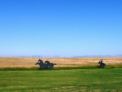
After recovering from seeing Frank Slide, we made a stop in Pincher Creek to load up on food, lunch and gas, and drove on to Waterton National Park, passing a series of black silhouette cutouts along the way. Representing the history of the area, Cowboys, Indians, settlers, and stallions.
Waterton Lakes National Park
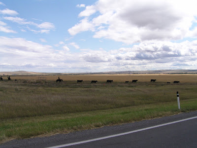
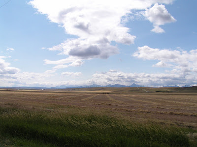
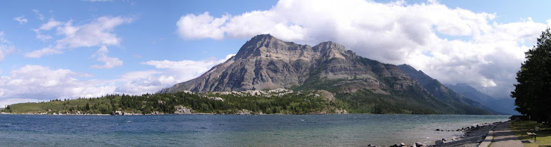
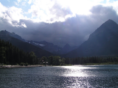
Waterton Lakes National Park is known as "where the mountains meet the prairie", and for good reason, from the flatlands you can see Waterton in the distance. You can't get any more South or West in Alberta. As we get closer we realize there is two unique weather patterns;
1) The wind is amazing, blowing hard and consistent, there is a ton of windmills in this area, apparently this area has one of the most consistent wind sources in Canada.
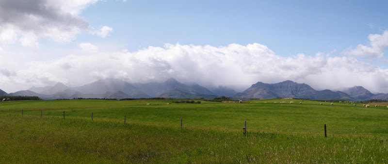
2) It is a sunny day, but there is light cloud over the mountains, as we get closer we realize it's not really clouds, it's blue sky, and it's raining... so weird, the raindrops accentuate the sunshine.
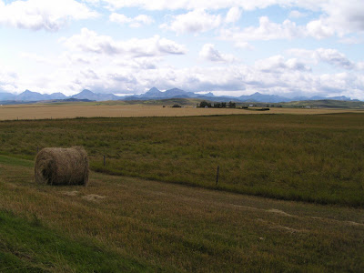
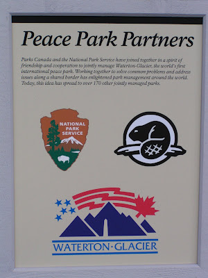
Suddenly we go from flat farmlands to mountainous parklands, we have entered Waterton. Waterton Lakes National Park borders Glacier National Park in Montana to the south, and together they make up the Waterton-Glacier International Peace Park, the first of its kind in the world.
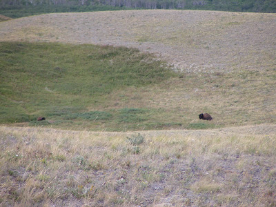
Our first stop as we enter the park is the Bison paddock, an area set aside to re-establish Bison herds in this area, we aren't too far from Head-Smashed-In-Buffalo-Jump. The population was basically wiped out, but after many years they discovered that it would be too costly to maintain a herd in this area. We wind our way through the area, up, down, left, right, and come back out never seeing a Bison... good start, very impressive grass.
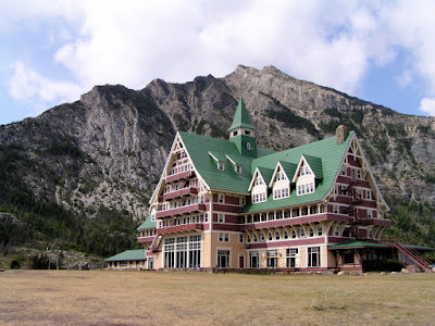
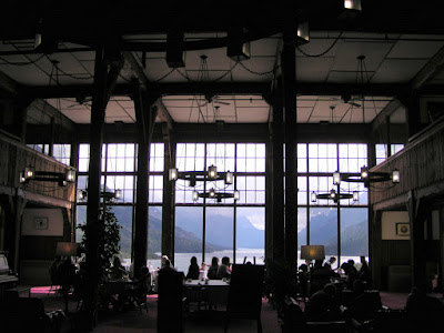
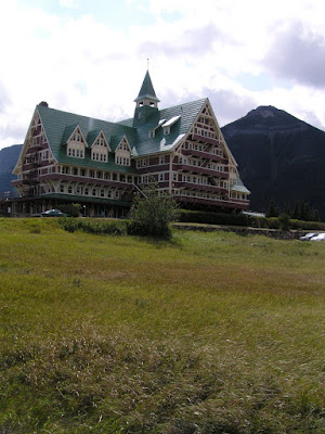
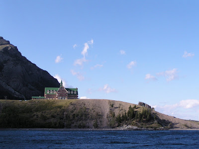
We knew it was windy, but we didn't know just how windy until we opened the doors to take a picture of the scenic 'Prince of Wales' hotel. Constructed between 1926-1927, the hotel was built by the American Great Northern Railway to lure American tourists during the prohibition era south of the border. The hotel was named after the Prince of Wales (later King Edward VIII), in an attempt to entice him to stay in the hotel on his 1927 Canadian tour, but the Prince stayed at a nearby ranch instead. When the Hotel was completed, the hotels owners returned after a long winter to find the winds had blown the hotel right off of it's foundation. They had to use horses, pulleys and raw manpower to push it back into place, adding a few more nails to hold it down.
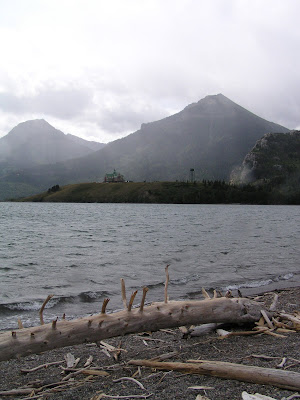
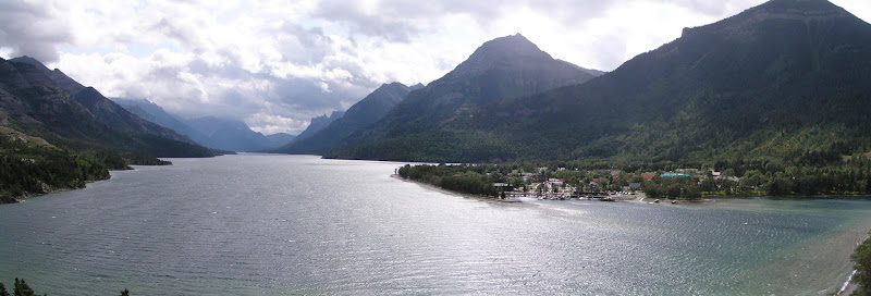
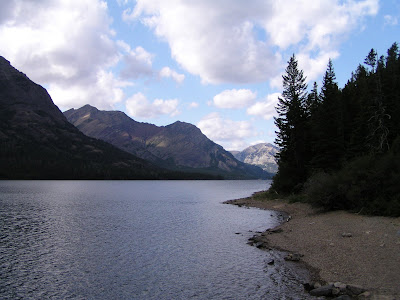
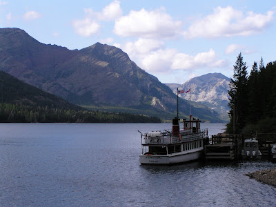
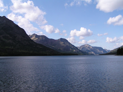
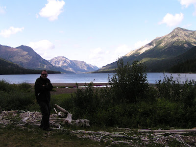
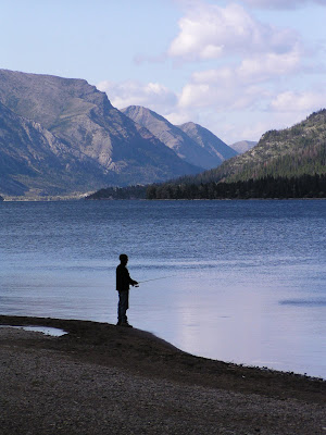
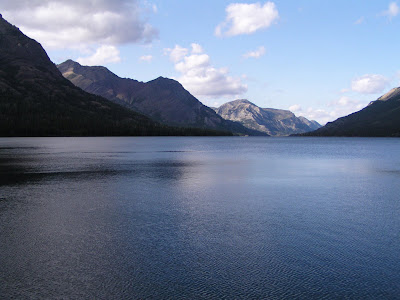
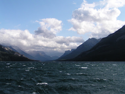
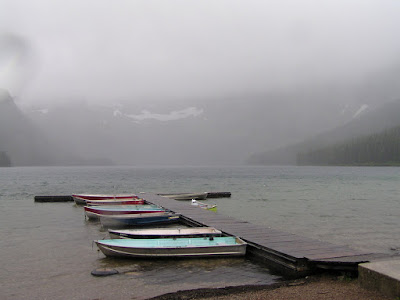
The highlight of Waterton�s sparkling chain of lakes is the international Upper Waterton Lake, the deepest lake in the Canadian Rockies. It is a 2 hour boat ride down the 7 mile length of the lake, as you cross from Canadian waters of Alberta into U.S. Waters of the state of Montana.
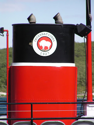
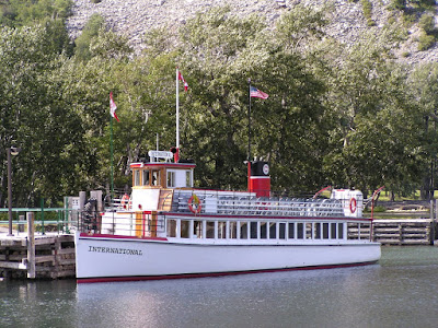
With the high winds and rough water we didn't think the boats would go, but this is normal for here, and the 81 year old MS International is designed for this lake. We set out on our cruise with only 9 passengers on a boat that holds 250. Against the wind we head to Montana.
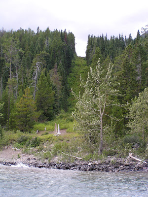
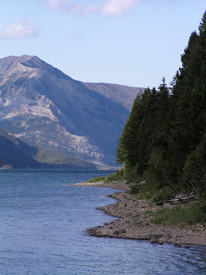
As we make our way down the lake we are quickly reminded just how far south we are, clearly carved in the mountainside is a swath of treeless growth indicating the US-Canadian border. Apparently the border must be visible from land and air, where there isn't trees, they have obelisks.
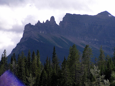
As we continue down the lake we pass many unique mountains, Upward looking chief, old saw-tooth, and Mt Bertha. Mt. Bertha is named for a woman who during prohibition forged prescription pads for "medicinal" alcohol, she was arrested and went to jail. When Bertha was released, she came home to find out that the townspeople had named a mountain, river and waterfalls after her.
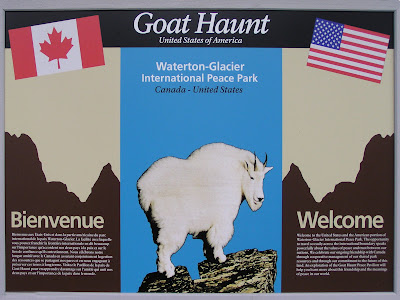
Our ship pulls up at Goat Haunt, our Montana stopover, we are allowed to walk between the dock and the US Customs building without declaring ourselves as entering the USA. A large rotunda shows the variety of flora and fauna in the area, as well as history of the 2 parks.
After warming up by a large fire, and talking to the US border guards, we make our way back to our ship, for the less windy return trip. Looking ahead it is blue sky, behind us the clouds are coming in with a fresh batch of rain, rainbows and sunbeams guide us back to Canada.
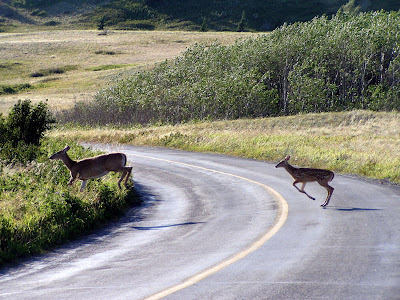
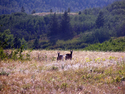
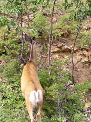
From the choppy waters of Waterton lake, we come back past the 'Prince of Wales' hotel, and head to Crandell campground to settle in for the night. As we are nearing the campground a deer and fawn appear on the hillside. The fawn panics and flings it's white-tail up in the air, and the doe gives it a look, as if to say, "Come on, it's just a human". Then they come down the hill and cross the road in front of us, running in the direction of our campsite.
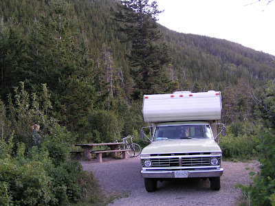
Crandell is a great secluded campsite, no trains, and very treed. We are allowed to pick the site we want, aside from the occasional crackle of someone's campfire, you would think we were alone in the middle of the forest. Once again it was blue skies and rain, as the sun went down it got very cold and windy... below 10°. The campfire was a little hard to start with the wind, but once it was going the flames were constantly going sideways, a little unnerving with the trees around.
Aug 27 - It was chilly when we woke up, definitely a morning to have oatmeal for breakfast. After packing up it was time to explore Waterton, first stop... Red Rock Canyon.
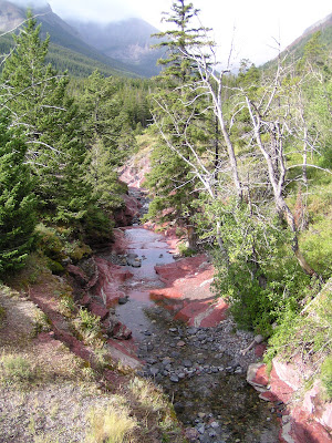
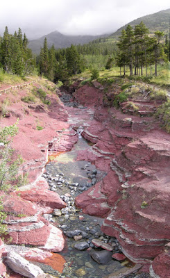
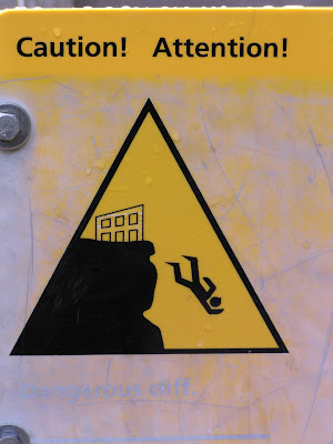
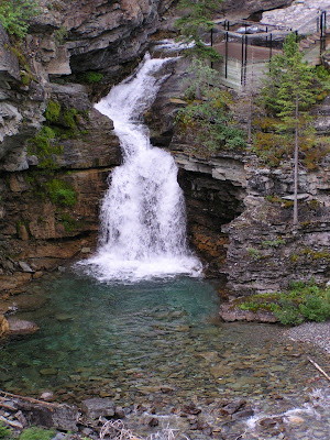
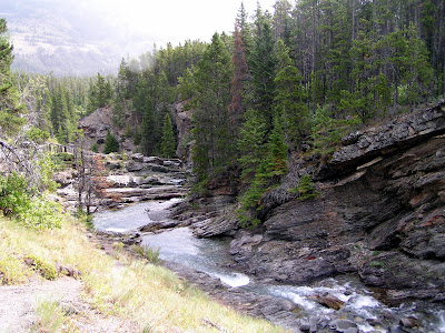
The name speaks for itself when you see the color of the rocks surrounding the creek that runs through here. A nice hike from the red rocks takes us up the hills to Blakison Falls. We are warned of the dangers of the area, but still proceed to enjoy the lookout onto the falls.
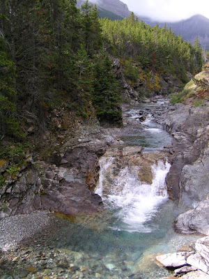
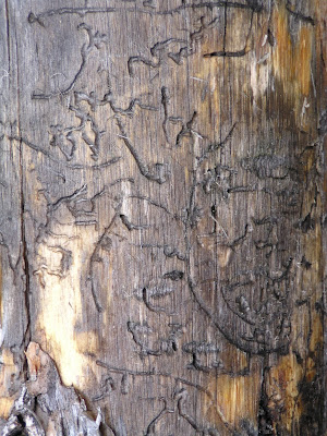
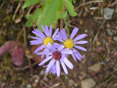
It's a pleasant hike, and we only see a few other people before we turnaround and head back. The mix of wildflowers, deer-tracks, and beetle tracked logs add texture to the trails.
From the Red Rock Canyon we make our way into the other main road of Waterton, and head towards Cameron Lake. As we get closer, it gets grayer, and then we're in rain, a lot of rain. By the time we arrive at the lake it is raining buckets, and the wind is torrential, we stay long enough to take 1 picture and leave. We are running from the rain again.
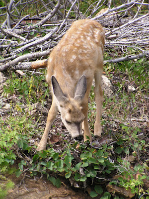
The further we get from Cameron Lake, the brighter the skies get and then the rain stops. We are pleasantly surprised when we see a small deer on the side of the road, and when we stop we notice she has a little spotted fawn with her... it's Bambi!
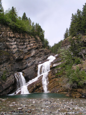
One of our last stops is right in the main town of Waterton, we heard there was a set of waterfalls. Imagine our surprise when we see the town center's Cameron Falls, certainly not like any town center we had seen before. A perfect spot for wedding photos.
It's time to hit the road, but before we leave Waterton Lakes National Park, we have to check the Bison Paddock again. After almost finishing the loop, there way way back on the hill... two Bison... can you see them, those black specs. I feel complete now, and we can start heading home.