The Kootenay Loop 2006
In my second summer of freedom from EA, I actually was able to take a summer holiday, my first camping trip in many years... 9 days a truck and camper, and a map of B.C. No set destinations, no set stops, just east towards the kootaney area.
On Saturday the 19th, we loaded up the camper, and before we were ready to go, Midnite leaps into the back seat of the truck, we weren't going anywhere without her, she wasn't going to get out until we were on the road. She goes to sleep 5 minutes into the drive. We head East... on Hwy 1, first stop, Hwy 1. Apparently nobody informed them we were coming, and some dumb-ass decided to get in an accident, so we crawled over the Port Mann bridge, and finally got off at the 106 Ave exit, taking the side roads out past Langley. Who would have thought single lane under construction roads would be faster than our "we don't need to upgrade" Freeway system. We make a gas-stop in Chilliwack, and after a minor radiator fluid scare, are back on the road heading East on Hwy 3, the Crows Nest Hwy... starting in Hope and making our way through Manning Park.
Keremeos
It was hot driving and as it was getting to be late afternoon we decided to start looking for a place to stay, We were never fans of the side-by-side RV campsites, we wanted to have some space, a place to relax, and a place to let Midnite have some freedom off the leash. Keremeos had a place that looked promising, Cathedral Provincial Park, we turn off the highway and start to doubt our ability to read directions, when we come across the private Ashnola Campground, run by the Similkameen indian tribe. A mid-size campground right on the Similkameen river, there was 3 of us camping there, one couple at each end, and us in the middle, all the space we could need, and hot showers to boot.

We pull our camping chairs into the river, and cool off "Merritt Mountain Festival" style, and we teach our old dog the first of her new tricks, the camping blanket. We figured keep her off the dirt, she figured, good place to get some sleep.

Later on as we sit by our campfire, we realize just how much the city lights affect your ability to see the stars, if only we had a star map, we would know what we were looking at. We could spot the Big Dipper right away, and you could see the milky way with your naked eye. It was awe-inspiring to use the binoculars and see just how many stars there are in the night sky.


The next morning we get up and continue our travels down the Crows Nest Highway, with a brief stop in Osoyoos to fix our cigarette lighter so we can use my iPod over the radio. We continue on through the historic towns of Greenwood and Grand Forks on our way to Christina Lake. Fate steps in when every campsite in or near the Tourist Meca of Christina Lake is full. We have no choice but to continue on and find somewhere else to camp.
Castlegar
We end up in Castlegar, and after rejecting the Pass Creek parking lot... errr campground, we decide to continue on. We see the sign at the gas station telling us that the Syringa Provincial Campground is Full, but there is overflow camping available. Apparently someone forgot to take the sign down on a Sunday night, because there was lots of empty spots, we find a nice secluded spot a very short walk from the beach of the Lower Arrow Lake.

The first night we are treated to a beautiful sunset over the lake, and the next morning after another night of star-gazing, we decide this accidental destination is worthy of another day on the lake. The second day on Arrow lake and we teach our old dog another new trick... floating. We blow up our air mattress and take it down to the lake, with hardly any encouragement, she steps onto it, and we float out into the lake, and Midnite lays down and goes to sleep. Apparently as long as she can sleep, it didn't matter where we put her.


After a lunch break and a bunch of paddling, we rig up an anchor with a rope and a rock, so we can settle into a nice spot without drifting down the lake towards the dam. Rolling off the matress to swim and cool down, splashing the dog to cool her down, we spend a few more hours at the beach. Did I mention we were alone on the water? Almost completely, with only 1 other family further down the shore.
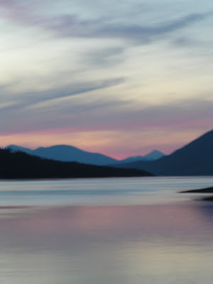
The second nights sunset is even more dramatic, with a dramatic, yet somewhat eery blood red sun in the sky.

The red sun must have been a sign of the coming clouds, so we packed up and head up Hwy 3a towards Nelson the next morning.
Nelson
We return to the scene of Norine's previous rowing destination, Nelson's Kootenay Lake. Although Nelson has some great historic buildings such as their City Hall, and a really nice park, it is one of the most dog-unfriendly cities we have been too. No dogs in the park, no dogs on the beach, we get out by city hall to take a picture, and there is a "no dog" sign painted on the sidewalk, we contemplate taking a picture of Midnite crapping on the sign, but she wouldn't cooperate.


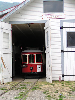
The park on the lakeside (seems like a river), is very nice, complete with gardens, and a historic trolley, but the only animals allowed to go there are the local squirells and birds.


So after a very brief photo stop, we continue on around Kootenay National park towards the small town of Kaslo. Once again fate sets in, as we are looking for a campsite for the night, the campgrounds near Kaslo are few and not very nice, so we continue on Hwy 31a towards New Denver
New Denver
On the way into New Denver we pass a turn-off that takes you to some historic place called Sandon, we make a note to check out what that is, and head into the town of New Denver, where the first sight we see is these weird/iunique domed houses, award winning pint-sized abodes design and built there.

By chance we ended up at the Rosebery Provincial Park, located on the Wilson River, across the street from Slocan Lake. The only empty site is a double, right by the bathrooms, that was ok with Norine, and it backed right onto the River. We had a huge double site to ourselves, and Midnite couldn't be happier.
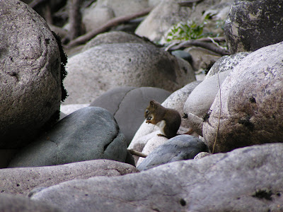
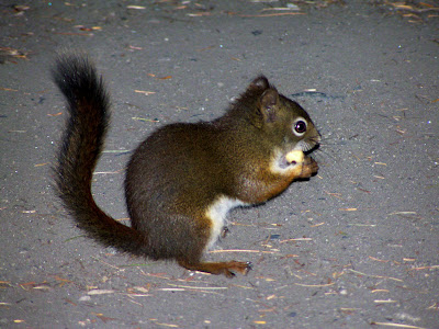
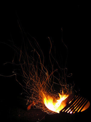
We are entertained by a very brave squirrel, he taunts Midnite, and sneaks around to try and get more of my cashews. We then spend the night reading up on Sandon, star gazing, and watching the magical embers of our apparently wet campfire. After a brief thunder and lightning storm, a few sprinkles end quickly and we are left with just the winds. It was good we were entertained by the light show, as the ranger never showed up with wood the next night.
That morning we get up and find an even nicer site on the river and move our chairs there after the other campers move on, they leave us a lovely styrofoam cup boquet of the local wild-flowers. A nicer site with a better riverfront location, a boquet of flowers, and no more wafting smells of the outhouses, life is good.

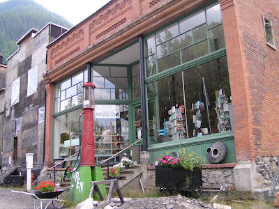
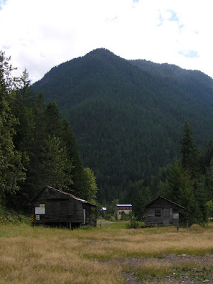
We discover that the turnoff we passed on the way into town leads to the ghost town of Sandon, an old Silver mining town from the late 1800's (circa 1890 picture below), that was abandoned in the early 1900's. We drive old Bessie up the gravel road several miles to the old town-site. Several of the old buildings have been purchased and are being restored, many more are beyond repair.
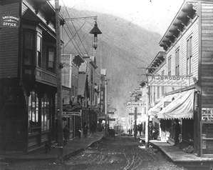


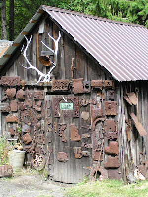
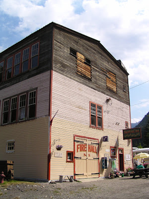


The unique aspect of Sandon is the old houses that are now lived in, but restored to be like the old town, including Molley's Brothel and the Tin Cup Cafe originally built in 1896.

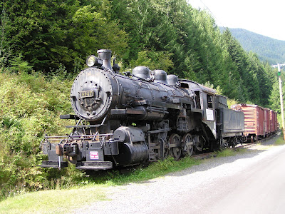
Another unique thing about Sandon was its collection of transportation devices... an old carriage, a 1908 Steam train, and the Brill trolleys from Vancouver. I'm not completely sure why they are there, as they were never used in Sandon, but when they were retired, guess where they end up?

The afternoon is spent lazing on the beach of Slocan lake, hoping that the newly arrived winds and clouds will die down.

They don't and we decide it's time to move on the next morning, especially since we had no campfire.
The Road to Nakusp
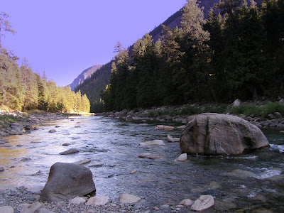
While checking our maps we discover this interesting dashed line that goes from Rosebery almost all the way to Nakusp. turns out it's a 42km forestry road, that starts right on the other side of the river from where we were camping. We have seen some trucks drive up the road, so what the heck, it could be an interesting adventure.


The trek starts out as expected, a fairly nice, but narrow gravel road, slowly rising through the hills, it starts to change the further you get in, less smooth, more narrow, more steep, but beautiful scenery none-the-less. Our first surprise is a turnoff that takes us down a steep steep trail, scraping both sides of the truck and camper with trees, we venture down to see what this user maintained forestry campsite called "Beaver Lake" is all about.

As we round the final corner we come into a small little campsite with 3 sites, picnic tables, fire pits and even a clean outhouse with TP (lucky for me). From the sites you look out onto a gorgeous jewel of a lake. These user maintained forestry campsites all have a log book where people that visit add their comments, the last visitor to this site was 3 weeks prior to our arrival, if we had stayed there, we would be alone, very very alone. Little frogs and tadpoles were everywhere, as where dragonflies and birds, unfortunately I expect there would be a few of those pesky mosquitoes later in the day too.
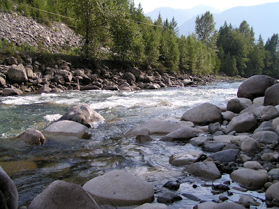
We make a note to check out more of these sites for future trips, and after a short break, we scrape our way back up to the "main road". We find another more 'rustic' campsite called Little Wilson Lake, and then find the main Wilson Lake campsite, again a beautiful lake with 5 sites, but one camper there already. we acknowledge each other, take a picture, test the water temperature, and leave him to his fishing poles, ATV's and privacy.
The next part of the "road" was much more exciting, we round the lake, and see a fork in the road, me must go right, has to be, it leads into a very steep uphill then downhill climb over very rough roads, by the time we think we have made a mistake there is nowhere to turn around, as soon as we find a spot, we'll go back... several kilometers later we pop out at the other end of Wilson Lake, and a 3rd road going to another little lake called Horseshoe Lake, maybe we didn't go the wrong way? Even though the road seemed like a non-main road, apparently it was, and we end up behind a logging company, and the road comes right out on the main highway to Nakusp... where we would be today if we had turned around and taken the other road, I have no idea.
Nakusp
We check out Nakusp and stock up on some groceries, then head South on Hwy 6 to find a campsite. We end up at the opposite end of where we started, Upper Arrow Lake and McDonald Creek Provincial campground. It is a long narrow campsite between the Highway and the lake, and the long-termers and early-risers have staked their claims on the lake side sites, but that just made the trek to the beach 50 feet instead of 30 feet.

We sucked it up, and selected a nice secluded site with a grassy area behind that Midnite thought was the best thing ever, and settled in for another BBQ dinner, and check out the deserted beach.


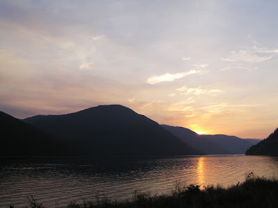
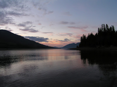
The color of the sky throughout our trip has been amazing, and Upper Arrow Lake was no different, we look across the lake at Saddle Mountain, and watch as the sky changes the scenery into an amazing pastel painting

We woke up to a beautiful day, and pump up the air-mattress, rig up an anchor and head out for a day of floating with Midnite... It's not until after 2:00 that anybody else comes down to the beach. A mile of waterfront, and a big family comes down and sets up right in front of where we are anchored... "it's so nice that the beach isn't crowded" they say... really? Then you drag all your lawn chairs and a vast collection of blow up floating toys, and put them right in front of the only people there? Dumb-Asses. So I grab our anchor and drift us further down the lake, oh... the hardships we endure.
After a day of soaking in the sun, we soak in another night of stars, we can even see satellites drifting past. There was no colorful sunset that night as there was no clouds at all. Saturday morning, and it's time to start heading home, we drive further South and take the little free ferry across the lake. We wind our way through the hills, and make our way through the Okanogan, ending up in Penticton.
Fate starts playing its hand again... If you have been to Penticton you know what a busy summer place it is. It is the same weekend as the Iron Man competition, it's wall to wall people, and the campsites are full, only allow lap-dogs, or are the Walmart parking lot style of campgrounds. We check into one, but after seeing the setup and walking over towards the beach and admiring the "No Dog" signs, we go back to the camper, pack up and get a refund... it's time to head West, this place is too much of a system shock compared to the previous 8 days.
Hedley
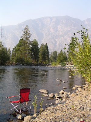
The grand new plan is to go back and stay at the Ashnola campground where we stayed the first night, a nice little river destination, empty campground, and hot showers... again plans are changed. A forest fire has been burning south of the border, and the closer we get to Keremeos, the thicker the smoke is getting, the smell of smoke is very strong in the air.


For comfort and health reasons we decide to keep going West until the smoke clears, and end up in the old mine town of Hedley, finding a little campsite called Stemwinder, funny thing is we stopped there on the way out, and it was full, lots of room this time. Stemwinder hangs right above the Similkameen river, so we climb down the hill to cool down. Someone has stacked the river rocks in such a way to create a perfect little pool, and the last day of our trip is spent in paradise, finishing it off with a morning swim before packing up and heading home.

The trip ended the same way it started, Hwy 1, an accident at the Port Mann bridge, but we found out in time and took the suburban route 7 to avoid it. So... 9 days, a truck and camper, a map of BC and a old dog with dementia, you quickly learn that the term "Beautiful British Columbia" is true.
Now we just have to start saving up our money again for the gasoline that costs $130 per fill, and we're ready to go again... or maybe we'll just go to Hawaii with that money.