Ireland Pt. 2
Driving away from Dublin
Our plan is to drive the Island of Ireland in a clockwise direction, heading South out of Dublin, and circling back around through Northern Ireland before heading back to Dublin to drop our car off. Once that is done, sadly we board an airplane and head home... but we've still got about 12 days.
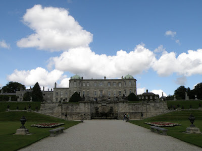
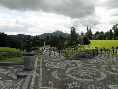
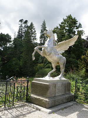
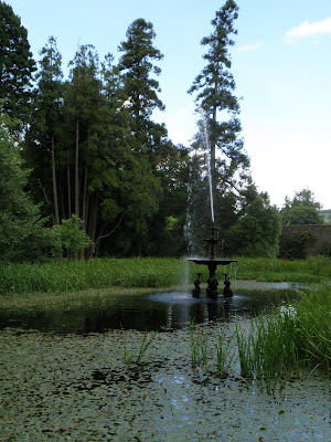
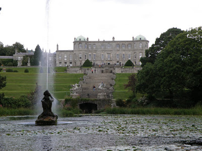
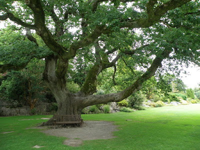
The first stop on our clock is the Powerscourt Estate house and gardens. The 47 acre estate was originally a 13th century castle, and was extensively altered during the 18th century. In 1974 there was an extensive fire, and they have only opened up 2 rooms since, so mostly we explore the gardens. Which is ok, since the gardens and ponds are really quite spectacular, unlike their food.
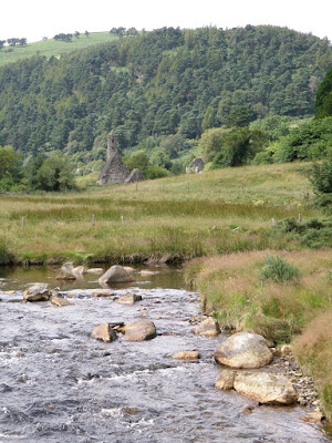
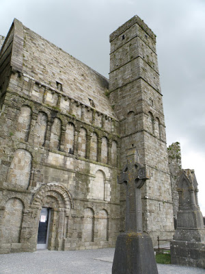
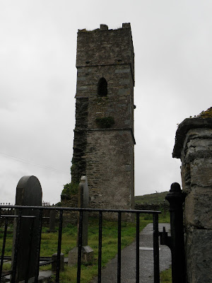
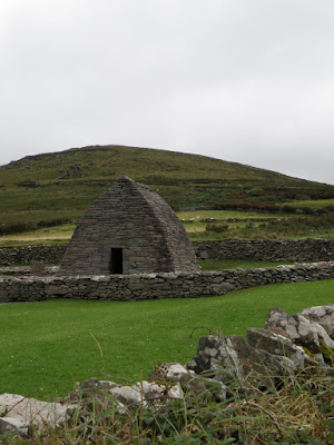
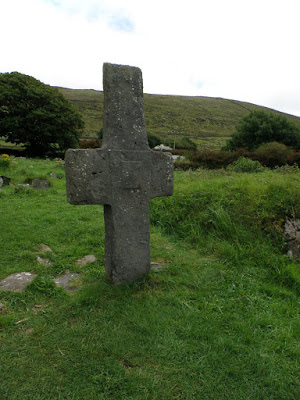
From a grand estate we headed to the crumbling ruins of Glendalough. Glendalough was an Early Medieval monastic settlement founded in the 6th century, and destroyed in 1398 by English troops.
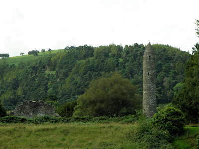
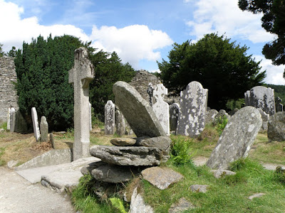
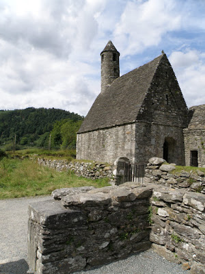
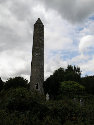
The Monastic Village consisted of a cathedral, seven churches, a number of dwellings and other farm buildings. It's impressive round tower, which is about 30 metres high (100 ft), with an entrance 3.5 metres (11 ft) from the base, must have an impressive view over the 2 scenic lakes.
Kilkenny
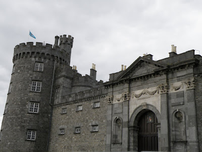
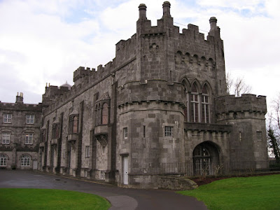
From Glendalough we drove to Kilkenny and checked out the aptly named Kilkenny Castle, but it was closed due to construction work. So we wandered around the massive grey structure.
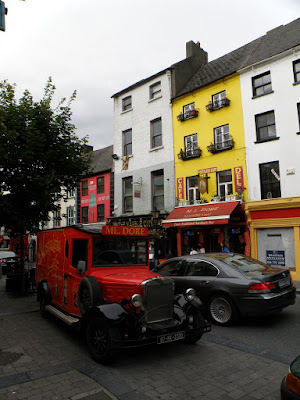
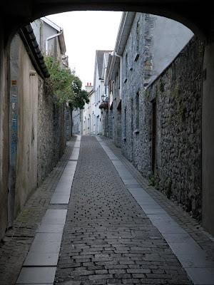
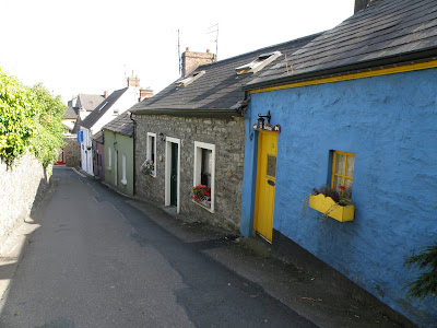
Wandering around the outside of a castle doesn't take too long, so we wandered into town to check it out. After a brief stop at the TI to find a room for the night, we wandered down the high street, past shops, restaurants and old cars to the next landmark.
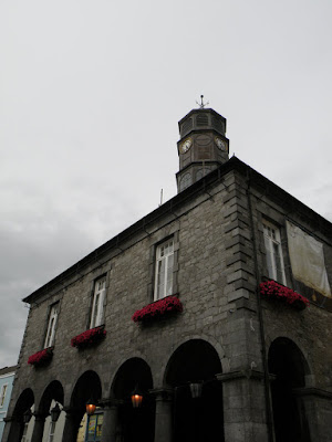
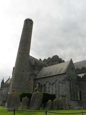
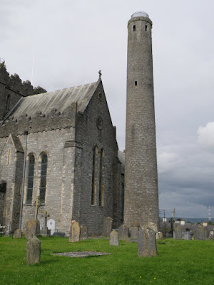
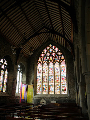
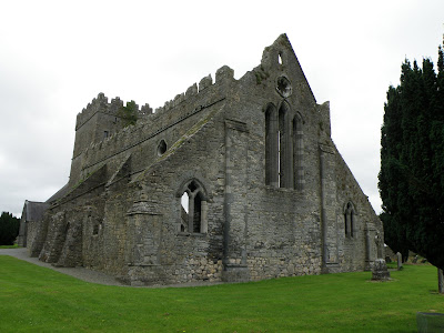
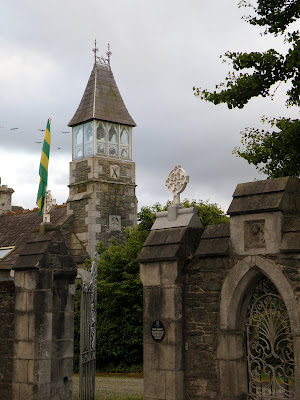
St. Canice's Cathedral dates from the 13th century and is the second longest cathedral in Ireland. Beside the cathedral stands a 100 ft 9th century round tower. There is something strange going on in Kilkenny as it is also closed early for a function. I guess we'll just walk around this building too.
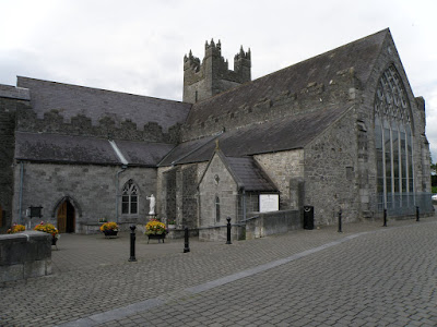
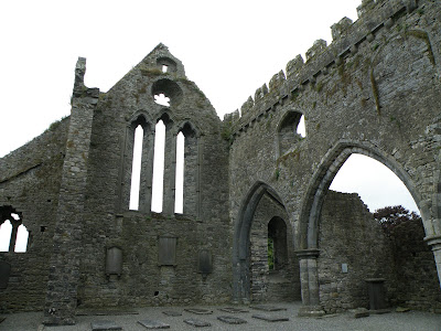
A short walk from St. Canice's Cathedral is the Black Abbey, founded by the Dominican Friars in 1225. The name of the abbey comes from the fact that the resident monks used to wear a black cape over their white habit. After Henry VIII shut it down in the 16th century, it was left in ruins and wasn't restored for use until the mid 19th century.
It's impressive stained glass windows, both ancient and modern are stunning.
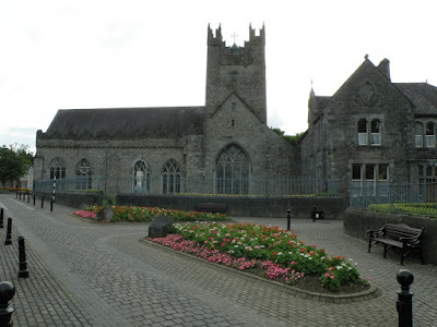
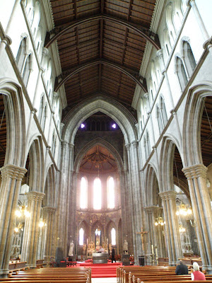
One last stop before looking for our B&B, is St Mary's Cathedral. This Early English Gothic Cathedral made of cut-limestone, is practically new having been completed in 1857.

We wandered back through town to our car, punched the address into Austin, and then couldn't find the B&B. We drove up the street, turned around, drove back down the street, turned around, when we finally stopped at a house to ask, a car pulled up to help us. It was the owner of the B&B, he saw us turn around about 100 M to soon, and figured we had to be his newest tenants.
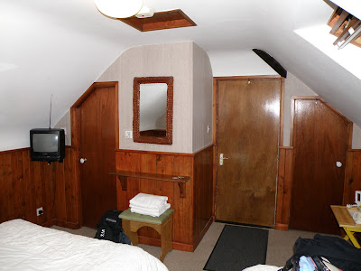
The owner was great, he came and found us, he even carried Norines bag up the 3 flights of stairs to the unique attic room in his house. He recommended a local pub that served good food at good prices, and we headed off for another really good Irish dinner. Then we crashed... hard.
After a great night of sleep, we woke up to our owner making breakfast, salmon omelette for me. It's a sunny day and time to drag our luggage down the stairs and make our way West.
Our first stop is the Rock of Cashel, a famous historic sight on the peak of a hill. We punch in 'Cashel' to our GPS Austin, and proceed on our way. After about 90 minutes of driving and strangely heading in an easterly direction I start to think something is very wrong. We pull over and punch in 'Cashel' again, to discover that there is many Cashel's in Ireland, and Austin sent us to the wrong Cashel. 3 hours later we would be back where we started... Doh!

When using a GPS, it is important to ensure that the destination you have punched in, is where you actually want to go. In many countries, a city name may be used numerous times in different states, counties, and provinces. You don't want to end up in the wrong Cashel.
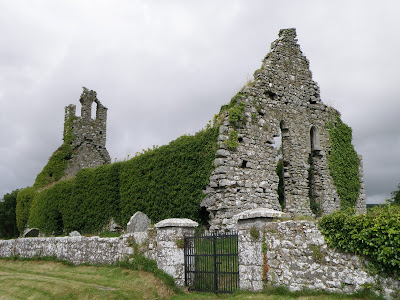
Our little misadventure wasn't a complete waste, as we found the 13th century Gowran church ruins. The St Marys Collegiate Church contains monuments from the 14th to 17th centuries.
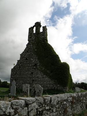
As we finally make our way back past Kilkenny, again, we stop at some abandoned Church ruins just sitting on the side of the road. It makes you wonder what happened; was it the potato famine? was it King Henry VIII? did they move into a more modern facility?
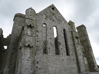
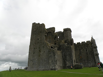
When we finally get to the right Cashel, it's not hard to find the Rock of Cashel, it's prominence at the top of a hill is hard to miss. The Rock of Cashel served as the traditional seat of the kings of Munster for several hundred years prior to the Norman invasion, that dates it from the 5th century. The majority of buildings on the current site date from the 12th and 13th centuries.
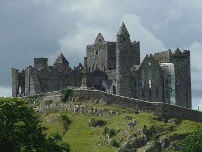
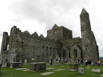
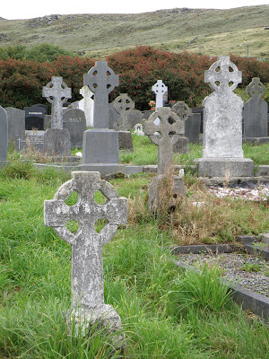
The Cathedral, Chapel and round tower form an impressive structure both up close and far away. The entire plateau atop the rock, on which the buildings and graveyard lie, is walled. In the grounds around the buildings an extensive graveyard includes a number of high crosses.
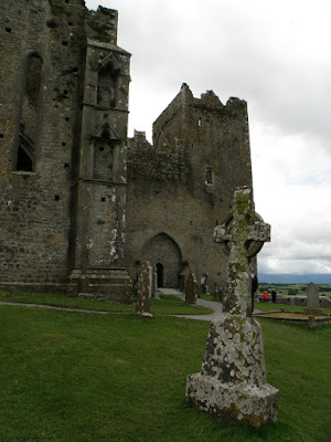
One of the largest and most famous high crosses on the Rock of Cashel was destroyed in 1976 when it was struck by lightning. The remains of the top of the cross now lie next to the rock wall.
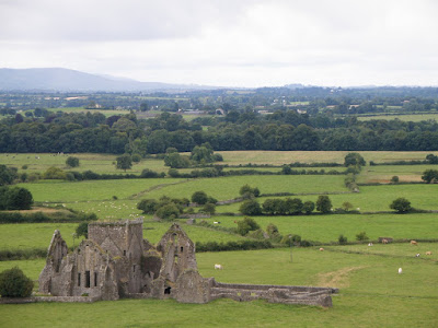
From it's prominent location overlooking the valley, we can see another ruined church. Even with its amazing views we can't see Tipperary, because "It's a long way to Tipperary". hahaha... ahem.
The day started sunny, but the more we drove the cloudier it got. When we arrived at Blarney Castle it seemed like it might be getting nice again, no need to bring an umbrella.
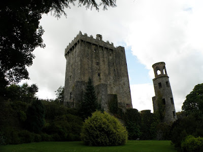
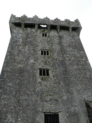
Blarney Castle is a medieval stronghold near Cork, though earlier fortifications were built on the same spot in 1200 AD, the current keep was built by the McCarthy clan and dates from 1446. More famous than the castle is the infamous Blarney Stone, also known as the Stone of Eloquence. It is a block of bluestone built into the battlements of Blarney Castle, and according to legend, kissing the stone endows the kisser with the gift of gab (great eloquence or skill at flattery).
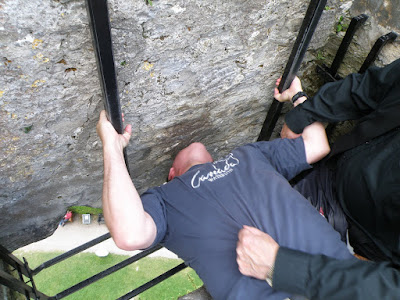
Tripadvisor.com recently ranked the Blarney Stone as the most unhygienic tourist attraction in the world. Who can refuse that attraction? You ascend the stairs of the castle in a slow climb to the top of the tower and step out into a balcony overlooking the countryside. As you wait in line to kiss the most disgusting germ infested rock in the world, you see the process, lay on your back, grab the bars and you are suspended upside down over a sheer drop while an old man holds your shirt, so you can lean back and kiss the now lipstick and spit coloured rock. The woman in front of Norine has a complete tear-filled meltdown when she looks down, and Norine decides that between the height, the gross rock, and the old man that has been holding hundreds of people already, she doesn't need to do it. So I'm next, I lay down, I grab the rails, and I hang upside down good and low and give it a nice smooch, then wipe my lips with sanitizer... I now have the gift of gab ![]()
That white hole is where you dangle
Back down on terra-firma, I am talking up a storm as we walk over to the unique looking Blarney House mansion, and we are caught without umbrellas during a sudden cloud burst. First we take cover in the entryway, then under a tree, before it stops raining long enough to get to the car.
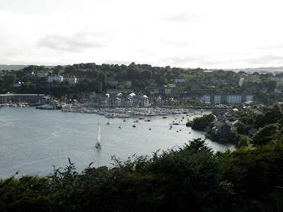
Driving away from the rains we head to the south coast and the town of Kinsale, a yachting and fishing town on the Irish Sea. First stop the TI to book a room for the night in Killarney.
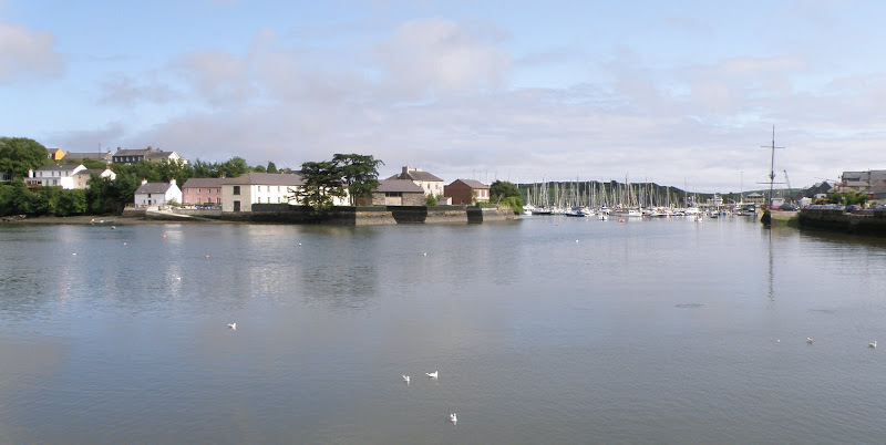
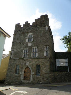
You always have to check out a towns castle, sadly Kinsale's Desmond Castle was a Lousy Castle. Basically it is a tower house built in 1600, with some sad exhibits, and is now the International Museum of Wine. They have some bottles and a map showing where wines come from... weak.
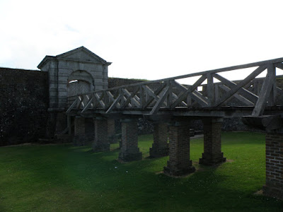
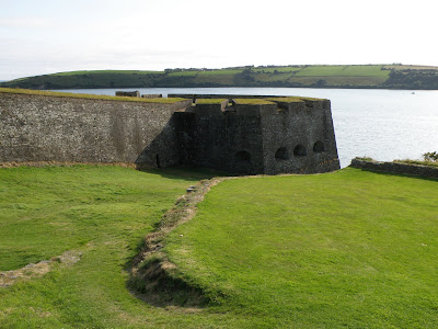
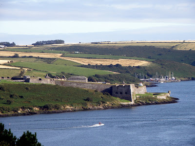
On the outside of town at the entry to the harbour is what we really came to see, Charles Fort. It's a series of hairpin turns and narrow roads to get to the 17th century Star Fort, a defensive construction, specifically designed to protect against incoming cannon fire. It seemed like a good idea, except they didn't plan for attack from higher ground inland, which allowed the Duke of Marlborough to take over and change it into a British Army barracks.
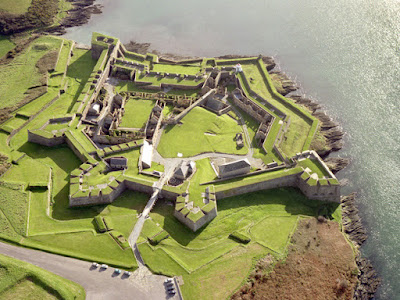
What it looks like from the air
As seemed to be a bad trend for us the last few days, we arrived at 4:02pm, and the fort closed at 4:00pm. We would have to admire the walls from the outside, and not see inside the massive fort.
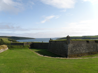
Driving back, there is some amazing views overlooking the fort and Kinsale harbour.
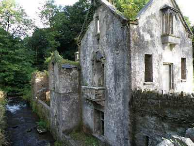
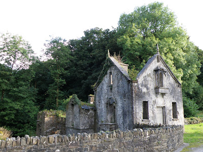
From Kinsale it's about an hour and half drive to Killarney, along the way we passed a very unique looking abandoned house on a creek, is it more remnants of the potato famine?
Killarney
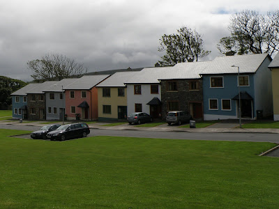
We had no trouble finding our B&B in Killarney. Just off the main road is a nice little place, conveniently only a 2 minute walk into town, but still in a quiet neighborhood.
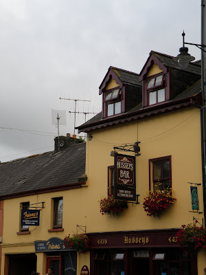
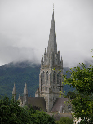
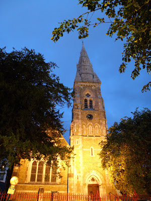
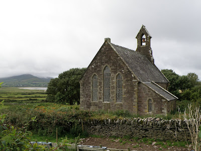
We walked the town, had a nice dinner, checked out Hussey's Bar, and yet another St. Mary's Cathedral. The construction of this 19th century Cathedral was delayed in 1848 when the full effects of the failure of the potato crops in 1846 and 1847 were felt and the Great Famine spread throughout Ireland. For 5 years nothing was done, and both the main builder and the designer passed away in that time, It wasn't completed for another 2 years.
Due to it's location close to Killarney National Park, the Rink of Kerry and Dingle Peninsula, and with a wide collection of pubs and night clubs, Killarney has a bustling nightlife, with lots of partygoers. It was very busy on a Saturday night, the shops were open late, and there was lots of Hen parties... as brides-to-be were strutted around the town for one last night of fun.
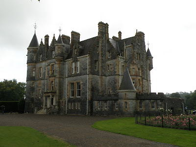
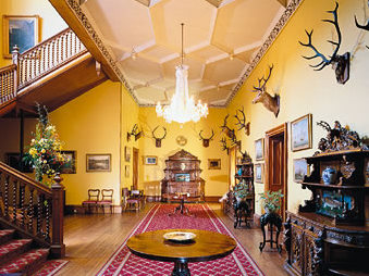
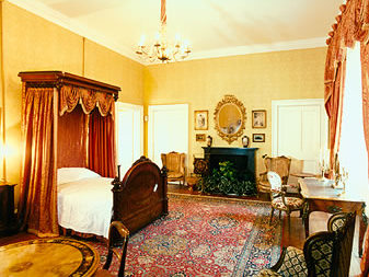
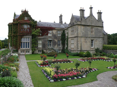
Not far from Killarney is Muckross House, a Tudor style mansion with sixty-five rooms, built in 1843 for Henry Arthur Herbert and his wife, the watercolourist Mary Balfour Herbert. Extensive improvements were undertaken in the 1850s in preparation for the visit of Queen Victoria in 1861. It is said that these improvements for the Queen's visit led to major financial difficulties resulting in them having to sell the estate.
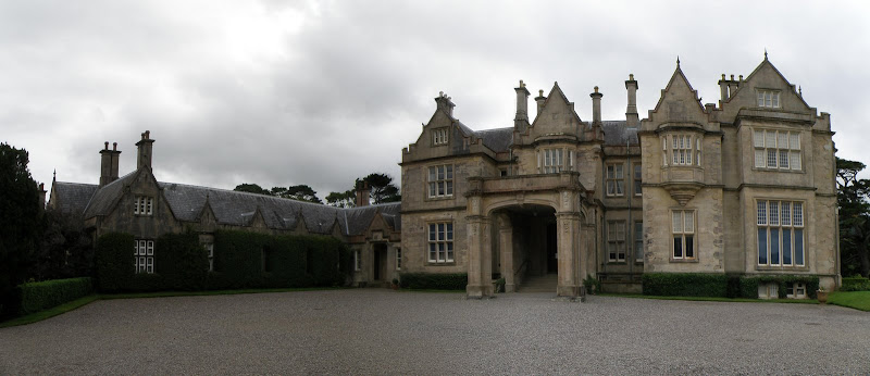
We toured the house and gardens before heading on the circle route known as "The Ring of Kerry"
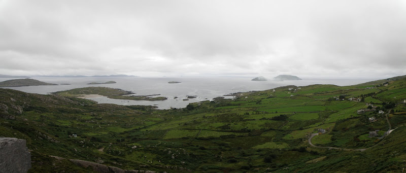
Ring of Kerry
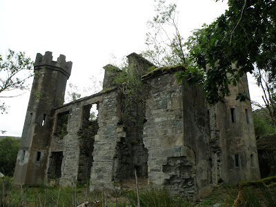
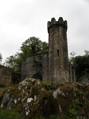
The Ring of Kerry is a circular road route in County Kerry, that winds its way around the Iveragh peninsula, and inside of the Killarney national park. The route is known for its scenic seaside views, but seeing the ruins of an old castle/house on the side of the road is also cool. Too bad there is no information on the history or fate of this turreted building falling to decay.
It always pays to do research ahead of time, and talk to the locals. All the Irish literature tells you to travel the Ring of Kerry in a counter-clockwise direction "to avoid traffic tie ups on the narrow roads". We are told to leave early, go clockwise, and you won't get stuck behind the huge tour buses. At the far end of the Peninsula, buses aren't allowed,
and you should come back the other side without any buses... that info isn't in Fodor's.
Along the main road is a very panoramic lookout known as Ladies View, the name is apparently based on Queen Victoria's ladies-in-waiting who appreciated the view during their 1861 visit.

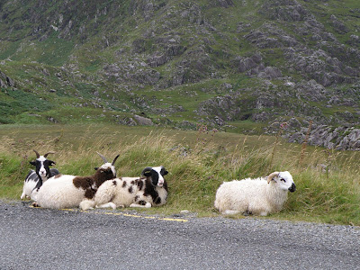
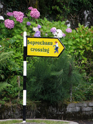
It seems everywhere we go on this trip you have to be aware of sheep on the side of the road, in this area however, you also have to keep your eyes open for leprechaun's too.
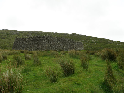
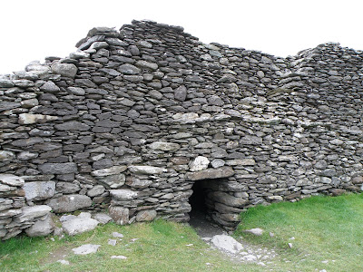
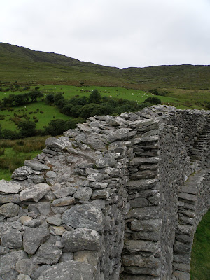
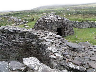
Our next stop would be the Staigue stone fort, the fort is thought to have been built during the late iron age, probably somewhere between 300 and 400 AD. These stone forts assembled with varying size rocks and no form of cement or mortar are more impressive to think they have stood up for so long without collapsing. We can't even build condos that last 10 year without leaking.
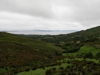
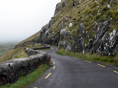
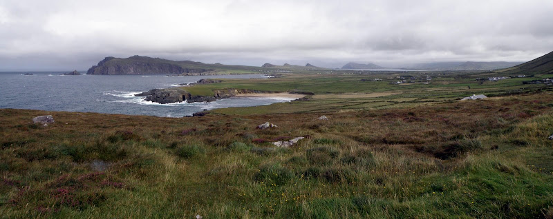
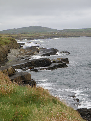
As we work our way around the Ring of Kerry we start getting more ocean views, steep cliffs, sandy beaches, small islands, and lots of rain. The showers would continue most of the day.
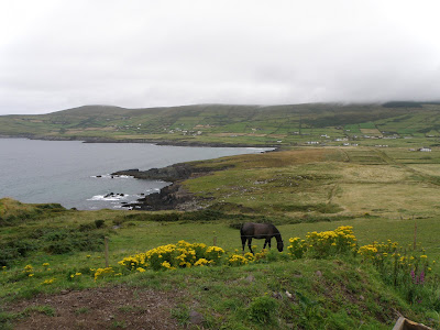
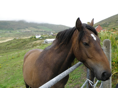
Horses are such graceful creatures, and when we stop to take a picture over a small harbour, this big fella has to gallop over and check us out, a beautiful friendly Irish horse. I think he just wanted to make sure we weren't carrying any extra apples, or a bag of oats.
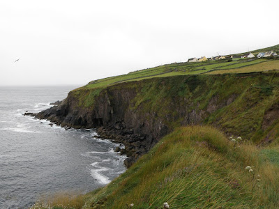
Turning off of the main road, we head down the "no buses allowed" stretch known as the Skellig Ring. It is named after the famous Skellig islands, home of puffins and other seabirds, unfortunately the weather didn't make it worthwhile to check out the islands. What we did check out was an unexpected stop... a small sign says "Amazing Cliff Views", we nearly drove past.
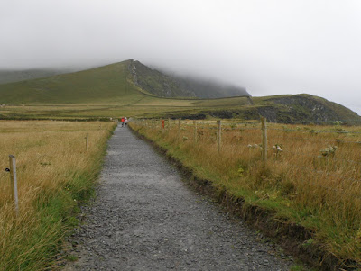
It's raining pretty good as we pay some guy to park in his driveway, and walk up a trail to an amazing overlook. The closer you get them more the wind blows, making an umbrella useless, and turning it inside out. But it is worth it as you stand on a cliff edge looking out along the coast.
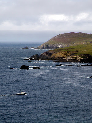
This section of the Ring of Kerry is expanded by driving across the bridge to Valentia Island. At the westernmost point of the island is where the first transatlantic telegraph cable was laid across the floor of the Atlantic Ocean in 1866. It crossed from Valentia Island to eastern Newfoundland.
It's a very rugged and desolate area, with crashing waves, sheer cliffs, and lots of seabirds, it seems a shame to leave it. Leaving Valentia Island is made even more interesting as you have to take a small ferry to get back onto the mainland at the eastern end of the island.
Since we were traveling the opposite way to the buses, by the time we got back on the main road, they had already gone past, and it was mostly clear roads the rest of the Ring, except for the rain.
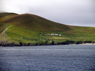
From the Ring of Kerry we weaved our way inland and back onto the Dingle peninsula. Our last sight before arriving in the town of Dingle is the remaining tower of an abandoned Church.
Dingle
Dingle, which is known as An Daingean in irish, is a small town on the Dingle Peninsula. All the signs leading to "Dingle" are labeled as "An Daingean", some even have black spraypaint blocking the Dingle name. Since 1984 a bottlenose dolphin has frequented the Dingle harbour area. He has been given the name Fungi and has become a major attraction for visitors, but we never saw him.
It is really important when traveling to find out how the local language is used, especially
for city names. Cologne in Germany is spelled Koln, Florence is Firenze, it can make it tricky when trying to follow a map or direction signs. There are parts of Ireland where Irish is still spoken as a traditional, native language daily. These regions are known as
Gaeltachts,
and in some of them they have ensured that all city names and signs use
only
the Irish
language. Dingle Peninsula is one of those areas, you better know your Irish.
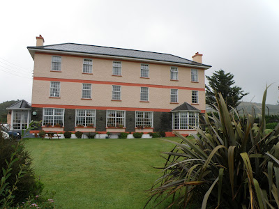
The Rick Steve's book describes the Alpine Guest House as looking like a Monopoly Hotel, so we kind of laugh as we drive up, it sure does. It is bright and clean, good breakfast included, close to town, and has sheep fields to make you feel like you are staying in the country.
We walked into town and went to an Internet Cafe to check our email and bank accounts. When we saw our Mastercard bill, yoiks! we decided to not look at that again until we got home.
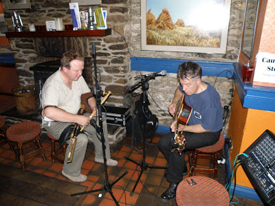
We had a very nice dinner in a local pub, the only local pub still serving dinner, and we were serenaded with Irish music by a pair of locals. One playing an acoustic guitar, the other playing a unique combination of flute with a bagpipe like bellows... no that isn't me on the flute.
Dingle peninsula
In the morning, after a full Irish breakfast, we packed up and jumped in the car for a drive around the Dingle Peninsula. The Dingle Peninsula is the most westernly part of Ireland, and is the location of numerous prehistoric and early medieval remains.
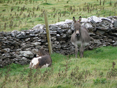
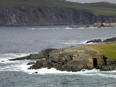
After passing a few nice beaches (if only the weather was nicer!), we made our first stop. As we cross a field to get to Dunbeg fort, we are watched very closely by a pair of donkeys and some dogs. Since we got an early start we are one of the first to arrive and we beat the bus tours.
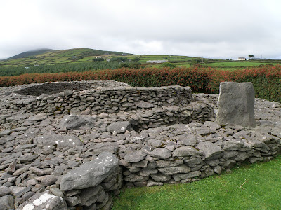
The location of An D�n Beag, or Dunbeg Promontory Fort, makes it one of the most dramatic archaeological sites on the peninsula. It has been excavated and results show that it was begun in the late Bronze Age, 800 BC, and was used right through the Celtic period up to the 10th century. Even the excavation results did not reveal conclusively what the site was used for; it may have been defensive, or used for ritual purposes, or it may simply have just been lived in.
An interesting novelty of this area is the Irish Currach, it is a boat with a wooden frame, over which animal hides are stretched (mostly canvas today), and then it is coated in tar. The style and construction of the Currach's have not changed much since Julius Caesar wrote about seeing them in the North Atlantic around 60-70 BC. Right next to a Currach is an impressive all stone cafe.
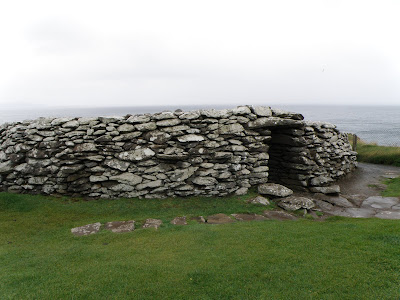
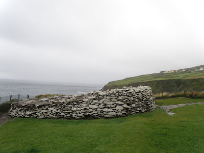
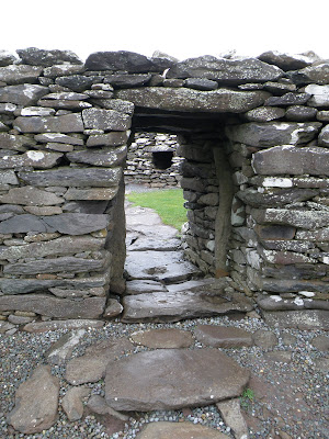
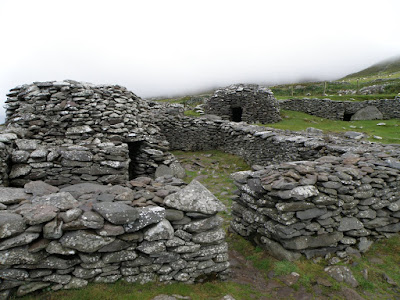
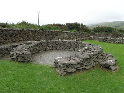
Next up on our tour around the Peninsula is the Fahan Beehive huts. These stone structures can be either single buildings or larger ones with several rooms, and even underground chambers as we saw on our stroll on the hillside. It is assumed that they are ancient dwellings, although in recent history they have been used for storage purposes. The huts are difficult to date because this technique of rock construction has been used from 3100 BC to as recent as 1950. However, these huts are believed to date from the 1100's when Norman conquerors forced the Irish off the best land and out onto the far reaches of the Dingle Peninsula.
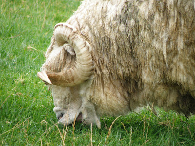
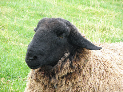
We are ignored by a variety of sheep, as we wander up the field and around the huts, but you can't ignore them, there is sheep droppings everywhere, and you have to be careful where you step.
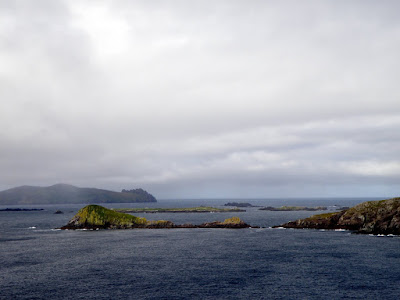
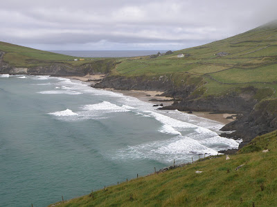
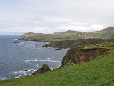
Winding roads along the shore give us occasional glimpses out to sea, then suddenly the grey clouds opened up so we could see the Blasket islands. On the horizon you can see the island known as The Sleeping Giant. You can't admire them too much while you're driving as most of the roads are 2-way single lane roads with pullouts for passing and some for viewing.
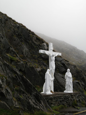
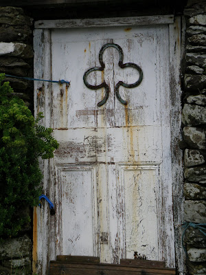
As we work our way around this more traditional part of Ireland, we are struck by the iconic symbols that we encounter, a bright white religious sculpture sitting alone on the side of the road, or the shamrock adding some texture to a rustic door at one of our rest stops.
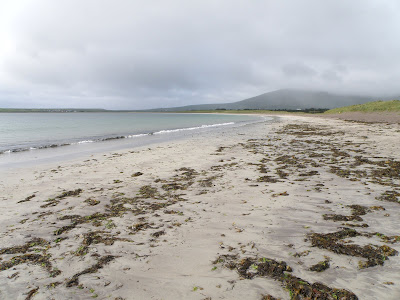
Driving along the coast we spot a few nice beaches, and since the rain had stopped...
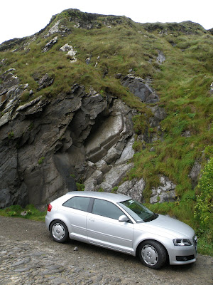
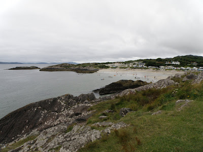
Looking down the hillside we can see the beautiful sands of Dun Chaoin beach, at the top of the hill is a parking lot, a large bus is there, great! But we notice that the parking trail doesn't stop, and keep going, taking our little Audi down the steep and narrow trail right to the beach. A number of the Bus passengers were a little shocked as we drove past them, as was the guy in a Jeep that had to back up to let us pass. The steep climb kept most of the snap-happy-shoot-and-run tourists from coming down to the beach, so we shared it with a few surfers, and waded in the surf.
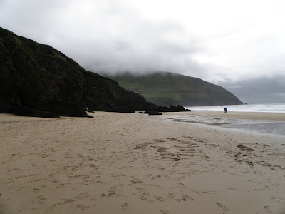
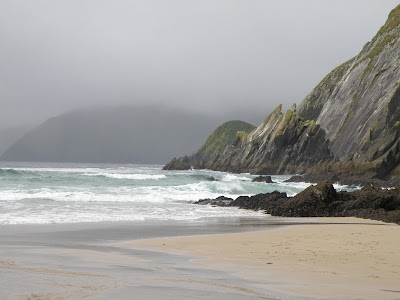
The scenery at the far end of Dingle Peninsula is breathtaking, sweeping hills, steep cliffs, crashing waves, and picturesque homes and farms sitting on massive fields of green. The rain keeps it very green.... Maybe there is a reason that Ireland is known as the 'Emerald Isle'.
Hidden up a tiny lane that most people would miss is a large ruin, the Reask Monastic site. Excavations revealed the ruins of an oratory, four clochans (stone huts), a graveyard and about
ten stone slabs. Two stone slabs with their carvings date back to the 3rd century AD, but were "decorated" with a latin cross in the 7th century, probably to disguise their pagan origins.
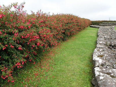
The whole Reask (in the marsh) monastic site is surrounded by colourful Fushia hedges, the same massive hedges that we see lining the roads as we drive around. At home we put it into planters and hanging baskets, here they use it as a fence. It's a peaceful location as we are by ourselves trying to imagine the history, it's peaceful except for super noisy cows mooing away in a neighboring field. It must be lunchtime, and they're making it known they are hungry.
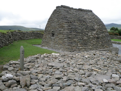
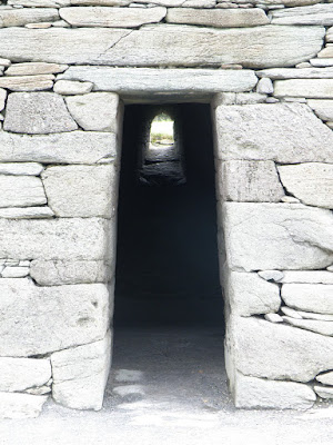
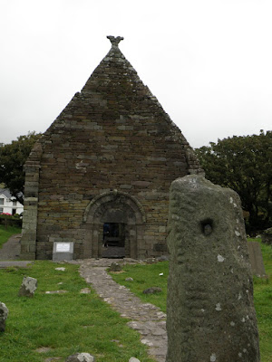
Working our way back towards Dingle we stop at Gallarus Oratory, in Irish it's called S�ip�il�n Ghallarais, literally "The Church of the Place of the Foreigners". It is an early Christian church believed to have been built between the 6th and 9th century. With no mortar and the stones laid at a slight angle, lower on the outside than on the inside, it allows rainwater to run off. This design has kept the interior dry for hundreds of years, keeping the building in excellent condition.
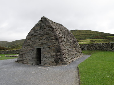
According to local legend, if a person climbs out of the oratory via the window, their soul will be cleansed. We just used the door, and after we left I discovered we could have got in for free if we went 200m down the road to another parking lot... oh well, have to keep the Irish economy going.
Not far from the Gallarus Oratory is the Kilmalkedar Church (Cill Mhaailcheadair), it is a 12th century Hiberno-Romanesque church from the Norman period.
Saint Brendan's house dating from the 14th or 15th century, is believed to be the priest's home.
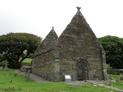
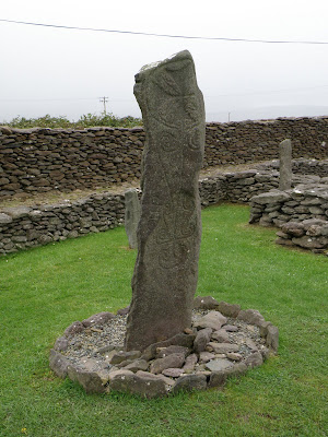
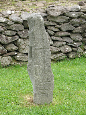
By the door of the church is an ancient stone, it has the appearance of a standing stone and is known as the Alphabet' stone, displaying an alphabet dating from early Christian times. In the graveyard surrounding the church is two grave markers that stand out. The first is a large undated stone cross, from the 7th or 8th century, and the second is a significant ancient ogham stone.
This ogham stone, has a hole near the top and was a meeting place for people to come and seal a deal by touching their thumbs through the hole. Supposedly you can renew your marriage vows in the same way... so in the middle of the Irish country side, amongst a graveyard and beside the ruins of a historic church, we renewed our vows. A pretty memorable day.
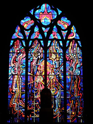
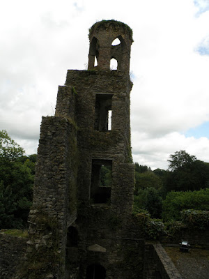
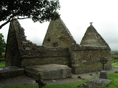
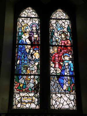
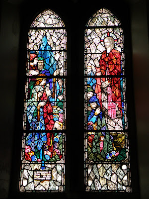
Finishing the circular route we find ourselves back in the town of Dingle. There's one key sight that we want to see here during the day, the Harry Clark windows of Diseart in an old convent. This beautiful neo-gothic building, was home to the Presentation sisters, established in Ireland in the last quarter of the eighteenth century, and who first arrived in Dingle in 1829.
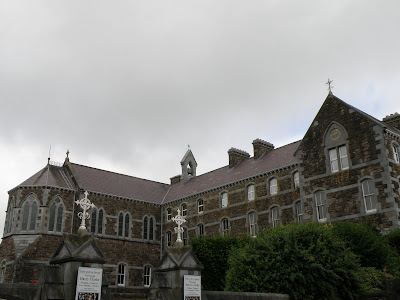
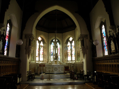
In 1922, the convent commissioned Irishman and one of the foremost stained glass artists of all time, Harry Clarke to design and install 12 stained glass windows in the convent chapel. What Harry Clarke created was six intricate and colourful pairs of windows that tell the story of Jesus.
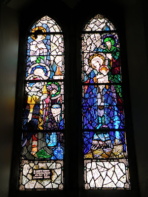

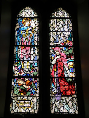
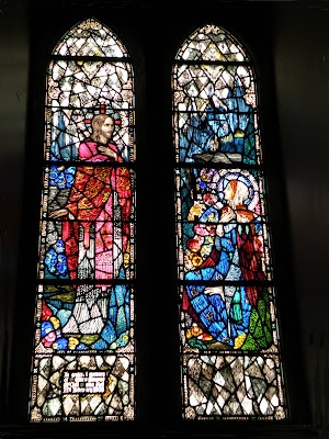
The Birth of Christ
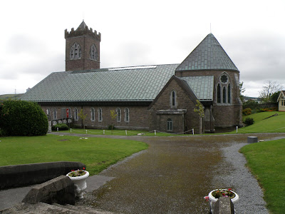
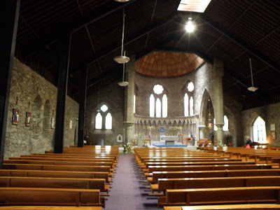
Across the lawn from the convent is of course, another St Mary's Church. Originally a neo-gothic church started in 1862, it has seen many renovations over the centuries.
Before continuing our travels we went into a small cafe across the street, just have a quick sandwich and be on our way... it took an hour and a half... for a sandwich... no tip for you!
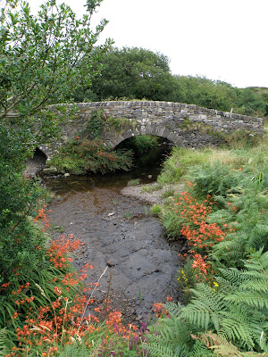
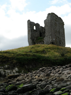
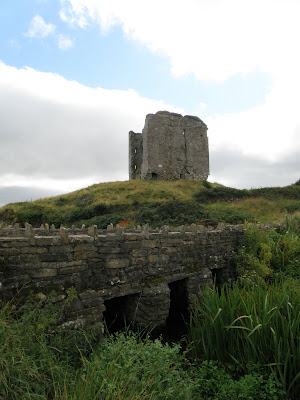
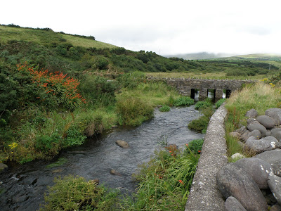
On the way out of the cute town of Dingle is Minard Castle, a very large ruin, the largest fortress on the peninsula. It was built by the Knights of Kerry in 1551, and destroyed by Cromwell in about 1650. It is no longer safe to enter, so we couldn't walk to it, but there is a nice stone bridge and a beach known as Storm Beach below. A very scenic location for the crumbling fortress, but finding it is a major challenge as you have to wind your way down backroads, thanks Austin!
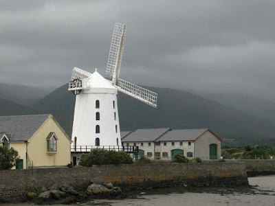
We left the Dingle Peninsula and started working our way north. Before we stopped in the town of Tralee and went to the TI to book a room, we passed the famous Blennerville Windmill. It was built in 1800 but by 1846 had fallen into ruins. In 1981 it was restored and is now the largest working windmill in Ireland. I don't think they compared it against Holland's many windmills.
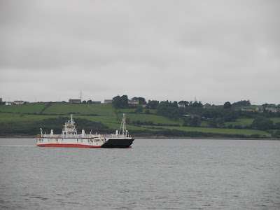
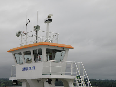
From Tralee we took another small car Ferry between Tarbert and Killimer, this cuts off a bunch of travel time by crossing the Shannon inlet and missing the busy town of Limerick.
Driving past ugly steaming power plants on our way to Killkee, it's nice to put them behind us and get back to the clean and fresh air of the Irish coastal areas. Our Hydro power sources in British Columbia are so much better than coal or nuclear power, and they look nicer too.
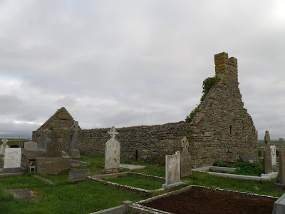
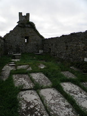
It seems everywhere we go we are encountering abandoned churches. This one full of grave markers, some quite recent, and some quite old, is just off the main roadway.
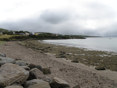
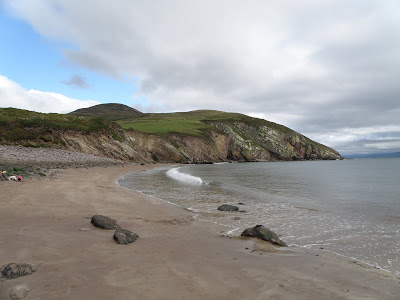
After a brief stop at a small fishing town beach area we head to the coastal beach town of Kilkee.
Kilkee
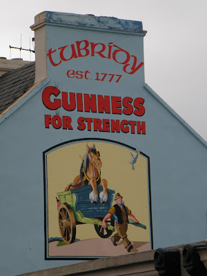
As we pull into Kilkee we are reminded of the strength of Guinness, not sure how true it is, but it's a funny piece of history. Nolan's B&B looks great from the outside, but it's pretty Bare bones, and it's more than just a walk into town... that's ok, they can't all be amazing guest houses.
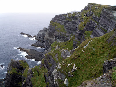
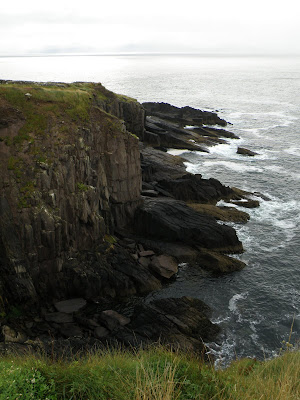
Arriving early enough, and with not much in the town, we decide to take a little drive to this place on the map called Loop Head road. If nothing else we'll see some of the countryside.
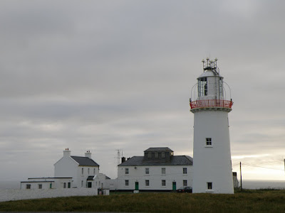
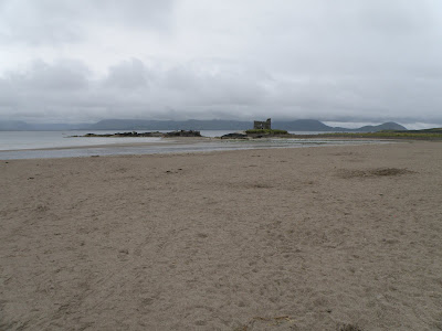
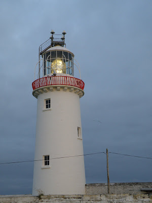
The lighthouse at Loop Head
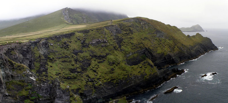
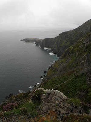
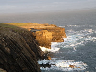
After a fairly straight drive down a fairly straight road through the country we end up at the tip of the County Clare headlands and an impressive lighthouse surrounded by amazing cliffs!!!
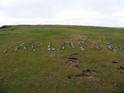
Using rocks that are lying around, visitors have spelled out messages on the cliff edges, most are sweet "I Love You" notes, some are country, city or team names, and some can't be written.![]()
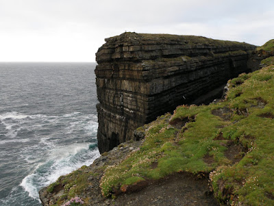
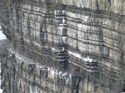
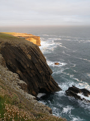
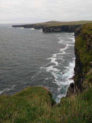
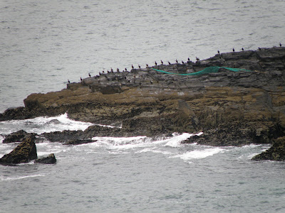
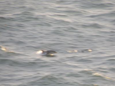
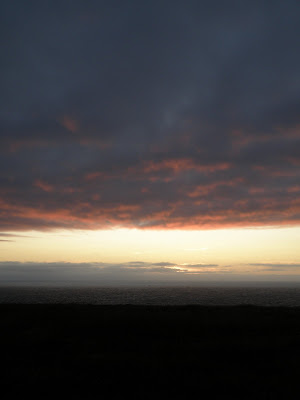
The cliffs on the three sides of the lighthouse are amazing! Seabirds are nesting and flying around, the cliffs are changing colours as the sun is lowering in the sky. As we watch, a pod of dolphins is playing in the Ocean, unfortunately as the sun is coming down, it's not bright enough to get a good picture of them as they splash, jump and weave their way back and forth on the coast.
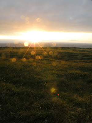
We are seemingly at the end of the world as the sun sets on the west coast of Ireland. Scenic cliffs overlooking crashing waves, seabirds circling in the skies, and a colourful sunset at Loop Head, what better way to end another great day on the Emerald Isle?

We drove back to Kilkee to have dinner in town, by the time we got back there was only one place still serving food, the Kilkee Bay hotel, just seemed appropriate to have seafood, and it was good.
Getting back to Nolan's B&B we discovered it had lots of cobwebs and a spider, so I had to "Clean House" before Norine would let us go to bed. Spiders removed, we head to bed, exhausted.